Crew 211 EVA Report 25Apr2019

[title EVA Report – April 25th]

[category eva-report]

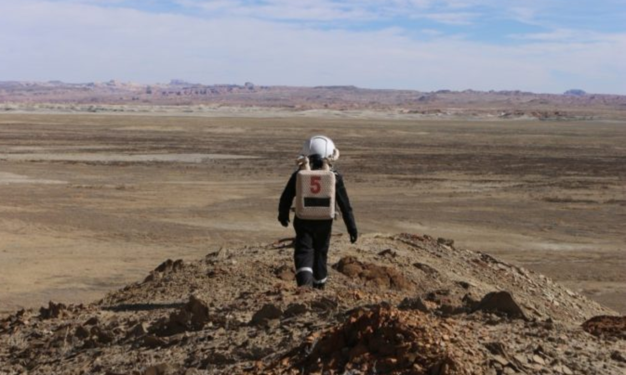
Crew 211 EVA Report 25-04-2019

EVA #4

Author: Simon Collignon

Purpose of EVA: Explore the Special Region in order to explore and search for ancient martian life.
Start time: 09:00 am
End time: 11:00 am

Narrative: The aim of this EVA was to explore the Special Region as said in the purpose section of this EVA report. Unfortunately, the rover SPIRIT was discharging too fast, the battery’s autonomy was not high enough to reach the Special Region. Therefore, we decided to stop on Cow Dung Road at the intersection with Galileo Road 1104. After a short exchange with the Hab, we decided to take Galileo road and explore the area delimited by Cow Dung Road, Galileo Road, Cactus Road and Stream Bed Connector. Sadly, there were no sign of ancient Martian on this area. Next time we’ll try to reach Special Region

Destination: Galileo Road 1104

Coordinates (use UTM NAD27 CONUS): Latitude: 4252000, longitude: 519500 (Intersection of Stream Bed Connector and Cow Dung Road)

Participants: Carl-Henrik Dahlqvist (commander of the EVA), Simon Collignon (medical officer), Chloe Peduzzi, Nathan Pechon.

Road(s) and routes per MDRS Map: On Cow Dung Road from Hab to the intersection with Galileo Road 1104. Then we took Galileo road1104 and stopped 500 meters after.

Mode of travel: Driving and hiking

EVA Report – April 24th

Crew 211 EVA Report 24-04-2019

EVA #3

Author: Simon Collignon

Purpose of EVA: Taking back the rover opportunity to the MDRS and exploring the surroundings of the hab.
Start time:09:00 am
End time:10:30 am

Narrative: The aim of this EVA was to reach the rover opportunity which had a battery failure yesterday on Cow Dung Road in order to drive it back home. After the rover’s rescue, we’ve explored the surroundings of the MDRS in order to have a better understanding of the geology near the Hab.

Destination: Intersection of Stream Bed Connector and Cow Dung Road, Hab View North.

Coordinates (use UTM NAD27 CONUS): Latitude: 4251500, longitude: 519000 (Intersection of Stream Bed Connector and Cow Dung Road)
Latitude: 4250900, longitude: 517900 (Hab View North)

Participants: Carl-Henrik Dahlqvist (commander of the EVA), Simon Collignon (medical officer), Chloe Peduzzi.
Road(s) and routes per MDRS Map: On Cow Dung Road from Hab to Stream Bed Connector then on Cow Dung Road from Stream Bed Connector to Hab. After parking the rovers at the hab, we walked around the MDRS towards North and directly turned towards West in order to reach the Hab View North.

Mode of travel: Driving and hiking

EVA Report – April 23rd

Crew 211 EVA Report 23-04-2019

EVA #2

Author: Maxime Bernard

Purpose of EVA: Explore the surroundings in order to find a shelter in case of strong solar winds during another EVA.
Start time:16:00 pm
End time:18:00 pm

Narrative: The aim of this EVA was to explore Cando Chasma in order to find a shelter in case of strong solar winds. Unfortunately no cavity that could be used as shelter could be found. Moreover, we had to let one of the Rover on the road because of a battery failure (position: intersection of Stream Bed connector and Cactus road).

Destination: Candor Chasma

Coordinates (use UTM NAD27 CONUS): Latitude: 4251000, longitude: 521000

Participants: Eléonore Lieffrig (commander of the EVA), Benjamin Flasse (medical officer), Maxime Bernard, Nathan Pechon.
Road(s) and routes per MDRS Map: Cow Dung Road 0110 (2 kilometers towards the west), then Galileo road to reach cactus road. We finally drove half a kilometer towards the east. We then parked the rovers at panel 1104.

Mode of travel: Driving and hiking

EVA Report #1 – April 22nd

EVA #1

Author: Eléonore Lieffrig

Purpose of EVA: Exploration and collection of soil samples

Start time: 4:30 pm

End time: 6:00 pm

Narrative:

We have had our first EVA this afternoon which lasted for two hours. We travelled to the hills on the left of the Cow Dung Road between the Robert’S Rock Garden and Zurbin’s head to take a few soil samples to be used by Chloé, the GreenHab officer, for one of her two experiments. The EVA went very well and the sunny weather allowed us to take some beautiful pictures of the Martian environment surrounding the MDRS.

Destination: Latitude: 4248000, longitude: 519000 (UTM NAD27 CONUS)

EVA Participants: Carl-Henrik Dahlqvist (commander of the EVA), Simon Collignon (medical officer), Chloé Peduzzi, Eléonore Lieffrig

Roads and routes per MDRS Map: Cow Dung Road 0110

Mode of travel: Driving and hiking

EVA Report – April 4th

EVA #7

Author: Julielynn Wong

Purpose of EVA: Geologic exploration and drone flying

Start time: 1430

End time: 1630

Narrative: Our EVA Team confirmed the battery charge on the Curiosity and Opportunity Rovers was 100%. GHO drove the Opportunity rover with COM as the lead vehicle for the EVA. At 82% charge, the Opportunity engine stopped at 0517574 4256201 and could not be restarted. After waiting approximately 40 minutes, the Opportunity rover was restarted and continued until 0518227 4250731 before stopping again at 72% charge. Our EVA Team was able to reach David who came out with an ATV to tow the Opportunity rover back to the Hab.

Destination: Gray Moon (not reached due to rover issues)

Coordinates (use UTM NAD27 CONUS): 0517574 4256201; 0518227 4250731

Participants: Julielynn Wong (COM), Dean Jin (XO), Erika Rydberg (GHO)

Road(s) and routes per MDRS Map: Cow Dung Road 0110, to Rd #1572, to Rd #1575 (Avoid Copernicus Hwy 1574)

Mode of travel: Driving Curiosity + Opportunity rovers

EVA Report – April 4th

EVA # 6

Author: David Kim

Purpose of EVA: Geologic exploration

Start time: 1030h

End time: 1200h

Narrative: Walked up the hill behind the Hab to Hab View North. Further walked to Hab ridge areas and explored local geology and paleontology. No issues encountered.

Destination: Hab View North

Coordinates: x518000, y4251000

Participants: Amanda Manget (ENG), David Kim (HSO)

Road(s) and routes per MDRS Map: n/a

Mode of travel: Walked

EVA Report – April 3rd

Crew 208 EVA Report 03-04-2019

EVA # 5

Author: David Kim

Purpose of EVA: Geologic exploration

Start time: 1030h

End time: 1300h

Narrative: Drove Curiosity and Spirit to destination through planned route. Arrived at Gray Moon and walked around area collecting Martian soil samples and took pictures. Returned without issues. Noted that Spirit originally drained its battery quickly from 98% to 80% in less than 5 minutes during normal operation. However, this normalized and drained slower after 80%. All normal rules and operations followed (Back Wheel Drive, Normal speed, Normal gear).

Destination: x516500, y4254500

Coordinates: x516500, y4254500

Participants: Amanda Manget (ENG), David Kim (HSO), Erika Rydberg (GHO)

Road(s) and routes per MDRS Map: Cow Dung Road 0110, to Rd #1572, to Rd #1575

Mode of travel: Spirit and Curiosity

EVA Report – April 2nd

Crew 208 EVA Report 02-APR-2019

EVA #3

Author: Julielynn Wong

Purpose of EVA: Flight testing of traditional versus new drone controller

Start time: 1130

End time: 1330

Narrative: Crew 208 set up pylons to conduct a flight test in a square pattern (60 feet in length) at an altitude of 20 feet to compare the performance of a standard versus new controller. Surveys were completed. Open-ended feedback was also recorded.

Destination: Hab

Coordinates (use UTM NAD27 CONUS): n/a

Participants: Dean Jin (XO), Amanda Manget (ENG), David Kim (HSO)

Road(s) and routes per MDRS Map: n/a

Mode of travel: Walking

EVA #3

Author: Julielynn Wong

Purpose of EVA: Flight testing of traditional versus new drone controller

Start time: 1430

End time: 1630

Narrative: Cancelled due to high winds

Destination: Hab

Coordinates (use UTM NAD27 CONUS): n/a

Participants: Julielynn Wong (COM), Dean Jin (XO), Erika Rydberg (GHO)

Road(s) and routes per MDRS Map: n/a

Mode of travel: Walking

Cheers,

Julielynn Wong, MD, MPH, FACPM
Chief Medical Maker

EVA Report – April 1st

Crew 208 EVA Report 01-APR-2019

EVA #1

Author: Julielynn Wong

Purpose of EVA: Flight testing of traditional versus new drone controller

Start time: 1100

End time: 1300

Narrative: Crew 208 set up pylons to conduct a flight test in a square pattern (60 feet in length) at an altitude of 20 feet to compare the performance of a standard versus new controller. Crew 208 ENG + HSO did figure-of-8 flight tests with a standard and new drone controller. Crew 208 XO did a hab roof inspection and ENG + HSO flew an exterior hab inspection with a traditional drone controller. Surveys were completed. Open-ended feedback was also recorded.

Destination: Hab

Coordinates (use UTM NAD27 CONUS): n/a

Participants: Dean Jin (XO), Amanda Manget (ENG), David Kim (HSO)

Road(s) and routes per MDRS Map: n/a

Mode of travel: Walking

EVA #2

Author: Julielynn Wong

Purpose of EVA: Flight testing of traditional versus new drone controller

Start time: 1430

End time: 1630

Narrative: Crew 208 COM and GHO conducted flight testing in a square pattern (60 feet in length) at an altitude of 20 feet and figure-of-8 pattern to compare the performance of a standard versus new controller. Flight test pylons were returned to Hab. Data collected will be forwarded to controller manufacturer.

Destination: Hab

Coordinates (use UTM NAD27 CONUS): n/a

Participants: Julielynn Wong (COM), Dean Jin (XO), Erika Rydberg (GHO)

Road(s) and routes per MDRS Map: n/a

Mode of travel: Walking

EVA Report – March 23rd

Crew 207 EVA Report 23-Mar-2019

EVA #6

Author: Diane Rothberg

Purpose of EVA: Drone map areas that will be used to create a 3D printed map of the MDRS Hab area.

Start time: 10:00
End time: 12:00

Narrative: Two Part 107 drone pilots mapped two areas outlined in Drone Deploy software. First one near Hab. Second one climbed the hill near Pooh’s corners and launched the drone from there.

Destination: Hab area, and Pooh’s Corners

Coordinates 4255000 x 518000, and 4251000 x 518920

Participants: Dean Jin, Tom Baldwin, Diane Rothberg

Road(s) Route 1103 near the Hab and Pooh’s Corners area

Mode of travel: Walking and Rovers (Opportunity + Curiosity)

Crew 207 EVA Report 20 Mar 2019

EVA #7

Author: Julielynn Wong

Purpose of EVA: Allow novice drone pilots to compare a standard versus novel controller to fly a camera drone in a square test flight pattern.

Start time: 14:40
End time: 16:40

Narrative: The weather was clear and sunny.

Two EVA Team members flew the traditional controller first for a test flight in a square configuration (60 ft for each side) at an altitude of 20 feet. Then the EVA team member flew a novel controller for the same square flight test pattern. XO also use the novel controller to conduct a habitat roof inspection. A post-flight survey was completed by all EVA team members.

Destination: MDRS sign

Coordinates: 4250850 / 518100

EVA Participants: Dean (XO), Diane Rothberg (GHO), Tiffany Ni (SCI)

Roads and routes per MDRS Map: Road 1103

Mode of travel: Walking

Copyright © The Mars Society. All rights reserved. | Main Site