
EVA #9
Author: Cesare Guariniello
Purpose of EVA: Study and collect geological samples from the upper layers of the area (Skyline Rim, Dakota Sandstone)
Start time: 11:09
End time: 13:35
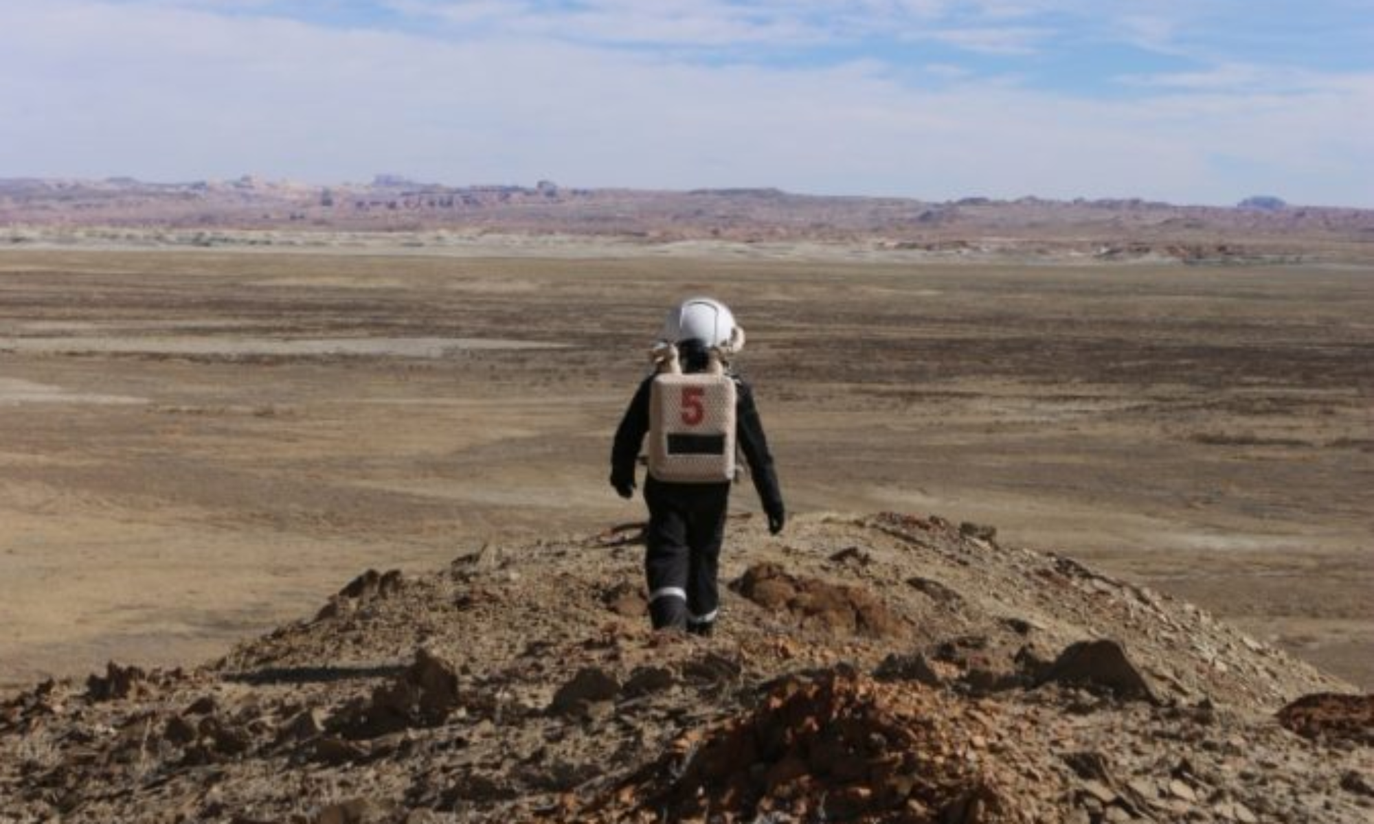
Narrative: First of all, the EVA crew is grateful to the Program Director Dr. Shannon Rupert and to the Assistant Program Director Atila Meszaros for authorizing the use of the ATV, providing ATV training, and trusting us with the logistics of this EVA for possible contingencies. With the snow almost completely melted in all locations, Cow Dung Road was wet in a few points, but in perfect conditions. Brahe Hwy was a little muddier than the main road, but still safe with the ATV. However, right at the intersection of Brahe Hwy and Copernicus Hwy 1574 south, the road became very muddy. Notwithstanding the absence of snow and ice, the EVA crew decided to be conservative. To avoid risk of losing friction on slopes due to the amount of mud on the tires, we elected to turn around without reaching the intended final destination. Sticking to the submitted roads and routes, we added stops on our way back to study locations close to the road about 100-150ft above the elevation of the habitat. The first stop (35 minutes) was at the intersection of Brahe Hwy and Copernicus Hwy, where we collected samples of crystalline gypsum from the region of the Moon. The second stop (40 minutes) was at the intersection of Brahe Hwy and Cow Dung Rd, in the region of the Glistening Sea, where we collected fluvial pebbles and crystalline gypsum, and studied the area of the water stream flowing towards the East. The third stop (20 minutes) was at the intersection of Cow Dung Rd and the Stream Bed Connector, where we walked to the entrance of the small canyon carved by the stream and identified sand deposits. Due to the decision to abort the intended destination and turn around, the EVA lasted 2 hours less than proposed, but yielded an interesting study of the crystalline salts, possible ancient evaporites, in the lower portion of the Cretaceous layers (Dakota formation). Once back to the habitat, the EVA crew scraped most of the mud from the ATV and polished the EVA suits from the mud. During an engineering EVA, the Crew Engineer and Executive Officer evaluated the remaining mud on the ATV, which will be further scraped once dry.
Destination: Skyline Rim (intended). Turned around along Copernicus Hwy 1574 (actual)
Coordinates (use UTM NAD27 CONUS): E515300, N4251250 (intended). E515907, N4254093 (actual)
Participants: Cesare Guariniello (CMD), Ellen Czaplinski (GEO), Alexandra Dukes (JOU)
Road(s) and routes per MDRS Map: Cow Dung Rd, Brahe Hwy 1572, Brahe Hwy 1575, Copernicus Hwy 1574
Mode of travel: driving and walking
Vehicle used: ATV Honda, 300, and 350.1