Research Report – December 20th

[category science-report]

Mars Desert Research Station

Final Research Report

Crew 305 – Valles

Dec 8th, 2024 – Dec 21st, 2024

Crew Members:

Commander and GreenHab Officer: Hunter Vannier

Executive Officer and Crew Geologist: Ian Pamerleau

Crew Engineer: Spruha Vashi

Health and Safety Officer: Peter Zoss

Crew Journalist: Rashi Jain

Crew Scientist: Monish Lokhande

AD_4nXfG08Wytn6yH1DAL_Nu6GbkNFNTh3gnNWrsC5MQzXHLIf5Y4C4FgjQwLBV0nbusy-I9I-8DdOOZIyo9mK1Tr74ZhkddLuI5Py-M3xEoLvsJh622vbwDh9theB0hGu1V2xMT9NF3sQ?key=nXF6LhGPgVKlB_50n6BnRzoV

Research Projects:

1.

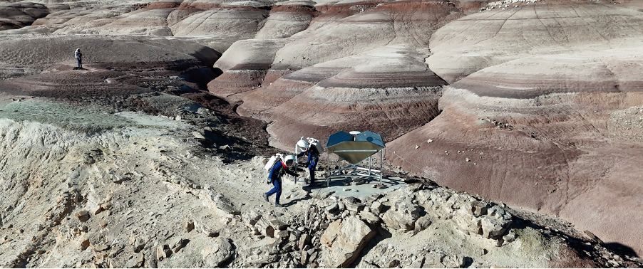
Title: Hydraulic Geometry of Ephemeral Streams to Potentially Elucidate Paleoclimate Author: Ian Pamerleau

Description, activities, and results: Ephemeral streams are present around the MDRS campus and carve out the landscape after heavy rain. The hydraulic geometry of these streams mathematically describes how the width and drainage area change as the flow moves up- to downstream. There is a range of values that the hydraulic geometry of rivers tends to fall within, which tells us more about climate, lithology, and sediment load. These values have been established for the more “mature” rivers with constantly flowing water.

However, the ephemeral streams at MDRS may not have achieved the values present in the literature. I will test if the ephemeral streams of MDRS hold the same hydraulic geometry in the literature, and if it is able to tell us anything about the climate.

We were able to thoroughly explore the three major areas where I wanted to take stream width measurements: Candor Chasma, Eos Chasma, and the region southeast of Kissing Camel Ridge (KCR). My objective was to take measurements of branching tributaries and between said tributaries along a main channel because the drainage area of a channel will substantially increase when the area of another stream is added. We also took three measurements of the stream width at each location a meter or so apart from one another to get an average width of the location.

I have not been able to create a plot of my data yet and am still in the processing stage. The trend I expect to see (i.e., smaller drainage area locations yield smaller stream widths and larger drainage area locations yield larger stream widths) will likely hold based on my observations and preliminary processing. The data may become a bit more complicated when comparing two sections of high drainage area, however, as there seemed to have been some variability in different factors such as lithology, slope, vegetation, etc.. I tried to limit these factors based on the location I chose but it is impossible to fully eliminate them, but I have taken photos of each location we took measurements of to better analyze any anomalies. I will hopefully be able to discuss these results with my undergraduate research advisor (whom I have worked on a geomorphology project with) or a geomorphologist/hydrologist at Purdue and share my findings at a conference once the analysis has been completed.

2.

Title: Effect of Variable Soil Moisture on Microgreen Growth

Author(s): Hunter Vannier

Description, activities, and results: Efficient plant growth is an important element of life at MDRS and will be critical for sustainability if we want to create a self-sustaining presence on other planetary bodies. For this project, I aimed to conduct an experiment that investigated how soil moisture content affects microgreen growth to find efficient watering practices. The established GreenHab infrastructure at the Mars Desert Research Station is an ideal place to conduct this experiment.

Experimental setup: I filled four 3” x 3” potting containers with Miracle Grow potting soil available in the GreenHab. The soil required priming and mixing with water, so the pots started out with some moisture level. In each of the pots, I added 1 g of broccoli microgreen seeds, then covered with a thin layer of soil. Each morning, I would water each pot with a specific quantity of water. Pot 1 received 2 oz water, Pot 2 received 1.5 oz water, Pot 3 received 1 oz water, and Pot 4 received 0.5 oz water. Pot 5 was a control pot and received no water over the duration of the experiment to determine if the ambient moisture conditions in the GreenHab were sufficient to stimulate growth without watering. The soil moisture monitoring system consisted of four capacitive soil moisture sensors (one for each pot) attached to an Arduino Uno R3 microcomputer (Fig. 1). Two measurements were taken in the morning, one prior to watering and one after, and one measurement was taken in the evening via direct connection to a personal laptop while running an Arduino serial monitor code. An initial baseline reading for each was obtained a day after the soil was primed

(prior to seeding). I waited a day after priming to equilibrate the moisture content for each pot. Subsequent measurements were subtracted from these base values for the respective pots.

AD_4nXcQJt8LkDQLbPncVr0r7je9XdFQ8EI_zwbKk1A71t1s8Uj4ulq2Ik-MTBoy5f9Tor0y4JVbW_E8whmxJ_9iuGEDooNg_L2XALlQnVXR3zkiAV94W8UhzHt_eZsGlGY5L0bohI5KVw?key=nXF6LhGPgVKlB_50n6BnRzoV

Figure 1: The soil moisture monitoring setup. The Arduino Uno is shown in the bottom left of the image, and soil moisture sensors are shown in each pot, labelled 1-4. The image is from the final afternoon of the experiment, December 20. One can see how similar the microgreen growth is in Pots 1-3 despite receiving significantly different water quantities. .

Results from the experiment are shown in Fig. 2. The first day of watering occurred on December 16. Initially, each pot was near the baseline value after the first watering except Pot 1 (2 oz). The 2 oz of water may have been sufficient to saturate more of the soil compared to the other pots. However, by the evening the pots had once again equilibrated. On the morning of Day 2, a sinusoidal pattern developed that persisted for the duration of the experiment, but the moisture of each pot seemed to reach a stable pattern on Day 3 (December 18). Pot 1 (2 oz) displayed the most significant change in soil moisture between morning watering and evening, and it maintained consistently higher soil moisture content than Pots 2-4. Interestingly, the pots ranging from 0.5 to 1.5 oz tend to have somewhat similar soil moisture content, each significantly lower than Pot 1 (2 oz). Pot 4 (0.5 oz) often has a higher soil moisture content than Pots 2 and 3, which is unexpected and may be due to a higher concentration of water being deposited near the sensor when watering, or a slightly different sensor depth. In general, the pots lose moisture at a relatively constant rate during the day and evening. Based on the sensor data alone, it seems that 0.5-1.5 oz of water could achieve similar soil moisture. However, most of the moisture could have remained in the top few cm of soil for Pots 2-4. This is in contrast with Pot 1 (2 oz) where water seemed to consistently saturate more of the soil and to a higher degree. This is an important result because microgreens have shallow roots and can be sustained by soil

moisture content at the surface rather than at depth. Therefore, I conclude that 2 oz of watering for these pots is more than needed to grow the microgreens.

AD_4nXd0XXIAAqCTIs-2lyZpfhL4EkShB2FYA40ktovrAaZfvicdpacRfTiWzyAyRn5x-JwvwV8nFPXFMqPMw98XZqG-Vzmir50SDCya5xh5hL5tGmprVyB0-lzejB5O4uNowykXOft2hA?key=nXF6LhGPgVKlB_50n6BnRzoV

Figure 2: Sensor data from the soil moisture monitoring station. The y-axis shows soil moisture values, and the x-axis shows the time of day when measurements were taken. Each colored line represents one of the pots: blue is Pot 1 (2 oz), Pot 2 is green (1.5 oz), grey is Pot 3 (1 oz), and Pot 4 (0.5 oz) is orange. There is a gap because data was not obtained for the Dec. 18 post water measurement.

This assertion is supported by observational evidence of microgreen growth (Fig. 1). The microgreens were first observed to sprout on the evening of December 19. Pot 1 (2 oz) clearly had 4 to 5 times the growth observed in Pot 2 (1.5 oz) and Pot 3 (1 oz). By the morning of December 20, Pots 1-3 clearly had microgreens occupying most of the pot; Pots 2 and 3 had similar amounts of microgreens, and about ¾ that of Pot 1. Pot 4 showed signs of soil disturbance caused by sprouting but the microgreens had not penetrated the surface of the soil. Based on the observed growth rates and soil moisture content, I conclude that 1 oz of water per pot is the most efficient watering practice for the broccoli microgreens. Pot 3 (1 oz) achieved a similar growth rate as Pot 2 (1.5 oz), and though it did not sprout as quickly as Pot 1 (2 oz), a similar level of growth was achieved by the end of the experiment with half the amount of water. A future experiment could be to first saturate each pot with variable amounts of water, then add a similar amount of water to each to see if a larger initial watering could stimulate growth and enable less subsequent watering.

To translate these results to the GreenHab, we can compare the pots to the raised beds that can be used for microgreen growth. The beds are 33.5”x 13” for a total surface area of 435.5 in2 and the pots are 3”x 3” for a surface area of 9 in2. Assuming the same depth, this means ~50 pots would fit in the raised bed, and that to efficiently water the bed it would take 50 oz per day. Throughout my time at MDRS, I have been using at least ~64 oz of water per day for one of these beds and sometimes an additional 30 oz. At minimum, my experiment supports that I could improve efficiency in raised bed watering by ~22%, a significant improvement. I would recommend 50 oz per day for future crews growing microgreens in raised beds. There may be changes in evaporative rates between the beds and pots which should either be calculated or tested.

3.

Title: Sampling Paleosol Sequences for Mars Comparison

Author(s): Hunter Vannier

Description, activities, and results: The goal of this project was to collect samples from at least one exposed paleosol sequence with the intention of bringing it back to Purdue University for spectral and microscopic analyses. Paleosols have been proposed to have been observed on Mars via rover data, and little work has been done to understand their role in sedimentary recycling and retention of past water on the Mars surface. Three paleosol sequences were collected (15 total samples) that represent tens of millions of years of history in the MDRS region. The first two sets were collected on Sol 3 in the interior and just outside Candor Chasma (Fig. 3). The third was collected near Zubrin’s head. Complimentary to the Crew Geologist’s work, river channel sediments were also collected at different locations across MDRS (7 total) with the aim of understanding how paleosols are recycled in the fluvial systems at MDRS, and how composition changes spatially across the field areas.

AD_4nXd3LW-fxnFrETmaSI0xQvvl9cZGEn0OA_ZIfVx4sxWC92vENUgwtjT3OZV2fPsASIZUGJriEweYvjvTdFY3N6hMz0GLTJS2Bmk7LQnwcrQKv5zXBtzRTXpyy54d8tyyLVC4fljP?key=nXF6LhGPgVKlB_50n6BnRzoVFigure 3: Example paleosol exposures observed during EVA 03 in Candor Chasma. Numbers indicate sampling locations within the paleosol sequence. (a) Paleosol sequence ~300 m after the entrance to Candor Chasma. Darker-toned layers indicate higher concentrations of organic material and are consistent with changing water environment. Capping rock is a

conglomerate and sandstone of the Morrison Formation (b) Paleosol sequence just exterior to the Candor Chasma entrance. Note the significant amount of red color compared to (a), indicating a much higher concentration of iron oxides. Cap rock is a fine-grained sandstone that is commonly exposed at ground level through the Compass Rock area.

The samples collected at MDRS will be analyzed in the pursuit of improving our understanding of paleosols on Mars and their relationship to variable climates on Mars. Visible to near infrared spectra, X-Ray fluorescence, and X-Ray diffraction data will be collected to form a preliminary data set to improve context for Mars observations. This data will likely be published at a conference in the next year. This data will also be the basis for a future NASA Solar Systems Working proposal to investigate the MDRS paleosols and river systems in greater detail.

BONUS: we came across sedimentary concretions that are documented in the MDRS Geology Unofficial Handbook. These are very similar to outcrops recently observed in Jezero Crater by the Mars 2020 Rover. See Figure 4 for a comparison.

a

c

AD_4nXccdkVnQhjqWw8W5R6Z0rPNiLDgsu3CZZxoztiQHBEuRuN3HdkwuZDNBLJikSTGHOVVp0JTuHRDk627IK_fmoDE27CDIRtXc0KPWYnvMA7-2ahbBoNCYF7b73hDnmPBCDLepccEYg?key=nXF6LhGPgVKlB_50n6BnRzoVb d

Figure 4: Comparison between concretions at MDRS and on Mars. (a,b) Sandstone concretions in the fluvial channel near Zubrin’s Head. (b,c) Concretions observed by the Mars 2020 Perseverance Rover in Jezero Crater near the Bright Angel formation around Sol 1022 (Courtesy Adrian Broz; publicly available images from Mastcam-Z).

4.

Title: Investigating Rover Applications in a Mars Analog Environment

Author(s): Spruha Vashi

Description, activities, and results: The objective of this work was to build a modular rover that can traverse the analog Mars terrain along with crew members on EVA. Testing at MDRS was set to include mobility testing over different sections of terrain, confirming communications and operability, and exploring human-machine teaming capabilities. However, after multiple long days of group efforts at assembly and troubleshooting, the rover, named Hermes, was unfortunately unable to start and be ready for data collection, but is pictured in Figure 5. While this outcome was unfortunate and meant that Hermes could not be tested outside on EVAs, it provided a good insight into major improvements in assembly that can be applied for future testing. Understanding the complex system and its weakest points of failure was not lost, and this information now allows us to ensure a smoother assembly process in future usage.

AD_4nXc_XllXfeSrelpjhdRWXP41gL87kTSY8PTBH1Pq9-szevSSHvl4wS1KqgPSEDicJ_MHvAwCtYg__RdW2N1mD3k-98V0dJcVuK36B-u19ZDJWZZNS2BWo_PhDcqtUQE8QBkpLiLz?key=nXF6LhGPgVKlB_50n6BnRzoV

Figure 5: Hermes the rover, with electronics and wiring included. Expected weight is 25 pounds, and expected maximum speed is 1.6 meters per second.

Although Hermes was not utilized on EVA, data and observations were still collected to help understand applications of rovers in the analog environment, especially in scenarios where the rover would act as a member of the EVA team. Some main points of investigation were mobility, functionality, communications, teaming strategies, and future design. For mobility, a single tire was taken out on EVA and tested on multiple different terrain types to understand its ability to travel across different terrain. Since the Crew Geologist’s research was primarily working with stream beds, most terrain testing was conducted on or near stream beds to understand the scenario in which the rover would be travelling along with the team while collecting stream bed data. The testing was done by rolling the single tire across 10ft strips of terrain multiple times, with the same downward pressure applied while rolling to simulate the actual rover’s 25lb weight, as seen in Figure 6. The results showed no more than 5 mm of tread depth in the softest terrain tested, compared to 200 mm footprints. In stream beds, the tires showed a clear tread but when hitting denser patches required more effort to get past. On dry and rocky lands, the tires showed no tread but rolled smoothly over different sizes of small rocks. It is still uncertain and unlikely that the rover would be able to traverse across very rocky, winding paths.

AD_4nXe1_gosO2ou-WU3BZJkmWXUpobR1am7UzsA-_uGpflQH1yDwXdwDQsdcXuByb8LHwfU9XILDKxFYffWFDUaAi2xLI1twq-aIUihMkOFYSApeYNjEJoFLZzFUceLNhqOptv8aYPkEg?key=nXF6LhGPgVKlB_50n6BnRzoV

Fig. 6: Image of terrain testing in a stream bed. Three strips of 10ft were identified and marked with flags and the tire was rolled along all three. Tire tracks are seen at each line, note that the found was denser in the center line and thus there are gaps of tracking since the tire slipped at those points.

To understand the functionality and teaming strategies that the rover could possibly adopt once it is functional, qualitative observations were made on certain aspects of data collection that delay operations and could be eliminated with the presence of a rover. For example, it was observed during the Crew Geologist’s stream bed measurements that the travel bag of materials is a hindrance to carry. It was noticed that writing down geological information, data points, and GPS information all takes time, and some of these items can be noted down by an autonomous system that is present, in this case, a rover. On EVA 11, the Crew Geologist was timed while he was taking measurements to understand his efficiency and points of improvement. On average, there was a reduction of about 1 minute of time from the Crew Geologist taking the measurement entirely by himself vs. having an EVA team member help with the measurement. While this confirms the idea that an EVA team will make data collection more efficient, the important note is that regardless of the number of members involved, data recording took 30-45 seconds for every measurement. Data recording was assumed to include notes on geological information, data points, and GPS information. All these items can be autonomized with a rover on hand that can collect and store the data and simplify the measurement process for the crew members. Another point of investigation was the time it takes for the rover to travel alongside a crew member. The specifications of Hermes indicate that its maximum speed would be about 1.6 meters per second, or approximately 3.5 miles per hour. Although Hermes was not actively tested, a measurement was made of comparing a crew member traveling from one data collection point to another at normal walking speed vs a crew member walking at specifically 3.5 mph (estimated to be 2 strides per second). The delay of a travelling rover was found to be 31 seconds and would also be further delayed in the case that the stream bed is very rocky, meaning it must travel on the outside, flatter areas.

The observations made on EVAs clarify future design upgrades of the rover. For example, communications and data recording capabilities, as well as carrying capacities would be the most ideal additions to Hermes at the time. It is hoped that with future usage of Hermes, more scientific applications can be implemented, and the rover can be well versed to work with many different variations of data collection and support the

crew’s research ambitions. Future observations of Hermes in action working in a team of scientists can further identify failure and improvement points for teaming strategies of autonomous systems and astronauts in analog environments, the Moon, Mars, and beyond.

5.

Title: MDRS Monitoring Overlay Sensors

Author(s): Monish Lokhande

Description, activities, and results:

Description: The project was focused on developing a network of Raspberry Pisto measure data from various locations in the habitat to measure the necessary sensor data (CO2, VOC, Air Quality, Temperature and Humidity). This data would be collected and analysed for any possible sudden changes. The “Sensor Packs” would be made to operate independently on batteries.

Activities: A total of two sensor packs were developed inhouse were placed in GreenHab and Lower Hab to continuously monitor the temperature, humidity and CO2 levels. The sensor packs relay the information in the two different types of feeds: Local and Global. The local feed updates every minute to provide real-time data to the crew members in the habitat and can be used by the local crew members to monitor the health of a certain location in the hab. On the other hand, global feed is used as a transfer of necessary information to a remote ground station. The feed is designed in such a way that it considers the delays inherent in Mars-to Earth communication. To limit the consumption of bandwidth and latency effects, the global feed by default parses the data and sends only the necessary data at regular intervals when everything seems within acceptable range of values. The continuous relay of data for global feed is done when there is a sensors which is not functioning or has faulty values. The sensor modules have the dual functionality to power using battery packs or by a wall power source. This makes it possible to be located at any location in the habitat.

Limitations: The sensor modules had a limitation on the number of sensors because of limitation of data to be published. The CO2 sensors needed calibration to have a reference for correct value calculation and therefore the values had a higher fluctuation.

Results: The sensor modules developed actively monitor data from the GreenHab and Lower Hab successfully. The local dashboard image is given as a reference, which populates with data every minute. If

any sensor has faulty data, there is a corresponding notification sent to the local and global dashboards. Having local and global dashboards help crew members quickly analyse any faults as well as inform the remote ground station of any anomalies that might have occurred. Future applications will include adding a notification in the form of sound or LEDs, to alert which sensors are not working or giving not acceptable values. Another extension will be to include more sensors. The project is being continued by Crew 306 for their research.

AD_4nXeOEHfPm72LlVcfznJhD_L_rETQdoDCnNNSr8rUqp0UfDWOY2ADd5ULUegc4XB1LE6EAYM_Qg97xFB1lPD2B-xdm6vJMGnMIugL-XJRme2XTJueYsFa50vfmalljoggakHsCC2WGg?key=nXF6LhGPgVKlB_50n6BnRzoV

Figure 7a. Local Data Feeds for individual sensors

AD_4nXeVRyRJPZvvZAFwg1Kr7AaqgD4LKJckOX0AM8ubOXsaiy1Phc2qgPO2ok8tkQ0P-qHqNfwAj-xFLppioW-SFGFNTguj5fII2MurBLCljTpaKjNtyHLy_PVd8clQXb4jUghMwGpp?key=nXF6LhGPgVKlB_50n6BnRzoVFigure 7b. Local Dashboard for sensor information

6.

Title: Safety Lessons and Design Requirements on Autonomy for future Martian Habitats Author(s): Rashi Jain

Description, activities, and results:

Description: Mars will have both periods of dormancy and crewed operations. Therefore, future Martian habitats must integrate autonomous systems and design practices that ensure reliable and safe operations in both operational phases of the Hab. The objective of my study is to understand how the different systems work together in a Habitat, identify weak design points and practices, and recommend safety controls and design requirements for future autonomous systems that can ensure both quick decision-making and resilient and safe habitat operations.

Activity: For this, I am studying MDRS habitat design and operations during the 12 Sols that we have at the Mars Desert Research Station from December 8th, 2024 – December 20th, 2024 to: (i) identify and draw out the functional relations between different systems in the Habitat, (ii) analyze how effective are the Habitat systems at maintaining or providing resilience to the anomalies and faults that we face during the mission.

Results: In this report, I include the results from Sol 1 – Sol 6 operations. I am still working on processing the data from the remaining six sols. For Hab, I include results only from Science Dome and the EVA operations. I am still working on processing observations made in the Main Dome, Green Hab, Repair and Maintenance Module, the Tunnels, and the Airlock.

Habitat Design

I toured each section of the Habitat and documented the different design features and resources available in each of those sections. The purpose for this exercise in each Habitat section is to understand the different resources available in each dome and what they enable us to do. It helps us (i) analyze how can or can the equipment and resources available to us both locally in each dome, and throughout the Habitat help us navigate anomalous situations, and (ii) are the current design and resources adequate to interface with autonomous systems? What, if any, should be the design requirements for future robotics or autonomous systems?

This step led to Habitat Systems Functional Relations

Habitat Systems Functional Relations

Relations between different habitat systems at MDRS. The different systems in the Habitat can be categorized into the following seven: power; interior environment; environmental control, life support system, and extra-vehicular activity, food processing, structure, command, control, and communication; and human, robots/safety controls. Here we show only power, but during the time at MDRS these models have also been sketched out for extra-vehicular activity, interior-environment, and command, control, and communication. I am still working on putting together models for other systems listed.

Power System: Figure 8 shows the power system component architecture and relations at the MDRS facility. There are two main sources of power, the solar panels (primary source) that are supposed to generate power and charge the batteries during daylight, and the backup generator (secondary source) that is to provide electricity in case solar panels malfunction, or the batteries run out of charge. Power generated through solar arrays, or the generator goes through a Sequential Shunt Unit integrated within the system which regulates the voltage of generated power. It then goes through a Direct Current Switching Unit (DCSU) which is the first component in the power distribution system. The DCSU determines power flow: i.e. how the power is distributed based on power generated and the integrated algorithm. DCSU interfaces with the batteries using a Battery Charge Discharge Unit (BCDU), whereas it interacts with the downstream loads using Main Bus Switching Unit (MBSU), DC to DC converter unit, that converts voltage to 120 Vdc, and Remote Power Controller Module (tripper box).

AD_4nXeqUSWOanEIR1Rp7ZZRFp-v0JKrfw6MG7ruq2js4nY5hUB0dpl8rhJxO_CcL7DV1gwAPxxeAULW-BtSL4MF9_Bk0gdJJoAdreXhfqhTJZJfeRsXmYANHDJG2gJp7fLro-7KJdeYlw?key=nXF6LhGPgVKlB_50n6BnRzoV

Figure 8: Power System Component Architecture and Relations at MDRS

With this power system component architecture and relation diagram at MDRS, we built a functionality diagram for individual components. Functionality diagrams are causal relation diagrams that show what the function of each component in the system is and what are the different factors it’s affected by. Figure 9 shows the functionality diagram of the solar panels. The grey circle represents the component itself (solar panel), the blue circle represents the function (generate power), the black circles represent the other systems in the Habitat system that affect either the component or its function (in this case we see that solar panel functions are affected by heating/cooling systems), the yellow circles represent variables and any other factors that influence the component’s function (in this case the solar irradiance affecting the power generative capacity).

AD_4nXcva6TWaWV5LlIydM-zzO-BA15P6-diT4KKq7_iNlsoWpPs94TgqJbCXt_0cvYoopuTSY0a4TT7dq3fvwI7bhv1W0FlQMVxiUX0ccHqOOzGJD2brPCew7P8yxbh-ERc021J-lUNeQ?key=nXF6LhGPgVKlB_50n6BnRzoV

Figure 9: Functionality diagram for Solar Panels

Using these functionality diagrams, we place “T” variables, also known as test variables. These T variables inform the design of where future monitoring systems should be placed. For instance, in case of a solar power, we recommend placing the

Operations summary: I monitored Hab operations, resources usage, and supplies through the 12 Sols and organized the data collected in an Excel sheet.

I use insights from Habitat Design, Systems Functional Relations, and Operations to establish Safety Lessons, and Design Requirements on Autonomy for Future Martian Habitats:

Safety Lessons:

1. Generate in-situ resources: With limited availability of resources available within the Habitat on Mars, we will need to generate in-situ resources. This includes water, oxygen, and fuel reserves. While Crew 305, did not conduct any experiment on in-situ resources: this should be a requirement for future crews as all long-duration mission to Mars will require the crew to become self

sustainable.

2. Make the most of available sources: Mars receives less than half the solar irradiance (590 W/m2) we receive on Earth, therefore every W of power generated here on Earth will have to be adjusted to what will be generated on Mars. It will be important to make the most of the resources available. For solar power, one can add solar concentrators and a controller that rotates the solar panels with solar position, like what happens at ISS.

3. Have a reliable source of reading for the sensors and water tank level: Our crew had two sources of water readings: one from the sensors at Hab, and the other that we got from our calculations. For the six sols I accounted for, the numbers differed anywhere 3.22 gallons – 37.855 gallons. We went with the more conservative estimate to estimate the remaining amount of water available to us. Given the scarcity of resources however, it is advisable to know exactly the amount of resource you have, and a margin of safety to it, than either under-estimate or overestimate.

4. Take an active effort at bringing the systems back to nominal operating conditions as soon as possible. Crew 305 Valles entered the Sim with no solar panel batteries non-functional (the Battery Charge Discharge Unit was broken, as a result of which, the batteries could not store power). This resulted in the crew using solar power in the day as the main source of energy during the day and the backup generator as the main source of energy during the night. In case one or the other failed, the crew would be left without power, which is essential to keep all critical systems running on Martian habitats.

5. Have magnetic self-aligned helmets on EVA suits. While we were a crew of six, with three people going on EVA and three people staying back to help with EVA operations, initial missions on Mars can have a lot of unexpected situations. For e.g. need for a rescue mission, only one person in the EVA/airlock module. It is important that while each crew member has help, they are also independent and able to wear their own space suit with minimal help from the others. One big problem with the two piece suits is the alignment of the helmet

6. Have multiple ports of exit: Cabin depressurization is a big cause of concern on extra-terrestrial habitats, both on Mars and especially on the Moon. In case of cabin depressurization, sections of the Hab will be isolated using airlocks. When this happens it is still imperative that people in other sections of the Habitat are able to safely exit the Hab. While it is not possible to have all EVA equipment in all Hab modules, it is important to limit the number of people in domes at one time and have the adequate number of EVA equipment and an exit airlock in each module.

7. Check for consistency in equipment performance: For the first six EVAs, I calculated the drop in percentage per mile travelled by the rovers (see Table 1). We see that the rovers perform better at preserving battery for longer distances than they do for shorter EVAs.

Table 2: Drop in Percentage per Mile of Rovers for the First Six EVAs.

Drop in percentage per mile travelled.

Miles

Curiosity

Perseverance

Opportunity

Spirit

EVA 1

0.55

20

10.90909091

EVA 2

0.55

10.90909091

9.09090909

EVA 3

3

8

3.33333333

EVA 4

7.45

4.02684564

4.966442953

EVA 5

5.54

6.137184116

5.77617329

EVA 6

8.22

4.501216545

4.62287105

We can use this information to keep track of rover performance, and confidently estimate how much each individual rover can travel before it runs out of charge. Long term tracking of rover’s performance will also help astronauts determine whether a rover needs earlier maintenance or not.

8. Install methods for investigating software bugs: Crew 305 Valles used Astrolink to track the GPS coordinates of the crew while they are out on EVA. On one of the EVAs, the Astrolink software showed four trackers out instead of three. The Hab comms team communicated with the EVA crew if they had an extra-tracker (Astrolink 10) on them. Upon receiving a negative, the crew with the Mission Support established that Astrolink 10 was a digital artifact. Situations like these, however, would get increasingly confusing with a larger / independent crew. It is important to have methods for investigating software bugs (evaluating what the root cause is) like these and addressing them.

9. Practice concise comms: Currently, aviation pilots use very precise language to communicate with other pilots and the Air Traffic Controller. It is important to establish similar rules for communication

over comms such that everyone is heard clearly without any misinterpretation. Crew 305 progressively improved in their communication while in the Sim.

10. Understand your systems well: It took a while for Crew 305 to realize that the rovers read the total number of hours they have been operational rather than remaining range on the full charge. While the crew was able to accurately figure out in time what the rover reading said (and fortunately it did not lead to any accidents), it is important for the crew to understand the systems they are working with well – to avoid any mis-interpretations that could lead to mishandling data or equipment.

Design Requirements on Autonomy for future Martian Habitats:

1. Add following monitoring systems and add remote access to them in each Hab area. a. Battery charges

b. Power Generated by Solar Panels

c. Temperature Sensors for Generators and Fuel Cells

d. Voltmeters for Sequential Shunt Units

Our functionality models for the power systems revealed that it is important to have the following sensors to track performance of the power systems at any given time. The readings can be output to the Main Dome Computer Unit that tracks all other systems. This is important for both equipment performance tracking and smooth autonomous system integration.

2. Have a running inventory of the Hab and the different resources available.

3. Automate system transitions: 1) and 2) will allow smooth automated system transitions. While the MDRS has very active Mission Support to facilitate these transitions, Mars is not going to have Mission Support. Or the Mission Support will be 20 – 40 minute lag, and won’t be able to provide on-site services.

4. Have functional back up devices, that are structurally non-redundant: During the power outage, the Main Dome in Crew 305 relied on an igniter heater that did not rely on the electricity, but instead on propane. This kept the crew warm, even when the electric heating system didn’t work. This highlights that it is important to have back up devices that are functionally redundant, but not structurally redundant.

5. Organize resources and tools for ease of use: Figure 10 shows some of cabinet space organization in the Science Dome that house different equipment.

AD_4nXfCzVfJbYedE0ngDaWFv1VZKr6iVIk8dit9ZiyHY4ZDKNOKAmVA6nftensp-IPenEQj1kRmV3ytUB14IO8WCBaedodGSHOHXxMHCmbmb6CL6mGBLv3gVL57V2lDQ5fPnpHV1OxQiA?key=nXF6LhGPgVKlB_50n6BnRzoVAD_4nXd16a8Go6dXDzJVEXqoqV6OwmTOFk4Um1RDuhnuU7aG3yWlzvfBfznyIhbIWXoSbMPxILgZnYKtWtGJIZwpoi3FMfLxvwW6rcONZN22yN6zIub6-0th9CEXiH34vcjN0RvXCRt2GA?key=nXF6LhGPgVKlB_50n6BnRzoVAD_4nXegcw16NLRYvvsb8TC4Pdo_aDT0Ct02afu_mdFnB8z3Wpwrr2eaof3vZcwYRMLHN0LRqROv8oreSd4c6fjR8QjwcicLM-NmBqdGXARf8xRKYQI8NqCHNE8v8XCslOQ8kktyAJE8uA?key=nXF6LhGPgVKlB_50n6BnRzoVFigure 10: Cabinet Organization in Science Dome

While this setup is good for a human to work with. They will look around and find out what they need, it is too cumbersome for an autonomous system and will confuse them. Autonomous systems will need a cleaner organization to work efficiently. The best way to currently do this is to use a 3D printer, where you can create custom shelves and cabinets that autonomous systems can easily work around with.

Future work on this will include compiling a list of functionality models for all systems and components I documented at MDRS. These component functionality models will be used to create a digital extraterrestrial habitat model on the Control-Oriented Dynamic Computational Modeling Platform, where we can simulate different disruptions that will be present on Mars that cannot be simulated at MDRS either due to their absence (such as radiation) or for safety reasons.

7.

Title: Wearable-Based Autonomic Activity Profiles for Real-Time Cognitive Performance Monitoring in Spaceflight

Author(s): Peter Zoss

Description, activities, and results: This study will longitudinally quantify individual changes in autonomic nervous system (ANS) status via a wearable sensor in MDRS crew members to understand how our autonomic activity is associated with sequential measures of cognitive performance for predictive model development. Baseline data from the wearable devices will also be used to look at changes while living in analog isolation. The activities planned to be completed at MDRS included cognitive performance testing. This testing was scheduled to take place every other day starting from Sol 1 for a total of 6 testing sessions for each of the crew members.

This human factor project was able to get through all of its data collection period at MDRS. Cognitive performance testing has been completed for all crew members for the planned 6 tests at the MDRS. These tests occurred on Sols 1, 3, 5, 7, 9 and 11. The tests on Sol 3 had to end early due to power failure, resulting in an incomplete test for one crew member and a missed test for another. The cognitive performance test used is called the Cognition Test Battery, and it was administered to the crew via an iPad. The results from this research will be looked at further back in West Lafayette where analysis can be completed.

Research Report – December 14th

[category science-report]

Mars Desert Research Station

Mid-Mission Research Report

Crew 305 – Valles

Dec 8th, 2024 – Dec 21st, 2024

Crew Members:

Commander and GreenHab Officer: Hunter Vannier

Executive Officer and Crew Geologist: Ian Pamerleau

Crew Engineer: Spruha Vashi

Crew Scientist: Monish Lokhande

Health and Safety Officer: Peter Zoss

Crew Journalist: Rashi Jain

AD_4nXeBPYE9h5NzR1l0w8nnWsUJXEmcMokprWGeEa2qvbaJ9CH0juY5WgZ5NGo5jPGYaJK41kZVk5Q-K0PYDKi9_wxC27piZwpUhiBc_eyoPNGl_VazOdP0Blk1eIEjqKGbi809HTWoTFIi70bR2zeX3RA?key=RpLM8OSTkweklrWfr8zyvKoe

Crew Projects:

Title: Hydraulic Geometry of Ephemeral Streams to Potentially Elucidate Paleoclimate

Author(s): Ian Pamerleau

Objectives: The primary question I seek to answer is: What is the hydraulic geometry of ephemeral streams near the MDRS campus?

Current status: We have explored and taken measurements from all the regions of Candor Chasma and Eos Chasma that we could reach within the time and safety limits of an EVA. In Candor Chasma, we were able to get 13 stream width measurements, mostly along the main channel, with a few tributary measurements as well. We obtained 23 stream measurements in the Eos Chasma region, and these ranged in many sizes of tributaries. Some were very narrow, while others had their own canyons that were tricky when it came to finding a safe route into. The reason for measuring different sizes of tributaries is due to their differing drainage area sizes, which ideally will be the dependent variable controlling the stream width. The ephemeral streams around the MDRS campus are only active during flooding events, which can range in size. Therefore, I am being careful to try and take the measurement that represents the highest flooding level that is still within the stream. Things like vegetation, waterfalls, and boulders within the stream path make this somewhat difficult in locations, so we try to find locations in which these features are absent. Future measurements will be required south of Kissing Camel Ridge and the large stream network there, and a few measurements near Compass Rock. With these future measurements as well as the 36 we have now, I should have enough diversity of data to see a trend emerge if there is one (note on 36 measurements, that is a single location where 3 measurements were taken a few meters within each other to create an average).

Secondary Objective: More detailed geologic mapping of the nearby MDRS campus.

With the stream measurements project, paleosols project, and future time being required for the rover project, I have not had time and will likely not have time to conduct any detailed geologic mapping.

EVAs Completed: 2 to Candor Chasma; 2 to Eos Chasma.

EVAs Still Required: 3 to South Kissing Camel Ridge (EVAs 07, 09, 10); 1 to Compass Rock (EVA 11)

Title: Refining orbital data with In-Situ analysis

Author(s): Hunter Vannier

Objectives: The primary question I seek to answer is: How does soil moisture content affect the growth rate of microgreens?

Secondary: Determine the composition of a paleosol sequence near MDRS.

Current status: The microgreen experiment has not been fully successful yet due to issues with wiring a microcomputer and establishing a connection to the soil moisture sensor, but all seed trays and soil have been primed to begin the experiment. I will be working in the RAM to get the moisture sensor working as soon as possible so a week of data can be taken and microgreen growth can be measured. If the soil moisture sensor is not set up by Sunday, I will use the soil moisture sensor in the GreenHab and take manual readings in the morning and the evening and still achieve the desired outcome of the experiment.

For my secondary goal, I have successfully completed the nominal mission of collecting paleosol sequences. Two sequences have been collected and photographed. The first set was obtained ~300 meters into the interior of Candor Chasma and was capped by a large conglomerate unit that is part of the Morrison formation; the conglomerate is abundant throughout the region surrounding MDRS other than directly to the east. The second was capped by a fine-grained grey/yellow sandstone just outside of Candor Chasma. I intend to collect at least one more paleosol sequence near Kissing Camel Ridge before the completion of Crew 305’s mission.

EVAs: Two EVAs have been performed for paleosol research, both to Candor Chasma. The first enabled scouting of paleosol exposures, and the second resulted in two sets of paleosol sequences being sampled, one in the interior (6 samples) and just exterior (4 samples).

Title: Investigating Rover Applications in a Mars Analog Environment

Author(s): Spruha Vashi

Objectives: The primary question I seek to answer is: How can a rover assist humans during EVA processes and what interactions are necessary for the rover-human relationship?

Current Status: As most of the rover was required to be deconstructed to be brought to MDRS, the first task was setting up the RAM with my supplies and redoing the mechanical assembly of the rover. This process took about 1 day with breaks for EVA prep, meals, and other crew responsibilities. Afterwards, the next big step was to work on the electrical system of the rover, which is about 70 percent complete. I hit a roadblock with the integration of a board that is setup incorrectly, and I have had to take almost 1 day to trouble shoot. Throughout this process, I still have kept the crew aware of my timeline and the ideal testing environments I would require once the rover is complete. The aim is to have the rover complete by Sol7, and begin testing on Sol 8, Sol 10, and Sol 11.

EVAs: 3 EVAs have been established. Sol 8 EVA will be to test the rover outside of the Hab and in a short-range distance, Sol 10 will be to test the rover at Kissing Camel Ridge, and Sol 11 will be to test the rover in any other terrains with Rashi observing the functionality for her research.

Title: MDRS Monitoring System

Author(s): Monish Lokhande

Objectives: The primary question I seek to answer is: How can we achieve data efficient communication to ground station?

Secondary: Can we transmit the data to a remote station?

Current Status: One sensor module has been developed and currently being tested to check for analysis of reading for correctness. The sensor module placement is being identified and the readings are being published locally. The module to identify potential errors in readings/ sensor damage has been developed and currently being tested.

The data is being published successfully on a website to analyse and viewable. Global and local pages have been made for crew and ground station accordingly.

Problems faced: Although the sensor module is working, additional tests for validity of the data is required. The publishing of the data to the station and testing locally is harder as simulating errors in measurement needs to be configured.

Next Steps: To add the delay of data relay to the Ground station website. Add a test case where error in data would lead to local update to resolve immediately and ground station update to notify the errors.

Title: Safety Lessons and Lessons for Robotics from a Mars Analog Astronaut Mission

Author(s): Rashi Jain

Objectives: 1. Study Habitat Operations and anomalies and use insights to suggest safety lessons. Assign effectiveness values to different design features, tools, and resources available in the Hab. 2. Identify functional relations within and between different habitat systems that can be used to (i) five crew a better understanding of their system, determine what the best places are for installing monitoring systems, and which autonomous systems can be used to keep habitats safe and operational during uncrewed mission phases.

Current status:

For my first objective:

I have been keeping a record of all Sol’s operations and anomalies. For each anomaly that we’ve encountered thus far, I’ve drawn up Fault Tree Analysis (FTA) and am working on writing safety recommendations on what can be done to mitigate if these failures were to happen on Mars where we would have no Mission Support.

I have also been documenting the use of resources, tools, equipment, and the rovers while they are out on EVAs and will be plotting their performance over our stay here (including performance degradation). These values will be used to model performance in the computational model of the habitat that I am developing for my Ph.D. research that studies performance of the habitat, its systems, and components over long durations (months and years).

For my second objective:

So far, I’ve documented design, tools, and resources in the following areas of the habitat: Science Dome, Upper Deck, Rovers and Martian landscape, and partially the Lower Deck and the RAM. I have completed the functional relations for the power system, and the thermal control system. I will be doing the same for the other areas of the Hab in the upcoming weeks, and complete functional relations for all systems: which includes structures, environmental control and life support systems, and other safety controls.

Once I complete all functional relations, I will use those to determine (i) where monitoring systems should be placed for safe habitats, and (ii) robotic design requirements for autonomous and safe habitat operations.

Title: Wearable-Based Autonomic Activity Profiles for Real-Time Cognitive Performance Monitoring in Spaceflight

Author(s): Peter Zoss

Objectives: This study will longitudinally quantify individual changes in autonomic nervous system (ANS) status via a wearable sensor in MDRS crew members to understand how our autonomic activity is associated with sequential measures of cognitive performance for predictive model development.

Current status: This human factor project is halfway through its data collection period. Cognitive performance testing has been completed for all crew members 3 times at the MDRS. These tests occurred on Sols 1, 3, and 5. The tests on Sol 3 had to end early due to power failure, resulting in an incomplete test for one crew member and a missed test for another. The remaining tests will take place on Sols 7, 9, and 11.

Astronomy Report – October 22nd

[category 

astronomy-report]

MUSK OBSERVATORY
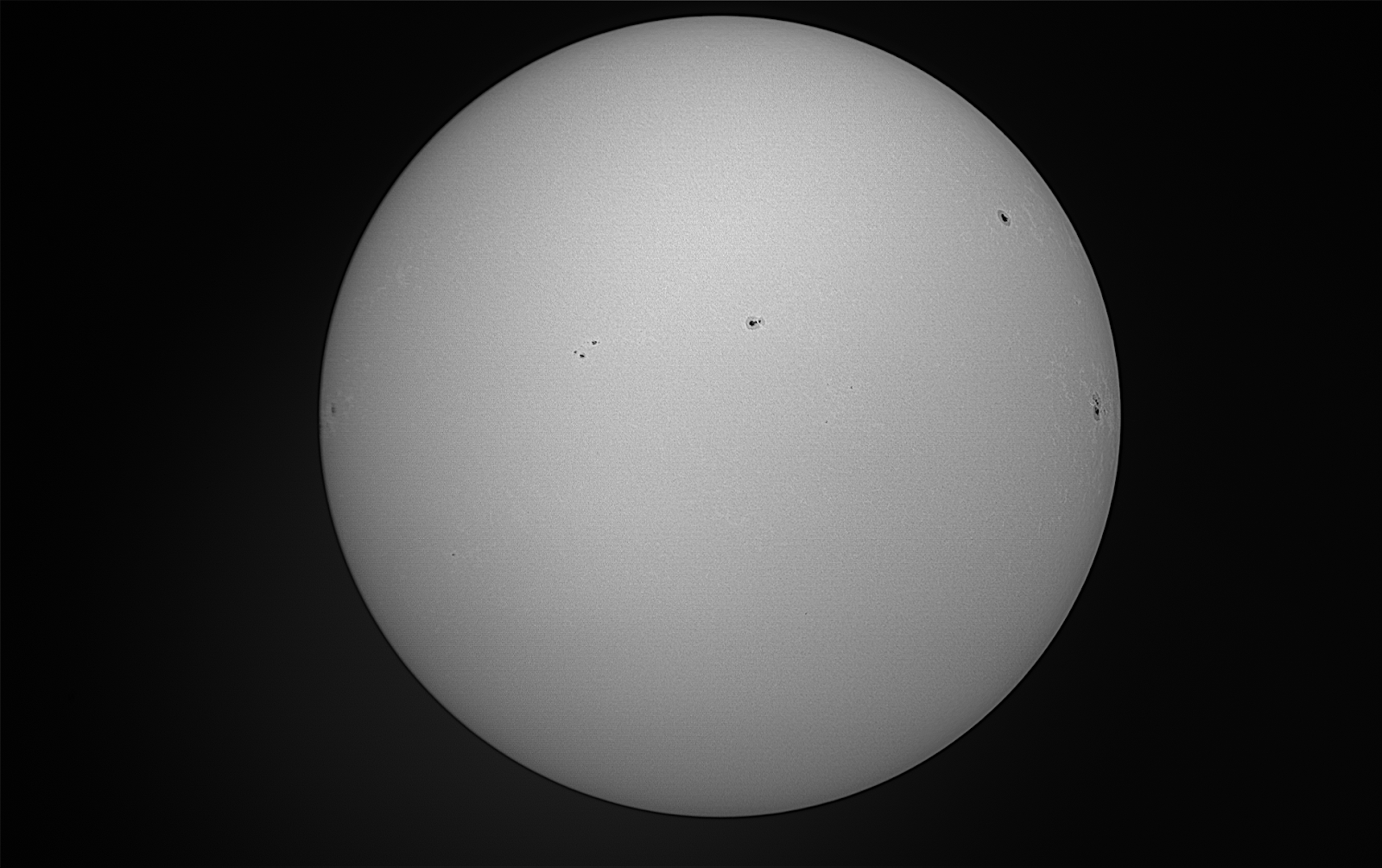
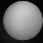
Solar Features Observed: Sunspots, Prominence

Images submitted with this report: Sun_241022_sunspots&prominence

Problems Encountered: None

Astronomy Report – January 5th

[category

astronomy-report]

MUSK OBSERVATORY

Solar Features Observed: Sunspots, Prominence

Images submitted with this report: Sun_241021_sunspots&prominence

Problems Encountered: None

Astronomy Report – October 21st

[category 

astronomy-report]

MUSK OBSERVATORY

Solar Features Observed: Sunspots, Prominence

Images submitted with this report: Sun_241021_sunspots&prominence

Problems Encountered: None

Astronomy Report – October 23rd

[category 

astronomy-report]

MUSK OBSERVATORY
Solar Features Observed: Sunspots, Prominences
Images submitted with this report: Sun_241023_Sunspots&Prominence
Problems Encountered: None

Crew 297 End-Mission Research Report – Apr262024

[title End-Mission Research Report – April 26th]
[category science-report]

End-of-Mission Research Report – Crew 297

Summary of Crew Research Projects:

Title: Advancing Planetary Mineralogical Analysis: Evaluating the Usability of Portable Gamma Ray Spectroscopy during Martian Operations
Principal Investigator: Sarah Lamm
Research Summary: Mars has been studied from orbit by gamma-ray spectrometers with great success since the 2001 Mars Odyssey Orbiter, which is still running to this day. This project is showing the practicality of a portable handheld version. This research is testing the practicality and feasibility of a portable Gamma-Ray Spectrometer in the field.

For this study we are using a RS-125 Gamma-Ray Spectrometer, which is 25.9x 8.1x 9.1cm at 2 kg, with a rubberized grip, and dust protected, one button operation, and sound loud enough to be heard in a spacesuit helmet over a fan. The assay was set at the standard 120 seconds, reading wt% of radioactive potassium (K), and ppm of uranium (U) and thorium (Th).
Stop 1: At 12S 518065 4250003 we ran initial Gamma-Ray Spectrometer readings of the tan and red regolith. The mounds of this region are unconsolidated fine grain clay minerals with desiccation cracks. The potassium amount in the red regolith was about double of the potassium in the tan region. Based on the Th/U ratio, it shows that the red regolith was oxidized, which makes sense based on the other observations and the red coloring is likely from iron oxides-stained clay minerals. The Th/K ratio indicates that the clay minerals inside both regolith are likely smectite.
Stop 2: At Robert’s Rock Garden (12S 518278 4249467), further south than Stop 1, we observed conglomerates that were from a higher layer, that had fallen due to lower layers being eroded away. The conglomerates are poorly sorted from gravel to sand size, clast supported, and likely a silica matrix. The K, U, and Th amounts were significantly below the average amount in the previous region.
Stop 3: Further south from Robert’s Rock Garden at 12S 518819 4248714, we found an area that’s regolith looked redder from orbit than the surrounding region. Here we found red and white regolith. The red regolith had larger desiccation cracks than the white regolith. The K in the red regolith was more than double the white, indicating that the K was likely leached out. The red regolith in this region did have a slightly higher Th/U ratio than the red regolith at Stop #1 indicating that this area likely had higher Redox change.
Stop 4: The grey unit (12S 516189 4254637) Northwest of the Hab, just south of the sea of shells, did have more uranium than the previous units, that being said the amounts were in the average range between 3-5 ppm. The K and Th amounts were also average.
Stop 5: The grey rocks north of the Hab (12S 518272 4251168) were depleted in K, U, and Th.
From this study, we tested the practicality of using gamma-ray spectrometers for field use as an astronaut. The mass of this portable gamma-ray spectrometer is minimal enough that it should have little impact on the payload capacity for geological samples that an astronaut could carry. This spectrometer requires only two minutes per assay, which might be lengthy for astronauts with other specific EVA tasks but is reasonable for a geologist to make and record observations about most geological units. The amount of bending over to set the spectrometer and read the results, and then picking it up afterward, may vary depending on the geological formation. However, due to its small size and mass, it should not impose excessive physical exertion. The gamma-ray spectrometer is easily operable with gloves on, functioning as a one-button system that changes functions and menu options based on how long the button is pressed. It is small and durable enough to be operated with gloves and a space suit, and not cumbersome when hiking up hills and down into dried streambeds.

To effectively utilize the portable Gamma-ray spectrometer during field missions, astronauts require minimal training and expertise. The operation of the portable gamma-ray spectrometer is straightforward, making it accessible for any astronaut. Therefore, less than 10 minutes of training is needed for basic usage. The primary challenge lies in choosing optimal geological formations and interpreting the results. Any astronaut could be trained in basic or preliminary interpretation since there are only three elements to consider. However, the formal interpretation should be handled by specialists. Overall, the gamma-ray spectrometer could be successfully used by astronauts with minimal instrumentation and geological training.

The portable Gamma-ray spectrometer enables real-time decision-making and direct extravehicular activities (EVAs), especially since gamma-ray spectroscopy can differentiate between samples that appear visually similar but differ in radioactive trace elemental amount. The significant distance between Mars and Earth results in a 6–40-minute data latency, making real-time direction from mission control impractical. Therefore, Mars astronauts likely possess a greater degree of autonomy in conducting measurements and collecting samples compared to lunar astronauts. Consequently, Mars astronauts require instruments that can provide rapid assessment and preliminary interpretations to guide their fieldwork, a role that gamma-ray spectroscopy can effectively fulfill.

From this perspective, the advantages of a handheld gamma-ray spectrometer outweigh the disadvantages. These devices provide rapid assays of radioactive material in the field, enabling the determination of lithology, past aqueous events, and even assessing risks such as Radon gas exposure for astronauts. Future studies should compare handheld or portable scientific instruments like Raman, IR, and LIBS with handheld gamma-ray spectrometers to determine the most effective and useful tool. Ultimately, a gamma-ray spectrometer is a practical instrument that astronauts could seriously consider taking on trips to Mars.

Title: Simulated Deployment of a Nuclear Power System: Logistics and Operational Challenges
Principal Investigator: Matthew Lynch
Research Summary: The goal of this project was to simulate the collection & deployment of an inert nuclear power system (NPS) on Mars by a crew of astronauts. To achieve this objective, the project was divided into 3 core tasks: 1) placing the NPS in a realistic landing site reachable from the Hab, but simulate inaccuracies in landing by giving the recovery crew incorrect landing coordinates, 2) locating and recovering the NPS by utilizing a variety of search methods in the expected area, and 3) determine appropriate excavation terrain to bury the NPS and determine expected human digging rates. Nine EVAs in total were done for this project and every crew member participated at least twice. Our combined search areas totaled to 1.75 square km (431 acres). We were successful in finding the NPS 5 out of 6 times within our given time limit, with the most successful search strategy being the "high-point" method. Our one unsuccessful attempt at finding the NPS was a particularly challenging hiding spot that was chosen to thwart the "high-point" search strategy. Several areas were scouted to potentially entomb the NPS, with two ultimately being selected to perform full excavation experiments at. These two spots were chosen as they exhibited a variety of contrasting ground features, resulting in an expected difference in digging rates. This was confirmed experimentally as the near ideal excavation site resulting in a material removal rate of ~53 cubic feet per hour, while the significantly more challenging location resulting in a rate of ~30 cubic feet an hour. Weather, tools, and digging procedures were kept constant between these two locations, so we are confident that this 43% decrease in removal rate is primarily attributed to the terrain conditions.

As we have demonstrated this project was a success and has resulted in valuable information for the deployment of a NPS on Mars. Furthermore, many of the findings here can be applied to other tasks such as search & rescue efforts, excavation for base construction, and a better understanding of the terrain surrounding MDRS.

Title: A Toolset for Shared and Long-term Document Management and IT Operations
Principal Investigators: Sean Marquez & Matthew Storch
Research Summary: The WIDGIT project got off to a fast start, as Matt S. & Sean were able to accomplish all of the following during our first day at MDRS:
set up a local WiFi network 100% independent of the Internet
get the WIDGIT server configured on that independent network, and accessible via NoMachine (as the monitor and keyboard we have available are only useful for rudimentary work)
finish the configuration of 3 workspace sessions for crewmembers that did not have adequate hardware to run the workspace locally on their own laptops
clone the notes repo for each of the server-based workspaces
At that point WIDGIT was in a usable state. However, as the mission got into full swing, the crew focused on EVAs and various other required tasks, and were also dealing with several power outages per day. Therefore we could not find enough time to conduct the crew’s WIDGIT training until Sol 4. Even then, only two crew members fully participated in the training while a third participated partially.

From Sol 2, the two PIs were using the system. In particular, the GreenHab Officer was pushing GreenHab reports into Dendron. The MDRS Handbook has also been incorporated into Dendron except for the Appendix.

From Sol 5, two other crew members were using the system for limited purposes. The main additional use cases were to use WIDGIT to write the Mid-mission and Final Summary Reports, thereby demonstrating that collaborative workflows can be conveniently accomplished on a purely local network.

The PIs had originally envisioned additional use cases for WIDGIT, such as:

[FPrime] running the FPrime data collection system for monitoring environmental conditions in the GreenHab on the same fully local network
[Notes] other crew members using WIDGIT for taking and organizing research notes
Other crew members did not actually use WIDGIT for taking notes. The reality is that WIDGIT has more overhead in terms of both learning and operations than conventional internet-based tools, and the crew had an ambitious schedule for EVAs and other research projects. In addition, many other activities (cooking, cleaning, etc. while dealing with power outages) took more time than anticipated, further dampening enthusiasm for using the tools. On the other hand, WiFi was continuously available, meaning that WIDGIT was competing with Google Drive and Google Docs, and the latter provided an irresistible level of convenience for a busy crew.

Based on these results, the PIs will consider alternative methods of collaboration and note-taking that require less learning and provide a more user-friendly experience, for use in such cases where the users are not programmers. For groups of users who are primarily programmers, we found nothing to contradict the thesis that the Git + Markdown + Dendron approach is effective. Also, for any group of users that rely on complex toolsets, a streamed workspace image built on immutable-infrastructure-as-code is a very useful mechanism.

Title: MDRS IOT-Assisted Data Collection Using OSHW & OSS
Principal Investigator: Sean Marquez
Research Summary: Progress and development efforts were made on implementing the FPrime data collection system for use in collecting environnmental data in the GreenHab at MDRS. The minimal characteristic components have been demonstrated, specifically with the open-source fprime-baremetal-reference, example Arduino sketches for the BME680 environmental sensor, and the SGP30 air quality sensor (developed by Adafruit). Unfortunately, the code implemented thus far using the FPrime flight software / embedded systems framework still has bugs to be worked out before a technology readiness level (TRL) 4 proof-of-concept can be fully demonstrated.

Title: Use of Sonar for Measuring Water Tank Depth
Principal Investigator: David Laude
Description: This research project would provide the means to accurately measure the amount of drop in static tank water level via an electronic sonar range finder device.
Objectives: This research project would replace acquiring the distance of the static tank opening to the water surface with a ruler, for determining the remaining volume of water, to acquiring via an electronic sonar (ultrasonic) range finder device, specifically an LV-MaxSonar. The volume can subsequently be determined by the sensor’s output signal measured with a digital voltmeter (DVM) and then entered into a spreadsheet formula that calculates daily water usage and water remaining.
Research Summary: Initial testing on a nearly full static tank did expose a problem. Inside the tank, near the top opening, there is a wide hose that spans across much of the top area. This hose interferes with measurement as one would expect. However, the hose lays mostly in the tank half closest to the Hab and placement of the device near the opposite side is all that’s needed for an accurate reading. As the tank lowers, more measurements will be needed to determine if accurate to near empty. Initially I had thought to further develop it, for a subsequent crew assignment, to indicate gallons remaining in a three digit display. However, now seeing the water usage spreadsheet with its input in units of inches, and output in gallons and average use, I believe it best for the final device to output in inches. This would also make it usable with other different sized tanks, assuming different formula parameters. Measurements of water level down to 28 inches below the rim of the static tank have been performed and compared to measurement by ruler. Accuracy has been consistent with that of ruler based measurements, to within a few percent, and therefore of sufficient accuracy. However, as the water lowered more of the hose and then the pump was exposed above water and erratic measurement results occurred. The pump with attached hose were slid several inches close to the side of the tank to facilitate accurate measurements. Future use of this device by others needs to include a notice of this potential issue. The device was also tested on the GreenHab water tank. Down to its last measured level of 24”, it was accurate when compared to a tape measure. I do have concern that at lower depths the device could become confused, due to the narrowness of the tank.

Title: Robot Competency Self-Assessment at MDRS
Principal Investigator: Nicholas Conlon (at CU Boulder, on Earth – Pawel Sawicki supervising project at MDRS)
Research Summary: The Human-Robot Interaction study from the COHRINT Laboratory to understand the relationship between astronauts and self-assessing robots was a success, despite suffering many early setbacks. More specifically, the achieved primary goal of this study was to understand how future astronauts involved with robotic applications rely on telemetry, map data, and intuition in order to infer how competent a robot will be within a given environment. The Sojourner-sized robot, named Case, functioned through the use of ground support equipment (GSE) consisting of a WiFi network router, a laptop, and a Reach RS2 GNSS Receiver.

Case was involved in six EVAs, totaling 10.5 hours. Five of these EVAs used the robot successfully, with one (EVA #8 on Sol 6) running into network connectivity issues. Another anomaly that occurred and was resolved during the mission was a non-functioning first-person view (FPV) camera (not used to meet any of this research’s objectives), which was not working due to an ssh public key authentication error on the connected Raspberry Pi. This anomaly was resolved on Sol 9, utilizing payload support from the CU Boulder team back on Earth. The first EVA that Case was on, EVA #5 on Sol 4, involved fairly nominal operation of the rover, minus the aforementioned non-functioning FPV. Although the rover would occasionally not reach Points of Interest (POI), this was easily overcome with manual override driving by Sawicki. Using synchronized manual and automated driving sequence, an adequate portion of the EVA area was captured on Case’s GoPro which will be post-processed post-mission to develop "Street view"-like imagery. EVA #10 on Sol 7 involved Laude as the robot controller. This EVA was performed locally from the RAM, as transporting CASE requires a noteworthy amount of heavy GSE. While Case’s paths to destinations were certainly mysterious at times during EVA #10, it was always able to reach the designated POI and avoid obstacles. Laude also took over manually to avoid obstacles, test Case’s range of operation, and perform the precise maneuver of bringing Case up the RAM’s ramps. EVA #13 on Sol 9 also conducted testing from around the Hab, specifically from the ScienceDome, until trust could be established with the reliability of Case. During this EVA, both Marquez and Lynch operated the robot. Marquez and Sawicki recreated the hexadecimal message scene from The Martian at this point and established confidence in the functionality of the onboard inertial measurement unit (which had shown transient problems in prior EVAs). The trust established in Case from EVAs #10 and #13, enabled the crew to utilize the robot once again out in the field. During EVA #14 and #16, where Lamm and Storch operated the robot, respectively, with relatively successful route maneuvering displayed from the robot. During these routes, Case would need to re-compute its next steps very often, but would certainly eventually make its way to the prescribed point-of-interests.

The crew also demonstrated the customizability of Case, incorporating their own Geiger-Muller Counter to the top of the robot’s chassis. From these readings, the highest count rate observed was at 34 CPM and dose rate indications at 0.221 μSv/h, in line with safe and nominal radiation levels.

Every crew member spent time operating and monitoring Case within various EVA configurations and filled out pre- and post- mission surveys related to its use. These results, along with corresponding logged telemetry of the robots movements and displayed assessment status, will be investigated further by the COHRINT Lab back in Boulder on Earth at a further date.

Mission Support COMMS closed 23Apr2024

Mission support is signing off.
Please see below received reports status:

Sol Summary Received
Journalist Report Received
GreenHab Report Received
Operations Report Received
EVA Report Received (2)
Photos (6-8 pics) Received
EVA Request Approved

________________________
Ben Stanley – Site ManagerMars Desert Research Station

435.229.3475

AIorK4zJwLwPIWpaKeu3MS1SRDkfIkROXwfkNaEgVlcUFUQOHMM_jnKth8pJaFRg3ou53q1RY40muac

Research Report – April 20th

[category science-report]

Mid-Mission Research Report – Crew 297

Progress of Crew Research Projects:

Title: Simulated Deployment of a Nuclear Power System: Logistics and Operational Challenges
Principal Investigator: Matthew Lynch
Current Progress: After some initial challenges with coordinating our "hide and seek" strategy of the NPS due to technical errors in converting between GPS datums, the remaining work for this project has had repeated success. Both Teams A & B have each had a successful "seek" EVA twice, using numerous search strategies. So far the most successful strategy has been the "High-point" method, in which seekers ascend local high elevation points and observe their immediate vicinity, repeating until the NPS is found. The second most successful strategy has been the "sweep method" in which EVA members stand a good distance apart (100-200 feet) and sweep through the search area together. Hiding the NPS has also been successful as it has given ample opportunity to study the Martian environment for interesting geological sites, as well as possible excavation sites for the NPS. There also has been two success instances of burying the NPS. Both attempts used the same tools and general method, but had significantly different terrain. Our initial results have shown that the actual excavation rate varies from 30 cubic feet an hour in challenging terrain, to 53 cubic feet an hour in near-ideal terrain. Digging crew’s have utilized a 1-on/X-off work strategy, where 1 crew member works at a time at a rigorous pace, while the remaining crew members rest, frequently switching positions. This has been done with 2 and 4 person crews, a normalization study may be done later to help account for digging rates between crews of different sizes.

Title: Advancing Planetary Mineralogical Analysis: Evaluating the Usability of Portable Gamma Ray Spectroscopy during Martian Operations
Principal Investigator: Sarah Lamm
Current Progress: This research is testing the practicality and feasibility of a portable Gamma-Ray Spectrometer in the field. For this study we are using a RS-125 Gamma-Ray Spectrometer, which is 25.9x 8.1x 9.1cm at 2 kg, with a rubberized grip, and dust protected, one button operation, and sound loud enough to be heard in a helmet over a fan. The assay was set at the standard 120 seconds, reading wt% of radioactive potassium (K), and ppm of uranium (U) and thorium (Th).
Stop 1: At 12S 518065 4250003 we ran initial Gamma-Ray Spectrometer readings of the tan and red regolith. The mounds of this region are unconsolidated fine grain clay minerals with desiccation cracks. The potassium amount in the red regolith was about double of the potassium in the tan region. Based on the Th/U ratio, it shows that the red regolith was oxidized, which makes sense based on the other observations and the red coloring is likely from iron oxides-stained clay minerals. The Th/K ratio indicates that the clay minerals inside both regolith are likely smectite.
Stop 2: At Robert’s Rock Garden (12S 518278 4249467), further south than Stop 1, we observed conglomerates that were from a higher layer, that had fallen due to lower layers being eroded away. The conglomerates are poorly sorted from gravel to sand size, clast supported, and likely a silica matrix (Figure 1). The K, U, and Th amounts were significantly below the average amount in the previous region.
Stop 3: Further south from Robert’s Rock Garden at 12S 518819 4248714, we found an area that’s regolith looked redder from orbit than the surrounding region. Here we found red and white regolith. The red regolith (Figure 2- left side) had larger desiccation cracks than the white regolith (Figure 2- right side). The K in the red regolith was more than double the white, indicating that the K was likely leached out. The red regolith in this region did have a slightly higher Th/U ratio than the red regolith at Stop #1 indicating that this area likely had higher Redox change.
Gamma-Ray spectrometers seem to be practical as they can be small and durable enough to be used in the field with gloves and a space suit. Furthermore, they can give rapid assays of radioactive material in the field which can be used for determining lithology and past aqueous events but also things like risk of Radon gas for astronauts.

Title: A Toolset for Shared and Long-term Document Management and IT Operations
Principal Investigators: Sean Marquez & Matthew Storch
Current Progress: The WIDGIT project got off to a fast start, as Matt S & Sean were able to accomplish all of the following during our first day at MDRS:
Set up a local WiFi network 100% independent of the Internet
Get the WIDGIT server configured on that independent network, and accessible via NoMachine (as the monitor and keyboard we have available are only useful for rudimentary work)
Finish the configuration of 3 workspace sessions for crewmembers that did not have adequate hardware to run the workspace locally on their own laptops
Clone the notes repo for each of the server-based workspaces
At that point WIDGIT was in a usable state. However, as the mission got into full swing, the crew focused on EVAs and various other required tasks, and were also dealing with several power outages per day. Therefore we could not find enough time to conduct the crew’s WIDGIT training until Sol 4. Even then, only two crew members fully participated in the training while a third participated partially.
As of Sol 5, the two PIs and two other crew members are using the system. In particular, the GreenHab Officer has been pushing GreenHab reports into Dendron. The MDRS Handbook has also been incorporated into Dendron except for the Appendix. An additional use case is to use WIDGIT to write this Mid-mission Summary Report, thereby demonstrating that collaborative workflows can be accomplished on a purely local network.
Use cases for the remainder of the mission include crew members using WIDGIT for research notes and writing the final report. The PIs had originally envisioned additional use cases, such as running the FPrime data collection system for monitoring environmental conditions in the GreenHab on the same fully local network.
However, the reality is that WIDGIT has more overhead in terms of both learning and operations than conventional internet-based tools, and the crew already has an ambitious schedule for EVAs and other research projects. In addition, many other activities (cooking, cleaning, etc. while dealing with power outages) are taking more time than anticipated.

Title: MDRS IOT-Assisted Data Collection Using OSHW & OSS
Principal Investigator: Sean Marquez
Current Progress: Setting up the initial localized IT infrastructure (codename, WIDGIT) was successful as of Sol 1. However, due to the EVA schedule, cooking duties, GreenHab duties, and recurring power outages, there’s been little to no time to set up and configure the environmental sensors needed to collect environmental data from the GreenHab using FPrime. The plan is to continue to attempt to configure the sensors as the mission continues, if time permits.

Title: Use of Sonar for Measuring Water Tank Depth
Principal Investigator: David Laude
Current Progress: This research project would replace acquiring the distance of the static tank opening to the water surface with a ruler, for determining the remaining volume of water, to acquiring via an electronic sonar range finder device, specifically an LV-MaxSonar. The volume can subsequently be determined by the sensor’s output signal measured with a digital voltmeter (DVM) and then entered into a spreadsheet formula that calculates daily water usage and water remaining.
Initial testing on a nearly full tank did expose a problem. Inside the tank, near the top opening, there is a wide hose that spans across much of the top area. This hose interferes with measurement as one would expect. However, the hose lays mostly in the tank half closest to the Hab and placement of the device near the opposite side is all that’s needed for an accurate reading. As the tank lowers, more measurements will be needed to determine if accurate to near empty. Initially I had thought to further develop it, for a subsequent crew assignment, to indicate gallons remaining in a three digit display. However, now seeing the water usage spreadsheet with its input in units of inches, and output in gallons and average use, I believe it best for the final device to output in inches. This would also make it possibly usable with other different sized tanks, assuming different formula parameters.

Title: Robot Competency Self-Assessment at MDRS
Principal Investigator: Nicholas Conlon (at CU Boulder, on Earth – Pawel Sawicki supervising project at MDRS)
Current Progress: Despite suffering a couple of setbacks, the Robot Competency Self-Assessment study, involving Case, is still on track for a successful completion. The primary goal of this study is to understand how future astronauts involved with robotic applications rely on telemetry, map data, and intuition in order to infer how competent a robot will be within a given environment. Thus, fundamentally the goal here is to understand how the crew will utilize the rover, whether or not it is as fully functional as initially intended. One such nonconformance occurred prior to mission start, when the first-person view camera (not used to meet any of this research’s objectives) was not working due to a ssh public key authentication error on the connected Raspberry Pi. This issue persisted through the first set of EVAs. There have been two EVAs involved with Case so far: EVA #5 and EVA #8. EVA #5, occurring on Sol 4, involved fairly nominal operation of the rover. Although the rover would occasionally not reach Points of Interest (POI), this was easily overcome with manual override driving. Using synchronized manual and automated driving sequence, an adequate portion of the EVA area was captured on Case’s GoPro which will be post-processed post-mission to develop "Street view"-like imagery. EVA #8 on the other-hand did not have the same amount of luck, as Case was not able to connect to the local network. Troubleshooting efforts were futile.
Both anomalies of Case are being investigated and have a path forward to resolution. Since Case requires transporting a noteworthy amount of ground support equipment (GSE), local tests around the Hab will be first utilized until trust can be established in the reliability of Case. These local EVAs will allow for more efficient troubleshooting and off-set the missed time of EVA #8. Further, the crew has incorporated the available space on Case’s chassis, attaching a Geiger-Muller Counter which will be used to simulate an approach of the [inert] NPS, and ascertain the radioactivity around the Hab.

Mission Support COMMS closed 22Apr2024

Mission support is signing off.
Please see below received reports status:

Sol Summary Received
Journalist Report Received
GreenHab Report Received
Operations Report Received
EVA Report Received
Photos (6-8 pics) Received
EVA Request Approved (2)

________________________
Ben Stanley – Site ManagerMars Desert Research Station

435.229.3475

AIorK4zJwLwPIWpaKeu3MS1SRDkfIkROXwfkNaEgVlcUFUQOHMM_jnKth8pJaFRg3ou53q1RY40muac

Copyright © The Mars Society. All rights reserved. | Main Site