Crew 200 EVA Report 10-12-2018
EVA #3
Author: Antoine Bocquier
Purpose of EVA: 1) Map out locations around the habitat that allow for radio communication between EVA crew and HabCom, 2) Test how EVAs can safely and effectively be conducted with three-member crews.
Start time: 10:35
End time: 12:30
Narrative: Crew conducted first 3-crew member EVA to explore and map the regions of communication strength/readibility. We applied a
communication protocol to control the radio strength/readability (QSA/QRK codes) every minute and communicate GPS coordinates every 5mn. We planned contingency plans for loss of signal and navigation. Afterwards, the crew mapped the locations of perceived path by each crew member against the estimated path based on recorded GPS coordinates. We could not explore as much area as planned (we planned to have a walk to Phobos’s Peak) given the time left but the experiment was a success, both on the EVA crew and HabCom sides for a 3-member crew.
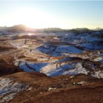
Destination: Kissing Camel East Ridge
Coordinates (use UTM NAD27 CONUS): 519000 E – 4249500 N to 518500 E – 42505000 N
Participants: Makiah, Lindsay
Road(s) and routes per MDRS Map : N/A
Mode of travel: walking



You must be logged in to post a comment.