Crew 261 EVA Report 05-05-2023
EVA # 7
Author: James Burk, Commander (with inputs from XO Aline Decadi)
Purpose of EVA:
Test of drones at Compass Rock.
Build experience for longer-range EVAs.
HabCom training of crewmembers to support longer-range EVAs.
Gathering of EVA traverse data using Meshtastic devices
Start time: 8:37 AM
End time: 10:35 AM
Narrative:
Overview of EVA
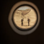
In preparation for the rest of the mission, this EVA was designed by the crew to build experience and confidence with long-range EVAs, including demonstration of a long rover traverse with frequent SOC checks to monitor battery capacity. We also wanted to practice flying drones with EVA suits on, using Compass Rock as a recognizable landmark that is easy to see on a drone viewfinder. We also planned to give other crewmembers back in the Hab time working as HabCom and learning how to support longer EVAs.
During this EVA both crewmembers carried two Meshtastic devices each (one T-Beam and one T-Echo) to gather data from the field to test the technology overall including its range from the Hab.
Commander Burk and XO Decadi drove with Curiosity rover to Compass Rock with intermediate waypoints: drive to Cow Dung Road, then North to Galileo Road, then East/Southeast to Compass Rock. Walk on foot to explore area.
It took us some time to find the right turn on Galileo Road (see Issues), and once we did and drove to Compass Rock, we disembarked and prepared our drones for flight.
The Atmosphinder electronics payload was included on EVA-7. The air quality monitor was added, which reports PM 2.5, PM 10, and NH3 every 10 seconds. This sensor data, along with the pressure, humidity, temperature, wind (anemometer), GPS, and battery, was logged at 1 Hz to the microcontroller’s microSD card. The data will be analyzed at a later date. Progress on Atmosphinder including adapting and installing both sail assemblies, affixing an improved towing method, and coding the mechanised sail trim motors.
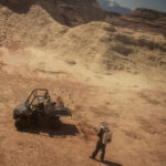
The plan was for both Commander Burk and XO Decadi to practice individually flying drones in their EVA suits with their associated difficulties (gloves, low visibility due to helmet, etc.) Upon arriving at the site, XO Decadi could not get her drone to power up. Commander Burk was able to deploy his drone (an off-the-shelf DJI Mavic Air 2) successfully and flew it for approx. 15-20 mins, making multiple passes over Compass Rock, and the EVA team and our rover.
Just as he was preparing to land the drone, he lost sight of it and attempted to use the “Return Home” feature, which he had tested successfully that morning back in the vicinity of the Musk Observatory (within the simulation protocols).
According to Commander Burk, the Return Home feature seemed off because he could not see the drone, even though the controls stated it was at distance 0 from home and landing. He aborted the Return Home feature, fearing that the “Home” waypoint was still set to the Musk Observatory (which was out of range of the drone’s battery), and attempted to manually pilot the drone back to him. Due to the limited visibility of his EVA gear, he was not able to ascertain position of the drone from only the viewfinder, and attempted to fly the drone using the mountains and Compass Rock as guide points. Long story short, the drone ran out of battery and he was forced to land it before he was able to sight its location visually. Commander Burk was under the impression that, because he had lost sight of the drone while it was north of Compass Rock, that it landed in that area.
After this happened, Commander Burk and XO Decadi packed everything up in the rover and began returning to the Hab on Galileo road, stopping briefly to look for the drone north of Compass Rock. Unable to find the drone, they returned to the Hab via Galileo Road and Cow Dung Road, briefly stopping at Marble Ritual to pick up an interesting animal bone that the previous day’s EVA had sighted.
The EVA team returned to the Hab safely, without the drone. During the debriefing session, the Crew Journalist requested that Commander Burk choose a name for the drone based on Greek mythology. He chose the name “Icarus”, after the story of the young boy who was given wings, and then flew too close to the Sun.
Later on in the day, Crew Engineer Julian Villa-Massone was able to both pinpoint the GPS coordinates of the downed drone using Commander Burk’s DJI controller and smartphone app. Villa-Massone then flew his own drone from the Musk Observatory and imaged the Icarus Drone at its landing spot, to enable future EVA planning to rescue it.
Issues Experienced During EVA 7
[Procedural] The Garmin units we took were not properly configured to show the coordinate system used on the official EVA map.
[Technical] XO Decadi’s drone batteries did not work despite being plugged in all night. After the EVA, she determined that the issue was due to her EU travel adapter (with the drone charger) not being fully seated in her stateroom’s wall outlet.
[Technical] The turn onto Galileo Road from Cow Dung Road is not a T-Intersection as shown on the map. It’s more like a half-oval off the road (almost like a turnaround for trucks, and the intersection to Galileo as off that half-oval. This turn off was hard to spot driving north.
[Technical] XO Decadi determined that the coordinate grid on the version of the official EVA map does not appear to be 100% precise.
[Procedural] Commander Burk flew a drone despite the high wind gusts, which caused the Icarus drone to be blown off course and visibility lost.
[Procedural] Commander Burk was not familiar with how to find & use DJI Fly app’s feature to “Find My Drone” which could have been used on-site to locate it.
Outcomes
As a lesson learnt from this experiment, we concluded that the map shall not be used as a primary tool while navigating in exploration areas, but rather as an indicator. The good solution is to focus on a detailed preparation upfront, using satellite imaging to visualize the shape of the road and understand the terrain landforms, combined with the use of waypoint-enabled navigation devices on the field.
Another outcome from this EVA was that the SOC of the Curiosity rover decreased in a non-predictive way: in ten minutes, it decreased very quickly from 100% to 85%, then it stayed at 66% for a very long time. As a lesson-learnt, it could be useful to test the rover under 60% in the vicinity of the MDRS station (for safety purposes) to predict the SOC. This could help to learn/ predict if the SOC goes very fast from 60% to 40% or even 20% or if it stays stable for a certain time around 50%-60%; and what are the parameters that can influence the SOC while in a long-range EVA. As the battery consumption may be different for each rover, we would recommend performing this test on the 4 rovers and provide the results to the mission support.
Mission Support provided a higher-resolution EVA map that we will begin using to plan.
Drone flights should not be done when there is danger of high wind gusts.
Drone flights should reference wind predictions at different altitudes using resources like Windy.com so that appropriate & safe altitudes are used for flights.
Destination: Compass Rock.
Coordinates (use UTM WGS 84): 520000 E, 4252000 N
Participants:
James Burk (Commander) (EVA Leader), Aline Decate (XO).
Road(s) and routes per MDRS Map: Drive to Cow Dung Road, then North to Galileo Road, then East/SouthEast to Compass Rock. Walk on foot to explore area.
Mode of travel: Rover
Vehicles you will be using (If applicable): Rover (Curiosity)
Crew 261 EVA Report 05–05–2023
EVA # 8
Author: James Burk, Commander (with inputs from XO Aline Decadi)
Purpose of EVA: Exploration of Area for Geologic Purposes
Start time: 11:25 PM
End time: 1:00 PM
Narrative:
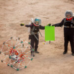
EVA-8 conducted exploration of Area for Geologic Purposes. The purpose was also to train for communication between the crew and HabCom. The crew walked to the MDRS sign, then headed due Southeast. The crew found various traces of ancient civilizations on the field.
The crew in the field had a positive experience overall, but suffered from some communication issues between themselves and between the HabCom team (led by GreenHab Officer Cecile Renaud with support from Commander James Burk). After the EVA, the crew hosted another long debriefing session, as was done yesterday. Our crew feels these debriefing sessions are very important to provide an open forum for discussion and also to help assist all crewmembers with building their analog astronaut experience, skills, and understanding of safe procedures.
Issues Experienced During EVA 8
1. [Procedural] Many Comms-related human factors process issues, including lack of use of different channels, lack of headset troubleshooting, not pausing after hitting the button on the radio before talking, and cross-talk between EVA crewmembers. All of these issues compounded and caused HabCom to have diminished understanding of the situation, including the perceived health status of crew members.
2. [Technical] Crew Engineer Julian Villa-Massone’s radio gear was acting temperamental and it was hard for him to hear HabCom. On the other end, HabCom’s receiving of Villa-Massone included heavy breathing (due to microphone too close to mouth) which caused HabCom to believe that Villa-Massone was struggling with breath often.
2. [Procedural] HSO was on the EVA and did her job by observing and checking in on EVA crewmembers, who were all nominal throughout the EVA, but because of the above Comms issues, the information on crew health was asked for by HabCom and not received. As a result, HabCom continued to assume that Villa-Massone was having difficulty and responded accordingly with Concern.
Outcomes
We spent a lot of time talking about correct Comms procedures, including use and troubleshooting of radios, using brief and factual communication, and ensuring that HabCom requests are better attended to by the EVA Lead and HSO.
We should provide more buffer time between EVAs to allow for debriefing sessions, which the crew is finding very valuable.
Crew members should take into account who is doing which role and how they communicate & like to receive communication. This is especially important because we have crewmembers from different cultures where English is not their primary language.
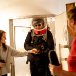
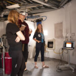
XO Decadi organized and held a training session for emergency procedures in the field, based on the past two days’ EVA experiences and her personal experiences on AMIDEE-18 and with the European Space Agency’s Ariane projects, with the purpose to expose what kind of hazards may happen on the field and how to detect and make decisions on the most appropriate “way for action”. Then we practiced how to remove the helmet/ backpack in different degraded situations as quick as possible.
Addition of Safety Check to Pre-EVA checklist to ensure crewmembers have acclimation with their gear to carry out the emergency contingency procedures we trained on today.
We agreed to plan out EVAs earlier in the day so that the entire crew can be involved.
Destination: Due Southeast of Hab, past MDRS sign.
Coordinates (use UTM WGS 84): 518400 E, 4250600 N
Participants: Julien Villa-Massone (EVA Leader), Kris Davidson (Crew Journalist), Audrey Derobertmasure (HSO).
Road(s) and routes per MDRS Map: Walk to MDRS sign, then head due Southeast.
Mode of travel: Walking






You must be logged in to post a comment.