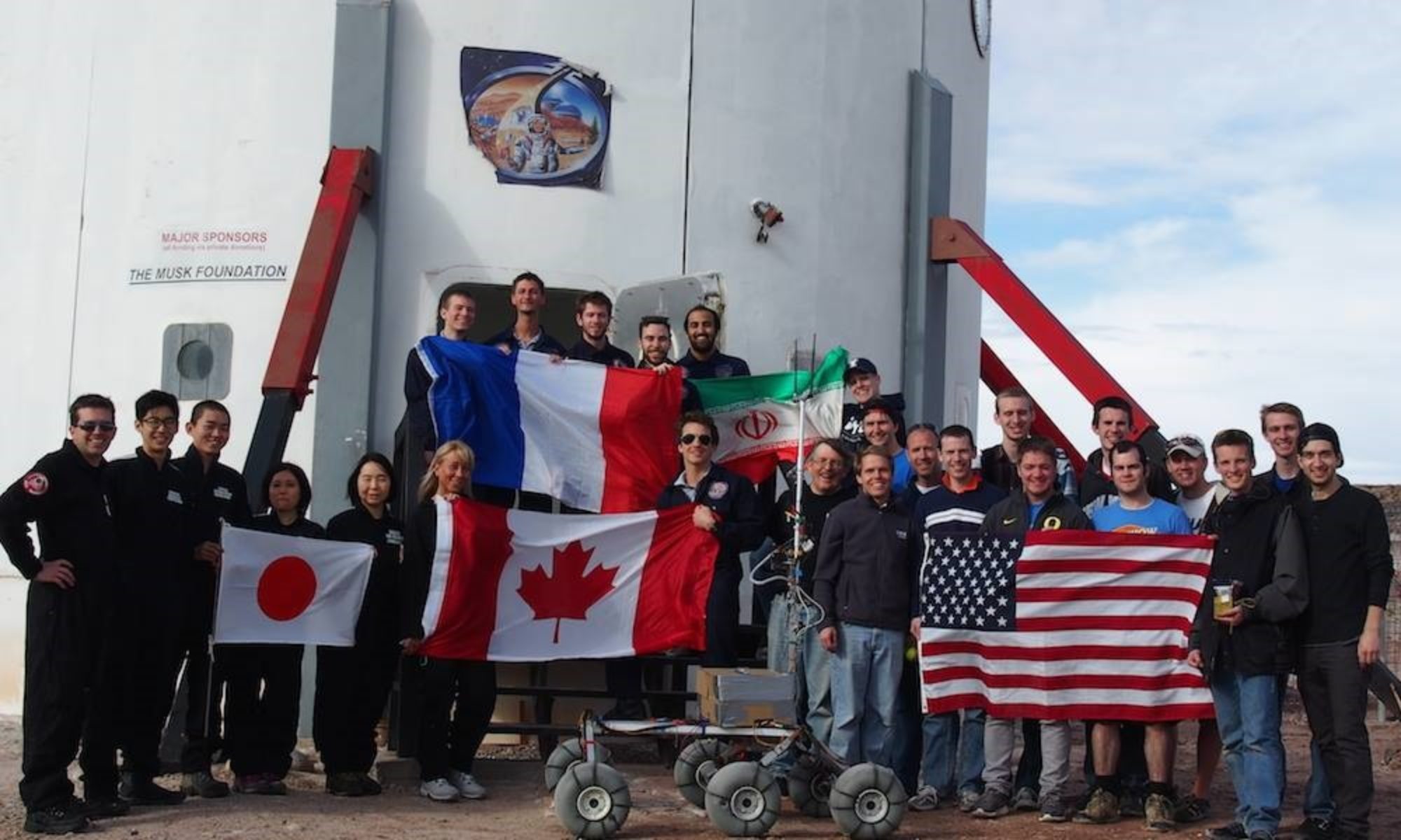
EVA Report – December 28th

Crew 236 EVA Report 28-DEC-2021

EVA # 9

Author: Kasey Hilton

Purpose of EVA: Evaluation of soil and ground conditions for additional potential habitat locations

Start time: 10:30

End time: 14:00

Narrative: The crew entered the airlock at 10:35 and headed towards Candor Chasma shortly after. Once both rovers were parked on Galileo, the crew headed east toward the destination. After hiking down into Candor Chasma, 2 locations were measured to see if they were large enough for a habitat, but neither were, however the ground and soil conditions were acceptable. This leads Vladimir (GHO) to believe that further east into Candor Chasma, there could be locations large and solid enough for a potential habitat location. At 12:15, the crew turned around and headed back to the rovers. The crew arrived back at the Hab at 12:54. The EVA, although not producing the desired results, is still considered a success, since multiple sites were evaluated.

Destination: Candor Chasma/Region G

Coordinates (use UTM NAD27 CONUS): N4251000, W521000

Participants: Kasey (CMD), Vladimir (GHO), and Ben (JOU)

Road(s) and routes per MDRS Map: From the Hab, driving north on Cow Dung Rd to Galileo Rd and Galileo Rd to near area F; walking from area F east to Candor Chasma

Mode of travel: Driving and walking

EVA Report – December 20th

EVA #1

Author: Cesare Guariniello

Start time: 11.38 AM

End time: 12.37 PM

Narrative: Team conducted a training EVA for Marble Ritual. Crew members collected and loaded rock samples at the collection baskets on Cow Dung Road. The crew explored the hills around Marble ritual and collected rock samples before heading back to the hab.

Destination: Marble Ritual

Coordinates (use UTM NAD27 CONUS): 12S 518700 4250800

Participants: XO, ASTRO, GHO, SCI

Road(s) and routes as per MDRS Map: Cow Dung Road

Mode of travel: Spirit and Curiosity

EVA #2

Author: Cesare Guariniello

Start time: 2.04 PM

End time: 3.18 PM

Narrative: Team conducted a training EVA for Marble Ritual. Crew members collected and loaded rock samples at the collection baskets on Cow Dung Road. The crew explored the hills around Marble ritual and collected rock samples before heading back to the hab.

Destination: Marble Ritual

Coordinates (use UTM NAD27 CONUS): 12S 518700 4250800

Participants: CMD, ENG, JOU

Road(s) and routes as per MDRS Map: Cow Dung Road

Mode of travel: Spirit and Opportunity

Cesare Guariniello

XO/HSO

Crew 236

EVA Report – December 27th

Crew 236 EVA Report 27-DEC-2021

EVA # 8

Author: Kasey Hilton

Purpose of EVA: Collection of samples from region D and Mancos Shales from Copernicus Hwy for analysis of water content and analog for rocks found in Gale Crater

Start time: 9:00

End time: 13:00

Narrative: EVA prep started around 8:30 and the group going on EVA was in the airlock at 9:02. Shortly after, the two pairs climbed in Spirit and Curiosity and headed towards region D using Cow Dung Rd and Brahe Hwy. About 30 minutes later, the group reached the moon overlook (region D) and parked the rovers to start walking down Copernicus Hwy in search of gypsum and Mancos shale. At the intersection of Brahe Hwy and Copernicus Hwy, the group found multiple samples of gypsum. Further down Copernicus Hwy and closer to the boundary walls, the group found samples of Mancos shales. Cesare (XO) was particularly excited about the mancos shale because he had been trying to find some for the last four years without any luck. The group turned around and walked back along Copernicus Hwy until they reached the rovers. They arrived back at the Hab at 11:46, happy that the research objectives they set out to accomplish had been achieved.

Destination: Region D and the Morrison and Mancos Shale boundary on Copernicus (2 stops)

Coordinates (use UTM NAD27 CONUS): N4254000, W515575

Participants: Kasey (CMD), Cesare (XO), Dylan (ASTRO), Pavi (ENG)

Road(s) and routes per MDRS Map: Cow Dung Rd north to Brahe Hwy, Brahe Hwy west to Copernicus Hwy, south on Copernicus Hwy

Mode of travel: Driving to the west side of Region D and walking down Copernicus Hwy

EVA Report – December 26th

Crew 236 EVA Report 26-DEC-2021

EVA # 7

Author: Kasey Hilton

Purpose of EVA: Collection of samples from region D and Mancos Shales from Copernicus Hwy for analysis of water content and analog for rocks found in Gale Crater

Start time: 12:00

End time: 16:00

Narrative: EVA # 7 was cancelled due to extremely high winds

Destination: Region D and the Morrison and Mancos Shell boundary on Copernicus (2 stops)

Coordinates (use UTM NAD27 CONUS): N4254000, W515575

Participants: Kasey (CMD), Cesare (XO), Dylan (ASTRO), Pavi (ENG)

Road(s) and routes per MDRS Map: Cow Dung Rd north to Brahe Hwy, Brahe Hwy west to Copernicus Hwy, south on Copernicus Hwy

Mode of travel: Driving to the west side of Region D and walking down Copernicus Hwy

Crew 236 – EVA Report – 24-Dec-2021

[Commander's EVA Report – December 24th]

Crew 236 EVA Report 24-DEC-2021

EVA # 5

Author: Kasey Hilton

Purpose of EVA: Evaluation of soil and ground conditions for additional potential habitat locations

Start time: 13:00

End time: 16:00

Narrative: EVA was canceled this afternoon due to winds and rain in the morning, making the ground very muddy. Will try this EVA again on 25DEC2021.

Destination: End of Galileo Rd/Area F

Coordinates (use UTM NAD27 CONUS): N4251500, E519750

Participants: Kasey (CMD), Vladimir (GHO), Dylan (ASTRO)

Road(s) and routes per MDRS Map: Cow Dung Rd north to Galileo Rd, then heading down into area F around Compass Rock

Mode of travel: Driving and walking

EVA Report Dec 23rd

Crew 236 EVA Report 23DEC2021

EVA #4

Author: Cesare Guariniello

Start time: 9.31 AM

End time: 12.02 PM

Narrative: The team began EVA preparation around 9 and entered the airlock at 9.31, just at the beginning of the EVA window. Crew Journalist replaced his earpiece that caused issues on EVA #3. After depressurization, the crew boarded the vehicles and headed south along Cow Dung road. After a drive of about 5 km, the crew walked towards Barainca Butte. Along the way, XO had a couple of stops to collect rock samples. One rock is brown and black and heavily vesiculated (possibly scoria). Other rocks came down from upper layers of hard mudstone and conglomerates. Meanwhile, SCI took rock temperature measurements for a project on thermal inertia of minerals at MDRS. ENG and JOU assisted and documented the work. The EVA crew reached the south side of Barainca Butte and continued its research proceeding counterclockwise around the butte. After having walked about one quarter of the perimeter of the butte, JOU noted some increasing fogging of the helmet and asked to position the fan switch at maximum speed. The fogging decreased, but JOU reported the fans slowing down. The crew decided to reduce the EVA time and began walking towards the vehicles. Unfortunately, within just a few minutes, JOU experienced a total loss of the fans which, on Mars, would require an urgent contingency rescue or would result in loss of the crewmember. Since the fogging disappeared quickly and JOU reported receiving enough air from underneath the collar, he elected to keep his helmet on for the drive back to the Hab. During the drive back, the crew met some astronauts onboard terrestrial-looking vehicles. The crew stopped the vehicles on the side of Cow Dung road, south of Kissing Camel range, to let the unknown astronauts pass by, with a brief and very amicable exchange of nods and smiles. The crew returned to the Hab about one hour earlier than the expected time, without further incidents.

Destination: Around Barainca Butte

Coordinates (use UTM NAD27 CONUS): N4247200, W519000

Participants: Cesare (XO), Tyler (SCI), Ben (JOU), Pavi (ENG)

Road(s) and routes as per MDRS Map: from the Hab south on Cow Dung Road, west towards Barainca Butte (region J)

Mode of travel: Driving and walking

Vehicles used: Curiosity and Opportunity

Cesare Guariniello

XO/HSO

Crew 236

EVA Report – December 22nd

Crew 236 EVA Report 22-Dec-2021

EVA #3

Author: Cesare Guariniello, XO/HSO Crew 236

Start time: 9.41 AM
End time: 10.28 PM

Narrative: The team first entered the airlock at 9.41. During depressurization, one crew member experienced a problem with the microphone, and after 3 minutes of repressurization the crew came back into the Hab to fix the problem. After the second depressurization, the EVA crew boarded the vehicles and headed south.

About 10 minutes into the drive, loud static was heard in the communication channel. The EVA crew stopped at the side of the road to troubleshoot the problem. XO assessed the radios and found that one radio was stuck in transmission mode (TX), thus preventing one EVA crew member from receiving communication. Switching a radio showed that the issue was in the earpiece, possibly the cable (since the earpiece does not have a vox setting).

As per EVA rules, for reasons of safety, the EVA was aborted due to one crew member has lost communication. The EVA crew returned to the Hab immediately, with no further anomalies.

Destination: Around Baranca Butte (INTENDED)

Coordinates (use UTM NAD27 CONUS): N4247200, W519000

Participants: Cesare (XO), Tyler (SCI), Ben (JOU), Pavi (ENG)

Road(s) and routes as per MDRS Map: from the Hab south on Cow Dung Road, west towards Baranca Butte (region J)

Mode of travel: Driving and walking

Vehicles used: Curiosity and Opportunity

Crew 260 EVA#1/2 Report for November 2nd

Crew 260 EVA Report 02-11-2021

EVA # 1

Author: Commander Jen Carver-Hunter

Purpose of EVA: Geologic sample collection

Start time: 10:30

End time: 12:30

Narrative: The EVA team departed the Hab 10:40, taking Cow Dung Road in medium-range speed, to see how Oppy would perform after the overheating during the training day. After crossing Robert’s Rock Garden, we incremented the speed and reach the 1101 intersection (Note for future EVAs and crews to take the southern entrance to not disrupt the natural wash). We reached our desired location where we collected our first geological targets as part of our mission objectives. After finding the needed samples, we went back to the main road and on our way North we stopped just before the Kissing Camels to go West and collect our petrified wood samples. We explored all the way to the beginning of the wash and noticing what time was it, we proceeded to return to the Hab after a successful EVA.

Destination: Road to Barranca Butte and Southwest Kissing Camel Ridge

Coordinates (use UTM NAD27 CONUS): 519700, 4247300 and 518200, 4249300

Participants: Atila, Katie, Adela

Road(s) and routes per MDRS Map: Hab road to Cow Dung Road to 1101 and back

Mode of travel: Rovers on roads, on foot off road

EVA # 2

Author: Commander Jen Carver-Hunter

Purpose of EVA: Geologic sample collection

Start time: 2:00

End time: 3:30

Narrative: The EVA team departed the Hab at 14:00. We followed Cow Dung Road to the 1101 intersection, and followed 1101 a few hundred yards to our first destination. We collected samples as part of our science mission objectives. Then we returned to the main road and turned to the north. The Opportunity Rover overheated just south of Kissing Camel Ridge, and we safely moved her to the side of the road. We piled into the remaining 2 rovers and continued on to Kissing Camel Ridge, where we collected samples at the base of the wash. Due to the onset of headaches and thirst, the EVA team returned to the Hab earlier than expected at 1530.

Destination: Road to Barranca Butte and Southwest Kissing Camel Ridge

Coordinates (use UTM NAD27 CONUS): 519700, 4247300 and 518200, 4249300

Participants: Jen, Tracy, David, Brandon

Road(s) and routes per MDRS Map: Hab road to Cow Dung Road to 1101 and back

Mode of travel: Rovers on roads, on foot off road

Crew 228 EVA#6 Report October 6th

Crew 228 EVA Report 06-Oct-2021

EVA #6

Author: Inga Popovaite and David Laude

Purpose of EVA: Exploration of Candor Chasma

Start time: 13.00

End time: 16.00

Narrative:

Dave and Inga drove to one of the entrances to Candor Chasma and explored the beginning of the canyon. The area is beautiful and breathtaking; the canyon is worth spending more time in. There was ample evidence for water flow along dry stream beds with rounded pebbles along the bed. Sedimentary layers were abundant. Also seen is what appeared to be limestone. They took a lot of photos and a few videos for outreach purposes. Inga interviewed Dave about his love for canyons. They took four radios; two of them either died due to low battery or started malfunctioning. Wind picked up on the second half of the EVA during the drive back and it was hard to communicate with VOX setting on. The wind noise caused radios to activate transmit via the VOX function. This helped to drain the batteries. A couple of lessons for the future: backup radios are a must; when it is windy it might be better to have the radio transmit manually operated.

Destination: Candor Chasma.

Coordinates (use UTM NAD27 CONUS): 38.4155 N, -110.768 W

EVA Participants: Dave Laude, Inga Popovaite

Road(s) and routes per MDRS Map: We traveled on Cow Dung Road 0110 and then along Galileo Rd 1104/Cactus Rd 1104.

Mode of travel: Driving, walking

Vehicles you will be using (If applicable): Curiosity and Spirit

EVA Report – October 05th

EVA #5

Author: Lindsay Rutter

Purpose of EVA: Collecting endolith and non-endolith rock samples on the Jotunheim structure

Start time: 0817

End time: 1032

Narrative:

Dave and Lindsay departed the HAB using the Opportunity and Curiosity rovers. The weather was cloudy, with a chance of rain. They turned left onto Cow Dung Road and proceeded North, until they arrived without incident at the intersection with Galileo Road. They parked approximately 50m North of the intersection, established contact with HabCom, and indicated they would likely experience radio blackout while circumnavigating the Jotunheim feature, and would return to an area with reception by 1000. They then dismounted the rovers, and traversed the remaining 500m to the structure by foot.

During the walk, they encountered numerous features that were visually similar to the target destination, but they did not experience difficulty finding it because Lindsay had already reached the structure using the same route in a previous EVA. Upon arrival, they conclusively identified the target destination with the aid of GPS. They then began to circumnavigate the structure counterclockwise. At five separate points along the structure, Lindsay collected samples, primarily on the structure’s slopes. Lindsay selected triplicate samples of endolith rocks and triplicate samples of non-endolith rocks. She donned extra large lab gloves over her spacesuit gloves and collected the rocks into sterilized bags for follow-up analysis. Dave recorded GPS coordinates, elevation, and collection time for each sample using the GPS Essentials application. He also manually recorded the metadata in a field notebook.

Dave and Lindsay departed the Jotunheim feature at 0958. Along the return walk, they attempted to reestablish connection every 30 seconds with HabCom, and successfully reestablished contact about halfway on the return walk to their rovers. Upon arriving at the rovers, Lindsay’s radio displayed a low battery warning and began failing to properly transmit and receive, despite it being fully charged at the beginning of the EVA. She rectified the issue by reconnecting her headpiece with her backup radio.

Dave and Lindsay began to depart Southward on Cow Dung Road, heading back to the HAB. About halfway of the return distance, they noted an off-white, elevated, and dome-shaped feature about 10m from the Westside berm of the road, that could be investigated in a future EVA. They returned to the HAB without incident. Less than one minute after entering the airlock, they were informed light precipitation had begun.

Destination: Jotunheim Structure

Coordinates: zone 12 4251912 N 518799 E (38.41712 N, -110.78466 W [NAD27])

Participants: L. Rutter, D. Laude

Road(s) and routes per MDRS map: Cow Dung Road 0110

Mode of travel: Opportunity and Curiosity rovers, walking

Copyright © The Mars Society. All rights reserved. | Main Site