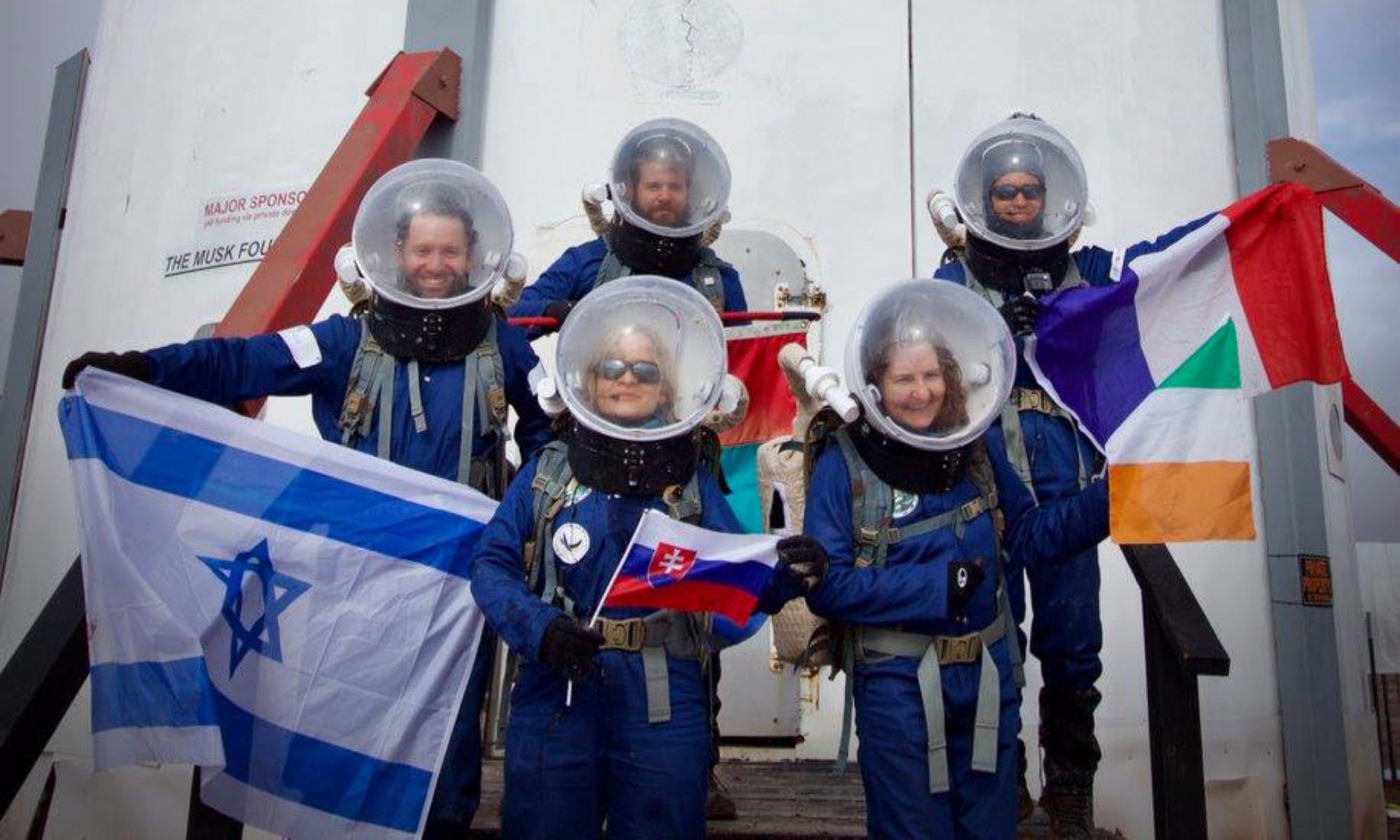
EVA Report – January 21st

Crew 203 EVA Report 21-01-2019

EVA # 5

Author: Liza Forero

Purpose of EVA:

Geologic recognition of the zone. Take samples and data for microbiology test and take some physic – chemical parameters of the ground using a LabQuest. The main parameters that are going to be taken are conductivity, pH and temperature.

Geology recognition of outcrops, topographic highs, sediment, canyons and lithology.

Start time:
12:11

End time:
16:00

Narrative:
 The EVA was successful, despite the weather, that was very windy and for a couple of minutes that rain, our EVA could be develop in the best possible way. We arrived at White Moon, leave the rovers over the Cow Dung Road and started to walk at west over the Brahe Highway. During the walk we covered some topographic highs. Finally, we arrived at the Beige Moon where we took some data for the physic – chemical parameters. 
During the walk we took samples that are going to be analyzed at the laboratory with the LabQuest. We described the lithology or the zone and found different types and colors of clays. 
During the EVA there were no trouble with rovers but at the middle of the simulation the suit of our commander Oscar Ojeda stopped working so he had to break simulation, but the rest of us could continue with the activities in a nominal way. After, we arrived at the Beige Moon and finish the activity we went back to the rovers and go back to the HAB. 
During the walk we were taking pictures and the register of the stratigraphy of the zone.

While we were walking we felt how the clays were so humid and plastic because of the water they absorbed with the snow and melted water.

Destination: Beige Moon (vehicle and walking).

Coordinates: 516500 E, 4254290 N

Participants:
Liza Forero, Yael Méndez, Oscar Ojeda, Hermes Bolivar

Road(s) and routes per MDRS Map: Cow Dungroad to the north till we get to the white moon, after that we are going to take west in the Brahe Highway to arrive to the Beige Moon.

Mode of travel: Walking and Driving

Vehicles used: Spirit and Curiosity

Crew 203 EVA Report 19Jan2019

[title EVA Report – January 19th]

[category eva-report]

Good night Capcom, here is our EVA Report of the day:

Crew 203 EVA Report 19-01-2019

EVA # 4

Author: Liza Forero

Purpose of EVA:

Geology recognition of outcrops, topographic highs, sediment, canyons and lithology. Take samples and data to be processed to make DEM´s (Digital Elevation Model) and data for microbiology tests.

Start time:
12:05

End time:
16:00

Narrative:
The EVA was successful. Thanks to the weather, that was dry, sunny and with low winds, our EVA could be develop in the best possible way. We arrived in Tank Wash where we covered two river valleys and some topographic highs. 
During the walk we took samples of rock and just two for microbiology tests. We described the lithology or the zone and found some minerals like quartz and gypsum. 
During the EVA there were no trouble with suits or with rovers and we went from west to east of the valley. After, we went to the south to a topographic high in the zone and went back to west to arrive in the road again and go back to the HAB. 
During the walk we were taking pictures, the register of the stratigraphy and some geologic and biologic samples that were taken to the HAB to be analyzed.

The weather was dry, but we felt how the clays were so humid and plastic because of the water they absorbed with the snow and melted water.

Destination: Tank Wash.

Coordinates: 518650 E, 4253640 N

Participants:
Liza Forero, Yael Méndez, David Mateus, Freddy Castaneda

Road(s) and routes per MDRS Map: Cow Dungroad to the north via Tank Wash

Mode of travel: Walking and Driving

Vehicles used: Spirit and Curiosity

Thanks you for the atention.

EVA Report – January 17th

Crew 203 EVA Report 17-01-2019

EVA # 3

Author: Liza Forero

Purpose of EVA:

Geology recognition of outcrops, topographic highs, sediment, canyons and lithology. Take samples and data to be processed to make DEM´s (Digital Elevation Model) and data for microbiology tests.

Start time:
14:05

End time:
17:00

Narrative:

In the EVA Request for today we expected to go to Tank Wash, nevertheless because of the weather and the muddy ground we decided to go to a nearest place, in this case, Kissing Camel Ridge. All this previously approved by Shannon and Atila. During the EVA there were no trouble with suits or with rovers and we went from east to west of the base of the ridge taking pictures, the register of the stratigraphy and some geologic and biologic samples that were taken to the HAB to be analyzed.

8 samples were taken, including sandstones, shales and clays. Each of it are going to be studied and characterized on the science dome with geologic and biologic tests.

The weather was dry, but we felt how the clays were so humid and plastic because of the water they absorbed with the snow. Nothing unusual happened and the EVA were successful.

Destination: Kissing Camel Ridge

Coordinates: 518700 E, 4249290 N

Participants:
Liza Forero, Yael Méndez, Oscar Ojeda, Hermes Bolívar

Road(s) and routes per MDRS Map:
We took the Cow Dung Road 0110 to the south from HAB via Kissing Camel Ridge.

Mode of travel: Rover and walking.

EVA Report – January 14th

EVA # 1

Author: Liza Forero

Purpose of EVA:
Recognition of the work area, practice in the use of suits and rovers and implementation of the protocol for taking samples.

Start time:
11:00 am

End time:
1:04 pm

Narrative:
We divided the EVA of the day in two groups, each one of 3 people. Each EVA has its own mission expert and a mission specialist. The mission expert for EVA #1 is Yael Méndez and the mission expert is Oscar Ojeda.

Samples were taken from two different areas for microbiological purposes, two from Phobos Peak and the other two were taken besides the 1103 road.

Before the EVA end, three samples of regolith were taken from Overlook Ridge to begin with the germination viability tests.

Destination: Phobos Peak.

Coordinates:
Sample coordinates:

01142019 – M1: 518419, 4250481
01142019 – M2: 518412, 4250427
01142019 – M3: 518956, 4251197
01142019 – M4: 518987, 4251193

Participants:
Yael Méndez, Oscar Ojeda, Hermes Bolívar

Road(s) and routes per MDRS Map:
For both zones we took the 1103 road and to arrive to the exact point of the samples for Phobos Peak we walk NE for 4 to 5 minutes.

Mode of travel: Rover and walking

EVA # 2

Author: Liza Forero

Purpose of EVA:
Recognition of the work area, practice in the use of suits and rovers and implementation of the protocol for taking samples.

Start time:
2:00 pm

End time:
3:56 pm

Narrative:
The mission expert for EVA #2 is Liza Forero and the mission specialist is David Mateus.

Samples were taken from two different areas for microbiological purposes. Three samples from Phobos Peak and one sample from the URC North Site.

Before the EVA end, three samples of regolith were taken from Overlook Ridge to begin with the germination viability tests.

Destination: Phobos Peak and URC North Site.

Coordinates:
Sample Coordinates:

01142019 – M5: 518530, 4250496
01142019 – M6: 518540, 4250475
01142019 – M7: 518654,4250439
01142019 – M8: 518936, 4251177

Participants:
Liza Forero, David Meteus, Fredy Castaneda

Road(s) and routes per MDRS Map:
For both zones we took the 1103 road and to arrive to the exact point of the samples for Phobos Peak we walk NE for 5 minutes.

Mode of travel:
Rovers and walking.

EVA Report – January 11th

Crew 202 EVA Report 11-Jan-2019

EVA #12

Author: Denys Bulikhov (EXO)

Purpose of EVA: Collection of geological samples and ambient radiation readings

Start time: 11:00

End time: 12:45

Narrative: EVA 12 crew walked northwest of the habitat, climbed the hills, went around the habitat area and came down from the south side. Along the way crew collected geological samples and radiation readings. The EVA was cut short due to radio malfunction (EXO).

Destination: Towards Old Repeater Point

Coordinates: E518000, N4250930

Participants: Denys Bulikhov (EXO), Kasey Hilton (ENG), Ellen Czaplinski (GEO), Alexandra Dukes (JOU).

Road(s) and routes per MDRS Map: walking northwest of the habitat.

Mode of travel: Walking

EVA Report – January 10th

Crew 202 EVA Report 10-Jan-2019

EVA #11

Author: Cesare Guariniello

Purpose of EVA: Collect radiometric measurements

Start time: 12:49

End time: 14:35

Narrative: The EVA left late, after the morning was spent showing our work and research to the guests. We drove north to the intersection of Cow Dung Rd and Galileo Rd, where we parked the vehicles and walked west, where we took radiometric readings of the environment and studied the rock formations close to a seasonal water stream. The crew demonstrated the work we do in the field, and let the guests share the difficulties of our mission. Due to the time window submitted in the EVA request, the crew did not further explore the area to the East and came back to the habitat.

Destination: Area west of the intersection of Cow Dung Rd and Galileo Rd

Coordinates (use UTM NAD27 CONUS): E518950, N4251975

Participants: Cesare Guariniello (CMD), Denys Bulikhov (EXO), Jake Qiu (HSO), Alexandra Dukes (JOU), Guest

Road(s) and routes per MDRS Map: Cow Dung Rd

Mode of travel: driving and walking

Vehicle used: Spirit, Curiosity, ATV 350.1

EVA Report – January 9th

Crew 202 EVA Report 9-Jan-2019

EVA #10

Author: Denys Bulikhov (EXO)

Purpose of EVA: Collection of geological samples and ambient radiation readings

Start time: 10:30
End time: 13:17

Narrative: Jake Qiu (HSO) was replaced with Ellen Czaplinski (GEO) due to primary geological intent of this EVA. EVA 10 took Cow Dung Rd north towards the Lith canyon until Spirit rover hit 60% of battery charge (Curiosity was at 65%). After that crew left the rovers and walked towards the canyon for approximately 0.8 miles. EVA 10 crew passed outside the dinosaur quarry and came out to the canyon from the west.

Here they collected radiation readings and geological samples. They looked for ways to get to the bottom of the Lith canyon, however, due to wet mud the descent was aborted. Right outside the quarry, EXO found the spot on the side of the larger formation where the ambient radiation level was almost 10 times higher than anywhere around MDRS area so far (12-16 uR/h on average around MDRS compared to the high 127 uR/h at this spot).

Samples were not collected however due to proximity to dinosaur quarry.

After that EVA 10 crew walked back to the rovers and came back to the Hab.

Destination: Lith canyon
Coordinates: N518800, E4256500

Participants: Cesare Guariniello (CMD), Denys Bulikhov (EXO), Kasey Hilton (ENG), Ellen Czaplinski (GEO).

Road(s) and routes per MDRS Map: Cow Dung Road.

Mode of travel: Driving and walking

Vehicles used: Spirit and Curiosity.

With best regards,
Denys Bulikhov

[end]

EVA Report – January 08th

EVA #9

Author: Cesare Guariniello

Purpose of EVA: Study and collect geological samples from the upper layers of the area (Skyline Rim, Dakota Sandstone)

Start time: 11:09

End time: 13:35

Narrative: First of all, the EVA crew is grateful to the Program Director Dr. Shannon Rupert and to the Assistant Program Director Atila Meszaros for authorizing the use of the ATV, providing ATV training, and trusting us with the logistics of this EVA for possible contingencies. With the snow almost completely melted in all locations, Cow Dung Road was wet in a few points, but in perfect conditions. Brahe Hwy was a little muddier than the main road, but still safe with the ATV. However, right at the intersection of Brahe Hwy and Copernicus Hwy 1574 south, the road became very muddy. Notwithstanding the absence of snow and ice, the EVA crew decided to be conservative. To avoid risk of losing friction on slopes due to the amount of mud on the tires, we elected to turn around without reaching the intended final destination. Sticking to the submitted roads and routes, we added stops on our way back to study locations close to the road about 100-150ft above the elevation of the habitat. The first stop (35 minutes) was at the intersection of Brahe Hwy and Copernicus Hwy, where we collected samples of crystalline gypsum from the region of the Moon. The second stop (40 minutes) was at the intersection of Brahe Hwy and Cow Dung Rd, in the region of the Glistening Sea, where we collected fluvial pebbles and crystalline gypsum, and studied the area of the water stream flowing towards the East. The third stop (20 minutes) was at the intersection of Cow Dung Rd and the Stream Bed Connector, where we walked to the entrance of the small canyon carved by the stream and identified sand deposits. Due to the decision to abort the intended destination and turn around, the EVA lasted 2 hours less than proposed, but yielded an interesting study of the crystalline salts, possible ancient evaporites, in the lower portion of the Cretaceous layers (Dakota formation). Once back to the habitat, the EVA crew scraped most of the mud from the ATV and polished the EVA suits from the mud. During an engineering EVA, the Crew Engineer and Executive Officer evaluated the remaining mud on the ATV, which will be further scraped once dry.

Destination: Skyline Rim (intended). Turned around along Copernicus Hwy 1574 (actual)

Coordinates (use UTM NAD27 CONUS): E515300, N4251250 (intended). E515907, N4254093 (actual)

Participants: Cesare Guariniello (CMD), Ellen Czaplinski (GEO), Alexandra Dukes (JOU)

Road(s) and routes per MDRS Map: Cow Dung Rd, Brahe Hwy 1572, Brahe Hwy 1575, Copernicus Hwy 1574

Mode of travel: driving and walking

Vehicle used: ATV Honda, 300, and 350.1

EVA Report 8 – January 7th

Crew 202 EVA Report 7-Jan-2019

EVA #8

Author: Denys Bulikhov (EXO)

Purpose of EVA: Collection of geological samples and ambient radiation readings

Start time: 10:55

End time: 14:05

Narrative: EVA 8 crew took Cow Dung Road up to the Galileo Rd and then down to the Cactus Rd. Crew came back to the same spot where EVA 6 crew investigated geological samples 2 days ago. EVA 8 crew attempted to find the lost trail since the snow melted down a little. EVA 8 crew drove around 0.5 mile around the plateau looking for the trail without any success. At the farthest point crew left the rovers and walked to one of the canyons where they collected geological samples, ambient radiation readings and took photographs on the rim of the canyon. Later they again attempted to locate the trail collecting the samples on the way. Trail was not found. After Spirit rover reached 60% of charge, EVA 8 crew came back to the hab.

Destination: Cactus Rd, canyons

Coordinates: N520500, E4252000

Participants: Denys Bulikhov (EXO), Kasey Hilton (ENG), Jake Qiu (HSO)

Road(s) and routes per MDRS Map: Cow Dung Road, Galileo Rd, Cactus Rd.

Mode of travel: Driving and walking

Vehicles used: Spirit and Curiosity.

EVA Report – January 5th

Crew 202 EVA Report 5-Jan-2019

EVA #6

Author: Denys Bulikhov (EXO)

Purpose of EVA: Collection of geological samples and ambient radiation readings

Start time: 11:03

End time: 13:13

Narrative: EVA 6 crew took Cow Dung Road up to the Galileo Rd and then down to Cactus road. Crew stopped in the middle of the valley where they collected geological samples and ambient radiation readings. Due to snow, collection of samples was problematic, and further movement down the Cactus road was impossible. EVA 6 was cut short. On the way back, crew stopped at Mtn. Nutella to take pictures. After that they returned to the Hab.

Destination: Cactus Rd.

Coordinates: N520500, E4252000

Participants: Cesare Guariniello (CMD), Denys Bulikhov (EXO), Ellen Czaplinski (GEO), Kasey Hilton (ENG)

Road(s) and routes per MDRS Map: Cow Dung Road, Galileo Rd, Cactus Rd.

Mode of travel: Driving and walking

Vehicles used: Spirit and Curiosity.

With best regards,

Denys Bulikhov

Copyright © The Mars Society. All rights reserved. | Main Site