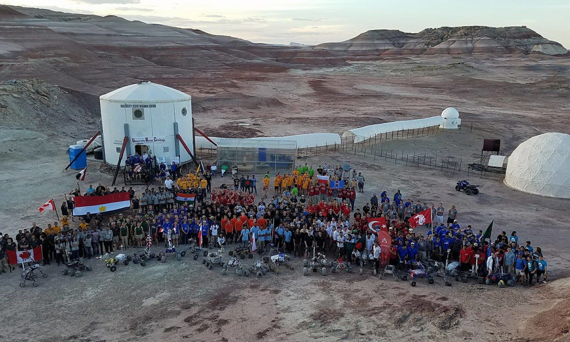
EVA Report – January 18th

Purpose of EVA: Aerial mapping of terrain, testing of mid-range EVA protocols, and mid-range operation test of Cóndor Space Suit Simulator.

Participants: Atila, Cynthia, Danton, and Oscar

Narrative: Today we had a successful and interesting EVA, attaining all the main goals, as well as a secondary goal. The crew left the airlock at 13:15. It was the first of an intended set of mid to long range of explorations in the area of MDRS. The crew donned the suits, consisting on 3 Exo suits and the Cóndor Space Suit Simulator. The target area was a canyon located south east from the habitat, which has not been much explored. Given the fact that this canyon has not been named, crew 187 decided to propose for it the name of El Dorado Canyon. A crew of 4 departed in two Rovers, Curiosity and Deimos, going south from the habitat through Cow Dung Road. After a traverse of approximately 15 minutes, passing Robert’s Rock Garden, the crew parked the vehicles and started walking east towards the entrance of the canyon. After traversing a rocky but flat terrain, the crew arrived at the southern edge of the zone, entering the dry riverbed by a small slope, which was found by following prints of a herbivore animal. Upon arrival, the crew started walking East, following the riverbed, quickly finding several elements of interest for future exploration, such as dry salt deposits, which could harbor extremophile microorganisms, frozen ponds, and sedimentary and clastic geological structures. These structures were present during all the traverse, being even more relevant towards the deepest segments. When the crew had made a walk of about 20 minutes from the ridge, a small pond was found, and the observation was made that it was probable to find wild animals around, which was confirmed by finding several prints of was probably a pack of herbivores, also a carnivore feline print was found, which we assume, belonged to a Mountain Lion. The print was presumably fresh, of at most hours, which made the crew to decide to stop the walking exploration, send the drone a few hundred meters ahead, and proceed to return, following the same path. A few samples of rocks with salt deposits were recovered and stored. Unfortunately, upon landing, the drone’s camera mount engine was locked, and the issue is being assessed by Danton. At the arrival to the ridge, the crew started walking West, to find the main road and the Rovers to head back to the habitat. During this walk a coral fossil was found and retrieved. The crew arrived to the Rovers and headed back to the MDRS campus. Upon arrival the Cóndor Space Suit proceeded to the airlock, due to the fact that the battery was drained, and it could represent a hazard to operations. The rest of the crew made a short excursion inside the RAM module to inspect the contents related to the HSO, as well as to store the cage for the Curiosity rover. The EVA ended at 15:55.

We also noticed that the coordinates given by the map do not match the ones provided by the GPS equipment available in the lab, we’d like to further explore this issue.

No incident or anomaly was sustained during the EVA.

Oscar Ojeda – EVA Officer

EVA Report – January 16th

Purpose of EVA: Collecting regolith samples for use on science projects (15kg, Atila and David)

Participants: Atila, David, Luis, and Oscar

Narrative: Today’s EVA was fortunately a short one, the most time you spend out in Mars, the most risk you have of suffering an incident, and safety comes first, despite of the always breathtaking views that you get. All the goals of the EVA were successfully attained. On a particular note, the excursion leader, Oscar, used the flexible segment of the Condor Space Suit Simulator, in combination with the Exo Suit. The requested EVA window was of two hours, with previous knowledge that it would last under an hour, planning for possible issues arising. At 9:15 the crewmembers started getting ready in the lower deck, donning the flight suits, as well as the accessories, such as radios and snoopy caps, the required elements for the activity were taken, mainly consisting of sealable bags, 3 shovels, and a bucket. Afterwards the crew proceeded to decompression protocols in the airlock, egressing the Habitat main door at 9:51. The crew proceeded to walk towards the base of Overlook Ridge, on its Northeast segment, where 10 full bags of regolith were collected, as well as a full bucket, all containing around 16kg of soil samples. The samples were then moved to the side of the hab, and after requesting permission, moved into the airlock. The crew sustained depressurization procedures, and then proceeded to doffing.

No incident or anomaly was sustained during the EVA.

Thank you,

Oscar Ojeda

EVA Report – January 15th

Purpose of EVA: Space Suit activity recognition and Assessment of in-suit performance

Participants:

EVA 1: Atila, Danton, Oscar, Cynthia

EVA 2: Atila, Luis, David, Tania

Narrative: The crew conducted the first EVA set of activities today, and it was a huge success, whit all the objectives completed. The main goal of the EVA was to get all the crewmembers a first approach to external operations, and to test the main tools we would be using from now on, on each of the projects. The EVA was designed to also test the performance of the crewmembers with the gear on, to plan better the next EVAs, and assignments. Both crews performed the same routine, with small variations. The routine began by the donning of the suits, proceeding to enter the airlock, 5 minute depressurization, and going out in front of the hab. From there, the group took a straight route until the south of Marble Ritual, try the quadcopter operation, and the shovels for sampling. Upon return to the hab area, the crew left some of the equipment back and mounted the vehicles, 3 ATVs and the Curiosity Rover. It is important to clear that the requested Rover was Deimos, but the designated driver in EVA 1, Danton, would not fit inside of it, requiring the use of the one without safety cage. In order to keep the same protocols, EVA 2 used the same Rover. The next route was traversed by vehicle and took the crew to Pooh’s Corner, where a second brief walk was undertaken, towards a small mound on the East of Cow Dung Road. Afterwards the crew returned to the vicinity of the hab to perform the last test, which consisted of making summit of Overlook Ridge. The crew then returned to the airlock, sustained repressurization, and upon entry to the hab, proceeded to doffing protocols.

Each crewmember was interviewed upon finalization of the doffing on qualitative, and quantitative factors, as well as general comments on the performance of themselves on the suit. Further comment on this will be posted on the final report.

Oscar Ojeda

EVA Officer – Crew 187

EVA Report – January 12th

Purpose of EVA: Collect and analyze samples of shale obtained from the region below Skyline Rim. Collect samples of fossilized shells that were discovered on a previous EVA near White Moon.

Destination: Skyline Rim

UDM27 Coordinates: 515300E, 4251200N

Destination: White Moon

UDM27 Coordinates: 517100E, 4254600N

Participants: Justin Mansell (Journalist), Melanie Grande (Engineer), Sam Albert (Health and Safety Officer)

Narrative: This was the final EVA of the mission and the members of the team were tasked with obtaining samples of shale from the base of Skyline Rim and analyzing them in the field with a spectrometer. Our secondary objective was to collect a handful of fossilized shells from a deposit near White Moon. This deposit was discovered on a previous EVA but no samples were taken. We departed the airlock at 11:07 am and drove north to White Moon. I led in the Deimos rover followed behind by Sam and Melanie in Spirit. We made a brief stop near Gray Moon to search for the fossil bed but were unsuccessful in locating it. We remounted the rovers after several minutes and continued to Skyline Rim by way of Copernicus Highway 1574 and Sagan Street 1103. We arrived on site at approximately 12:30 pm.

Sam was able to make contact with the habitat from atop a small hill using a ham radio while Melanie and I searched for shale near the end of Sagan Street. Once we had positively identified several samples of shale the team collected equipment from the rovers and proceeded to the base of the cliff. We also made a brief test of the navigation radio to verify the direction to the habitat.

Sam made his way up an escarpment to collect chips of shale directly from the cliff wall using a rock hammer. Melanie also climbed an escarpment to take complimentary spectra using the spectrometer. I remained at the base of the escarpments to monitor Sam and Melanie’s safety. The team then returned to the rovers and departed Skyline Rim at 1:15 pm.

We made a second stop at White Moon on the return journey and relocated the shell fossils found on a previous EVA. We filled a sample bag with a handful of shells and returned directly to the habitat. We arrived at the habitat at 2:23 pm. The total time on EVA was 3 hours and 21 minutes.

Justin Mansell, MDRS Crew 186 Journalist

EVA Report – January 11th

Author: Max Fagin

Purpose of EVA: The last testing of the Yagi-Uda antenna based navigation experiment for navigating back to the hab. Destination change the night before to Skyline ridge allowed photographic reconnaissance in preparation for tomorrow’s geology EVA to the same site.

Destination: Plains to the east of skyline ridge

UDM27 Coordinates: 516000 E, 4251000 N

Participants: Max Fagin (Commander), Kshitij Mall (Executive Officer)

Narrative: This EVA was the final demonstration of the radio beacon navigation system, with the goal of demonstrating its effectiveness when line of sight was obstructed for the duration of the walk. Kshitij served as the lost astronaut, and had the hood in place over his helmet that limited his field of view to 5m from his feet. Max monitored the route and tracked the progress via gps to ensure the route was safe. We left the airlock at 10:36 and walked north along a foot path to the top of the ridge that rises over the hab to our west. After cresting the ridge, we walked due west along Sagan Rd before swinging south 50m to await the first beacon transmission. When the beacon was received, we started back, Kshitij leading the way, and Max monitoring. When Kshitij would stop to check the bearing on the hab, Max tested an experimental chlorophyll detector that Chris McKay and Matteo Borri had designed for us for use on the local flora. A loss of the beacon for ~15 minutes led to a complete turnaround, but it was corrected when the beacon was picked up again. We crested the ridge 45 minutes later at the ridge’s closest point to the hab, exactly where we should have been. So close that Kshitij gave an audible gasp when Max removed the hood and saw the habitat was so close. We deactivated the beacon, and walked north to find the route back down to the hab. Airlock ingress was at 12:37 for a total EVA time of 2:01.

Note: One of the hab’s radios has been damaged beyond repair. I was carrying it in my front pocket as a backup radio, and when I lifted my leg while climbing the ridge, the antenna was pinched against my front and snapped off. Shannon: There are still more than enough radios at the hab to provide spares, so I don’t know if you will want to replace it or not, but either way, I will note this on the checkout sheet as damage incurred. My apologies for the damage.

EVA Report – January 10th

Author: Cesare Guariniello

Purpose of EVA: Testing the next phase of the Yagi-Uda antenna-based navigation experiment for navigating back to the hab. Testing with a stranded astronaut in a condition of low visibility

Destination: End of Mountain Goat Road

UDM27 Coordinates:

519750 E

4250500 N

Participants: Cesare, Melanie, Mark (stranded astronaut)

Narrative: This EVA put an astronaut in condition of low visibility, simulating a dust storm. This condition was obtained with a cardboard placed over the top portion of the ExoSuit helmet. The astronaut has visibility limited to about 5m ahead (for reasons of safety) and can look at the handheld radio when navigating, in order to find the direction of the habitat. The crew egressed the habitat with Mark already “under the hood”, and checked the safety of the hooding apparatus, then the three EVA crewmembers started walking Northwest to the intended destination, guided by Cesare’s GPS unit. During the outward path, Melanie and Cesare had Mark stopping multiple times, to spin around and be redirected so as to be completely disoriented. The outward path was also chosen so that the return direction would not follow it.

Once the turnaround point was reached, Mark turned on the Yagi-Uda antenna receiver and began scanning for the radio beacon from the habitat, sent initially at intervals of 5 minutes. Melanie and Cesare took care of the safety of the path chosen by Mark, but let him decide the direction to walk towards. When rock walls occurred, Mark decided the best path around them, and only once he was requested to stop to avoid excessive proximity to a shallow canyon. The EVA gave significant results to the experiment. Mark was able to locate the habitat with adequate precision even when hills and rocks obstructed the line of communication, though a power attenuator might be required in close proximity to the habitat (Mark could navigate close to saturation of the signal, at about 500m from the habitat). A major problem was the difficulty to follow a straight path. Mark always pinpointed the direction towards the habitat, but walked in wide arcs. For this reason, Cesare and Melanie requested continuous transmission of the beacon signal which helped reducing the path error.

Around 1:40 (one hour and 35 minutes into the EVA), the weather turned to rain. The crew immediately reported the occurrence to the HabCom. Upon indication by the commander the EVA was scrubbed immediately, Mark was unhooded, and the EVA team returned to the hab (which had been in sight for about 20 minutes, and was only 500m away) without delays and ingresses the airlock after collecting two soil samples from the immediate vicinity of the habitat, to be analyzed for use in the Greenhab by future crews.

Cesare Guariniello, crew geologist

Crew 186 – Boilers2Mars

Mars Desert Research Station

EVA Report – January 8th

Author: Max Fagin

Purpose of EVA:

1. Visit the Beige Moon and White Moon areas, which remain unsampled by our previous EVA team during EVA#3

2. Test the Yagi-Uda antenna based navigation experiment by walking back to the hab

Destination: Yellow moon, white moon, beige moon, walk back

UDM27 Coordinates: 516500 E, 4254250 N

Participants: Max Fagin (Commander), Kshitij Mall (Executive Officer), Justin Mansell (Journalist)

Narrative: We exited the hab on schedule and departed north to the Moons region. We started at the western most site, and traveled east, stopping at each site to collect a sample of clay, salt, and a panoramic photo. Despite the cold, not being burdened by sensing equipment was a welcome relief, and we got really good at quickly dismounting, sampling, photographing and documenting a new site. Thanks Cesare for the great geology training! After sampling all three sites, we drove back along Cow Dung road until the GPS indicated we were within 2 km of the hab. We dismounted, set up the radio beacon, and Justin began navigating across the terrain back to the hab, with Kshitij and I following for safety. Inspecting the route on GPS after the fact revealed it was as near to a direct route as could be expected given patches of unnavigable terrain. A great success for the navigation system! All that remains it to duplicate the results with the astronaut’s view of the horizon restricted to remove the possibility of subconsciously navigating by distant terrain features or the sun. We will attempt to do this tomorrow, weather permitting.

After returning to the hab, Justin and Kshitij took three sorties out (one on Opportunity, two on Curiosity) to recover the ATVs that had been abandoned for the navigation experiment and bring them back to the hab.

Note: Another one of our radios gave a low battery signal ~20 minutes into the EVA. Since we were carrying two spare radios as per our decision from yesterday’s EVA, communications were instantly restored. I recommend listing it in the MDRS handbook that the EVA team must always carry at least one fully charged spare radio. It is such a small additional burden, and such a large increase in EVA safety.

EVA Report – January 7th

Author: Max Fagin

Purpose of EVA: Photography and sampling of the previously identified stratified cut in the canyon wall east of the Maxwell Montes region.

Destination: The canyons just to the east of the Maxwell Montes region.

UDM27 Coordinates: 522500 E 4254500 N

Participants: Max Fagin (Commander), Cesare Guariniello (Geologist), Sam Albert (HSO), Melanie Grande (Crew Engineer)

Narrative: We departed the Hab at 10:45 and arrived at the end of Cactus Rd. at 11:15. The initial descent into the canyon was steep but navigable, and we descended 200 ft east down a ridge line and stream bed before we encountered a cliff in the stream bed that we could not safely descend. Instead, we turned north west to follow an offshoot of the canyon in the general direction we wanted to go, then climbed up onto a dirt embankment that lay beneath the Muddy Creek canyon’s west edge. This embankment allowed us to travel a 0.5 miles north with no obstruction, but ended at the edge of a smaller canyon on the west of the Muddy Creek, still 0.5 miles south of our target. As we now had only 45 minutes left until our turn around time, we elected to descend into this canyon (which we named Boilermaker canyon) and sample the stratified layers on its north shelf.

Returning to the rovers was more difficult as we realized that the final slope we had descended into Boilermaker Canyon from the embankment was too steep to safely climb up again without scrambling. In hindsight, this was a mistake, as it made us completely dependent on our gps for safe navigation. The original intent had been to exactly retrace the same route into and out of the canyon so we could follow our footprints back to the rovers in the event that we lost our GPS. Instead, in order to avoid scrambling back up the south slope of Boilermaker Canyon, we turned down slope to the east and walked towards the Muddy Creek to find a more shallow slope back up to the west embankment that would allow us to rejoin our path. We eventually found a route up a ridge and back onto the embankment, but without the gps, this would have been nearly impossible. Our footprints on the embankment were invisible until we were right on top of them, and had we not had the gps to tell us where our track was, we could have easily gotten turned around in the maze of stream beds and side canyons. During the walk back, we made several wrong turns when we lost our foot prints. Because we had the gps, the wrong turns were noted and corrected within seconds, but had we not had the gps, walk back would have taken much longer, producing a late return. This was not a navigation mode that I would consider sufficiently safe for EVA operations, and I do not intend to repeat it in the future. We will no longer venture into terrain where a safe exit would be impossible without digital assistance, and we intend to carry at least one gps in the future to guard against the risk of failure.

We returned to the rovers at 3:00 and made use of the reserve water supplies through a camelback to avoid doffing the suits. The water had been reserved for this purpose, as a Mars suit would be expected to allow the occupant to drink, so we did not consider this a breach of sim. We returned to the Hab at 3:25.

Notes on comms issue: One of the radios indicated a low battery on the outbound trip. We elected to continue as communications were still possible, but turned the radio off between transmissions to maximize its lifetime. We also implemented the practice of the incommunicado crew member remaining close to another crew member who could signal via hand that they were needed on comm, or relay instructions via simulated helmet contact. The radio lasted until we reached the site, but then could not be used at all. We swapped radios and kept the crew member with the dead radio in the 2nd place of a single file line, ensuring they could not become separated.

As this is now the second time as apparently fully charged radio battery has failed on EVA, we are implementing a new EVA policy where two spare radios will be carried with the EVA team at all times, and swapped in in the event of radio failure.

EVA Report – January 5th

Author: Max Fagin

Purpose of EVA: Geological sampling of the Greenstone Rd. area and continuing the search for hematite blueberries

Destination: South of Greenstone Rd

UDM27 Coordinates:

520000 E: 424850 N

Participants: Max Fagin (Commander), Kshitij Mall (Executive Officer), Cesare Guariniello (Geologist), Justin Mansell (Journalist), Mark Gee (GreenHab Officer).

Narrative: We reformatted the EVA after suiting up and a radio conversation with Shannon to be an exclusively geological EVA, and delay the navigation component to a later EVA (we previously misunderstood the EVA rules about crew members separating into teams after departing the hab, and how this would technically constitute two separate EVAs). We departed the Hab at 11:10 and arrived on site at 11:48. We walked a long counterclockwise loop around the area searching the ground and occasionally stopping for spectral samples with Cesar’s portable spectrometer, and for the first time, with the portable laser spectrometer that had been generously lent to us by NASA Ames. Despite spending 3 hours on site and seeing many interesting geologic features, we did not find any of the hematite blueberry deposits that are reported to be in this area. We stopped at the Kissing Camels feature on the way back to sample a layer of Dakota Sandstone from the Cretaceous period and returned to the Hab at 14:30.

I expected a 5 person EVA to only be ~20% harder than our more typical 4 person EVA, but in reality, my impression is that they are ~50% harder. In addition to requiring multiple press/depress cycles, the 5th crew member requires an extra vehicle and more room than is easily available in the suit up area. We will probably stick to the conventional 4 crew EVAs in the future. That really does seem to be the perfect number.

EVA Report – January 4th

Author: Cesare Guariniello

Purpose of EVA: Visit the regions of Beige Moon and Yellow Moon, collect samples of salts

Destination: Yellow Moon

UDM27 Coordinates:
515700 E
4254200 N

Participants: Cesare, Melanie, Mark, Samuel

Narrative: This EVA brought the crew for the first time Northwest of the habitat, in the region of The Moons (White Moon, Beige Moon, Gray Moon, Yellow Moon). After egressing the habitat airlock, the EVA crew members spent about fifteen minutes strapping and securing the spectrometer case and the geology toolbox to the ATVs. This simple activity was very instructive about the difficulties of performing simple tasks when donning bulky gloves and a space suit, being able to communicate only via radio, while always “thinking like a Martian” (for example, this means slow and accurate movements, paying attention to the safety of all crew members).

Due to the low temperature, the crew had to use the choker to start the ATVs. However, despite warming the 300, its engine quit multiple times. Since the EVA had multiple stops planned, the crew decided not to use the 300, and instead added a third 350 (vehicles used were the Honda, 350.1, 350.2, and 350.3). The ride North was quite slow, due to the presence of a delicate, expensive instrument.

Once again, the crew did not spot the unmarked road (in this case, Hwy 1572), and went further North to the end of the ATV road. This detour gave the crew the first spectacular sight: on the way back towards Hwy 1572, the crew drove through the Glistening Seas, and the position of the Sun showed how appropriate this name is. The whole plain was sparkly with reflections from gypsum crystals, which gave a sense of awe. In the middle of the Glistening Seas, the EVA crew spotted the location of Hwy 1572 and followed it towards Yellow Moon. Upon reaching the location and parking the ATVs, the crew geologist began his collection of samples, while other EVA crew members explored the area. The magnificent landscape, open to the East on the red Morrison formation, and shadowed to the West by the brown rims of Mancos shale, prompted a discussion within the EVA crew to discuss about the possibility of reaching the Martian Moons.

Due to the delays at the beginning of the EVA, the crew had to turn around after just 40 minutes in the field. On the way back, two more stops for collection of geological samples were added, before the crew stopped at Mount Nutella (see photos of the day) to climb the sand dune and look at the formations from the top of the mount. Melanie lost communication at this point, but this did not cause any problem: she was put in the middle of the ATVs convoy, and the EVA party was already enroute to the habitat. Upon returning, while Melanie refueled the ATVs and tested the 300 (which worked, since it had warmed up), and Cesare unstrapped the tools, the crew was welcomed by a new pet: the NorCal Mars Society’s rover Phoenix!! The EVA crew played with it for a little bit, before ingressing the airlock to end this astonishing EVA.

Copyright © The Mars Society. All rights reserved. | Main Site