
Crew 280 EVA Report 26-04-2023
EVA #10
Author: Carla Conejo (Executive Officer & Biologist)
The EVA had the following goals:
Documenting the EVA for outreach purposes, by Núria Jar (Journalist).
Drone flight recording, by Carla Conejo (Executive Officer & Biologist) and the support of Mariona Badenas (Commander & Astronomer).
Collecting sand samples for the CatMart project, by Laia Ribas (GreenHab Officer).
Start time: 10:10 AM
End time: 12:50 PM
Narrative:
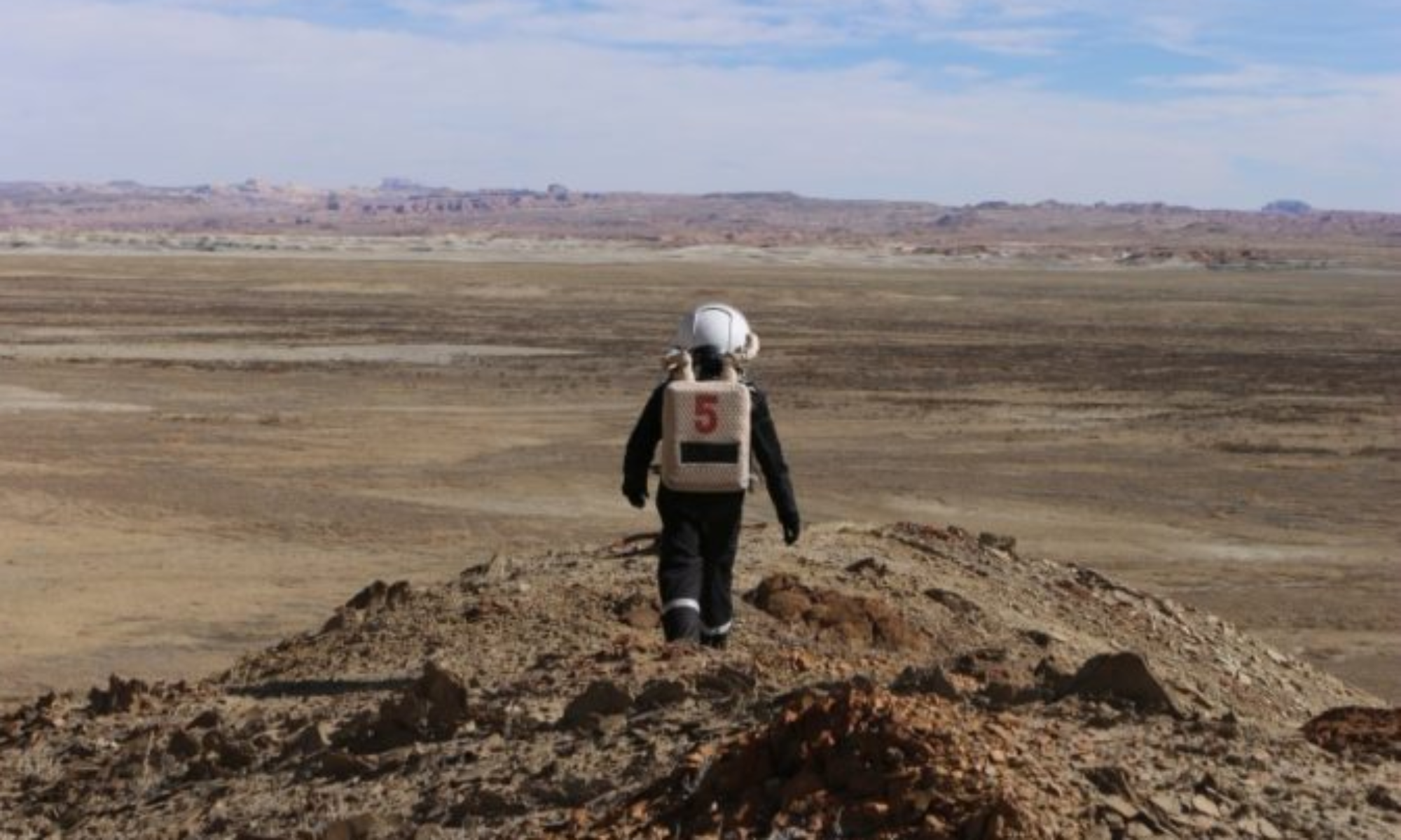
After performing 5 minutes of depressurization in the front airlock, the EVA team took Curiosity and Spirit rovers and headed north towards the cross with Brahe Highway 1572. The crew performing the EVA had the goals of: i) collecting sand samples searching for Martian biosignatures for Laia Ribas’ (GreenHab Officer) project; ii) documenting the latter process with a GoPro camera; and iii) recording some Martian landscape images with a DJI Mini 3 Pro drone.
The communications with the base were established with normality during the whole EVA with checks-ins every 30’ minutes. Just before arriving at Brahe Highway 1572, we parked the rovers and the EVA team climbed a hill nearby next to the road. From there, communications were established with the base to inform of our position. After that, to facilitate the communications between the EVA crew and the EVA leader, the EVA leader decided to switch between channel one and two on the radios. After taking a 5-minutes rest, the EVA team split themselves into two groups. The first group, Mariona Badenas (Commander & Astronomer) and Carla Conejo (Executive Officer & Biologist) stayed in the hill to fly the drone and take some zenith pictures of Mars; whereas the second group, Laia Ribas (GreenHab Officer) and Núria Jar (Journalist) descended the hill to access a dry water drain to search for Martian biosignatures. The two groups maintained constant visual and radio communications.
Around 12:10PM the team decided to return to the MDRS, which they reached at 12:50PM. Before entering the Hab, we followed the 5-minutes pressurization protocol.
Destination: Cow Dung Road 0110 cross with Brahe Highway 1572. Our initial plan was to reach Overlook, but we finally explored the Brahe Highway 1572 area by foot.
Coordinates (use UTM WSG 84): 516000 E, 4255000 N
EVA participants: 4: Mariona Badenas (Commander & Astronomer) (EVA Leader), Carla Conejo (Executive Officer & Biologist), Laia Ribas (GreenHab Officer) and Núria Jar (Journalist).
Road(s) and routes per MDRS Map: Drive east on Cow Dung Road 0110 and park before arriving at Brahe Highway 1572.
Mode of travel: Drive east on Cow Dung Road 0110 and to Brahe Highway 1572, to walk around the area no farther than 1000m from the rovers.