EVA Report – November 15th

EVA # 1
Author: Jenni Hesterman, Elizabeth Balga
Purpose of EVA: Familiarization with spacesuits, communications system, and rovers
Start time: 1000
End time: 1100
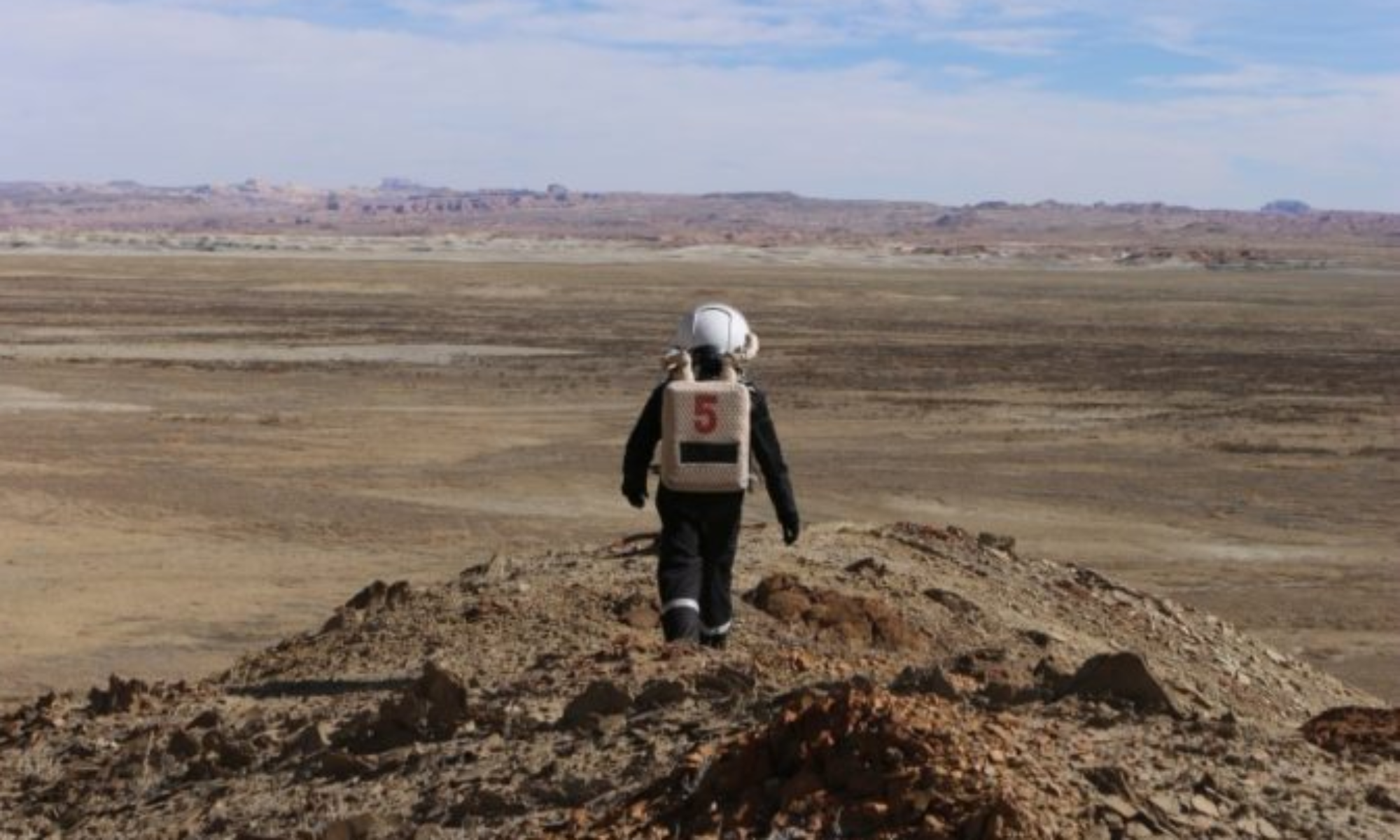
Narrative: The crew took overshot Marble Ritual, executed a three point turn without breaking the berm and arrived at the target area. We set off on foot exploring and noted petrified wood and many types of rock in the area.
Destination: Marble Ritual
Coordinates (use UTM WGS 84): 519000, 4251000
Participants: CDR, COMM, ENGR
Road(s) and routes per MDRS Map: Cow Dung Rd (0110) to Marble Ritual
Mode of travel: Rover, Walking

EVA # 2
Author: Caitlyn Hubric, Elizabeth Balga
Purpose of EVA: Familiarization with spacesuits, communications system, and rovers
Start time: 1430
End time: 1530
Narrative: Attempted to fly our drone today, winds were too high, crash landed but in good condition. Will try again in future EVA. Scouted the area around Marble Ritual for plant life, found 5-6 different plants of interest to sample the dirt/substrate around the roots. Found the presence of an orange organism on the northside of rocks, which looked like a lichen, would like to return to scrape a small amount to look under the microscope.
Destination: Marble Ritual
Coordinates (use UTM WGS 84): 519000, 4251000
Participants: XO, BIO, HSO
Road(s) and routes per MDRS Map: Cow Dung Rd (0110) to Marble Ritual
Mode of travel: Rover, Walking

EVA Report – November 11th

EVA # 15
Author: Laurène Delsupexhe
Purpose of EVA: End of mission engineering EVA
Start time: 12:10am
End time: 12:30 pm
Narrative: The Crew Engineer did a final Engineering EVA to report if there had been any change to the exterior of the station: there are no updates to bring since the previous engineering EVA. After leaving the hab, Laurène went around it, then around the Green Hab, behind the Science Dome, around the solar panels and the observatory and behind the station before finally going around the RAM and heading back.
Destination: MDRS
Coordinates (use UTM NAD27 CONUS): 4251000-518000
Participants: Laurène Delsupexhe
Road(s) and routes per MDRS Map: N/A
Mode of travel: Walking

EVA Report – November 10th

EVA # 13
Author: Laurène Delsupexhe
Purpose of EVA: Experiment with robot Lazarus + Exploring Sagan Street
Start time: 11:50am
End time: 1:40 pm
Narrative: The crew left the main Hab at 11:50am with the robot and tested 3 times the same straight path of 10m close to the observatory. After that, they left the equipment in the airlock for the team in the Hab to download the data and recharge the battery. Meanwhile, Laurène and Cristina headed towards the North Ridge in order to reach Sagan Street. The Mission Support Crew contacted them to let them know the testing of the robot had not properly worked. As there was still an hour and a half in the EVA and the crew was already halfway to Sagan Street, they decided to continue the exploration part of the EVA. They reached their destination, took some samples to test later on and headed back to the station by the same way they arrived. They ended their EVA as soon as they came back to the station and decided that Paula and Marta will redo the test during their EVA.
Destination: Sagan Street
Coordinates (use UTM NAD27 CONUS): 4251500-516500
Participants: Cristina Vazquez and Laurène Delsupexhe
Road(s) and routes per MDRS Map: Sagan Street, 1103
Mode of travel: Walking

EVA #: 14
Author: Marta Ferran
Purpose of EVA: Experiment with robot Lazarus + Exploring
Start time: 2:40pm
End time: 5:30pm
Narrative: Paula and Marta left the main Hab at 2:30 PM with Lazarus, the visual odometry robot developed by Dronomy. The crew tested 4 times the same straight path of 12 m close to the MDRS. Once finished, the crew came back to the Hab and left the robot equipment in the airlock. After that, Paula and Marta continued with their exploration around the MDRS. The sky was gorgeous and so, the crew took amazing pictures of the red planet. After almost 3h of EVA, the crew headed back to the Hab and started working on Lazarus’ files.
Destination: Around MDRS
Coordinates (use UTM NAD27 CONUS): 4251000-518000
Participants: Marta Ferran and Paula Peixoto
Road(s) and routes per MDRS Map: N/A
Mode of travel: Walking

EVA Report – November 8th

EVA # 12
Author: Cristina Vazquez Reynel, Crew Exec Officer and HSO
Purpose of EVA: Experiment with robot Lazarus
Start time: 2:10 pm
End time: 4:10 pm
Narrative: The crew left the main Hab at 2:10pm with the robot and tested 3 times the same straight path of 12m with the intention of comparing the end coordinates recognised by the visual odometry. After that, they left the equipment at the airlock for the team in the Hab to download the data and recharge the battery. Meanwhile, Paula and Cristina took a walk around the station exploring the area. Once the robot was ready to test again, they collected it and tested 3 times a square path of 10m. The data was downloaded from the robot and will be analyzed.
Destination: Around MDRS
Coordinates (use UTM NAD27 CONUS): 4251000-518500
Participants: Cristina Vazquez and Paula Peixoto
Road(s) and routes per MDRS Map: N/A
Mode of travel: Walking

EVA Report – November 7th

EVA # 11
Author: Laurène Delsupexhe – Crew Engineer
Purpose of EVA: Testing of the Dronomy robot + Explore the surroundings of the Hab.
Start time: 2:10 pm
End time: 4:30 pm
Narrative: After double-checking the 2 suits were fully charged, the EVA crew waited for a final confirmation from Mission Support. Once they had it, they left the hab to reach an area east of the Marble’s Ritual, quite flat and less windy, where they set up the experiment of the Dronomy robot. The testing went well and the robot responded as predicted. The data was collected but the memory was full a little earlier than predicted. Once finished with the experiment, the EVA Crew headed back to the station to drop off in the airlock the robot and the necessary instruments. They then headed back north of the station, aiming for a hill north of the Marble’s ritual. Some photos were taken and soil was collected. The crew then headed back home, tired but satisfied
Destination: North MDRS station
Coordinates (use UTM NAD27 CONUS): 4251000-518500
Participants: Laurène Delsupexhe and Marta Ferran Marques
Road(s) and routes per MDRS Map: Cow Dung Road 0110
Mode of travel: Walking

EVA Report – November 6th


EVA # 10

Author: Paula Peixoto Moledo – Crew Biologist and Journalist
Purpose of EVA: Explore the surroundings of the Hab.
Start time: 10:10 am
End time: 10:55 am
Narrative: The EVA Crew took the 2 suits that were functional at the moment and explored the surroundings of the Hab. Once Mission Support advised coming back to the hab to troubleshoot properly the suits, the crew cut short the EVA and headed back to the station to continue troubleshooting.
Destination: Around MDRS station
Coordinates (use UTM NAD27 CONUS): 4251000-218000
Participants: Paula Peixoto Moledo and Laurene Delsupexhe
Road(s) and routes per MDRS Map: N/A
Mode of travel: Walking

EVA Report – November 5th

EVA # 9
Author: Cristina Vazquez Reynel, Crew Exec Officer and HSO
Purpose of EVA: Test Dronomy robot, experiment 3
Start time: 10am
End time: 12pm
Narrative: The crew took the robot Lazarus for a third trial behind MDRS station where the orography is very different from the previous test. The crew did 3 trials in a straight line and 3 trials in a square ending at the starting position. Cristina’s EVA suit ventilation stopped working and the crew had to come back to the station to change it.
Destination: Around MDRS station
Coordinates (use UTM NAD27 CONUS): 4251000-218000
Participants: Cristina Vazquez and Marta Ferran
Road(s) and routes per MDRS Map: N/A
Mode of travel: Walking

EVA Report – May 4th

Crew 265 EVA Report 04-05-2022

EVA # 9

Author: Laude

Purpose of EVA: Social media filming by the Crew Journalist.

Start time: 0900
End time: 1140

Narrative: We made our way on foot to the base of Phobos Peak taking photos and videos along the way. Many interesting rock and sediment formations were seen with all displaying the forces of erosion likely by weather and water. We readily hiked a short way up to its southern slope and stopped at a nice nearly flat overlook, but could not view MDRS.

We then descended to the base and walked partway around the base looking for another perch. Finding none, we rehiked up to the previous overlook where Treadwell continued her work. We stayed there for about 40 minutes until she got everything she could think of and several minutes longer as Laude was reluctant to leave such an awesome view and time was on our side.

Finally, we made good speed and arrived at the hab 20 minutes early.

Destination: Phobos Peak

Coordinates (use UTM NAD27 CONUS): UTM NAD27 CONUS 519324 4250177

Participants: Laude and Treadwell

Road(s) and routes per MDRS Map: Walking to Phobos Peak.

Mode of travel: Foot

EVA Report – May 4th

Crew 265 EVA Report 04-05-2022

EVA # 10

Author: Levesque

Purpose of EVA: Long-range communications testing

Start time: 1300
End time: 1600

Narrative: The EVA team drove to Zubrin’s Head and then proceeded on foot to a point 500 meters west for a comms check. They returned to the rovers and drove down the road to repeat the process on foot on a road near White Rock Reservoir and later in White Rock Canyon to the south. They next drove back to the junction of Cow Dung Road and a rough road leading to Barrainca Butte and walked on foot from there to conduct two comm checks along that road. After completing all checks, they returned to the rovers and drove back to the Hab, having to stop twice because of a rover’s overheating.

Destination: Zubrin’s Head, White Rock Canyon, Barrainca Butte areas

Coordinates: UTM NAD27 CONUS 518804 4247962, 520100 4248538, 515968 4254298, 520369, 4247380, 519554 4247285, 518956 4247098

EVA Participants: Iakymov, Blanco, Licea

Road(s) and Routes per MDRS map: Cow Dung Road, Zubrin’s Head, White Rock Reservoir and Canyon, and Barrainca Butte.

Mode of Travel: Perserverance and Opportunity and on foot.

Crew 265 EVA Report April 30th

Crew 265 EVA Report 30-04-2022

EVA # 6

Author: Laude

Purpose of EVA: To conduct more distant communications project testing, examine possibility of rover travel to the north of Moon Overlook, map areas of interest and to simulate a first Phobos manned mission from Mars and perhaps from anywhere. The crew will collect limited regolith samples and small rocks, plenty of photos and explore on foot in nearby areas that warrant closer examination. Also, we will look south from Moon Overlook to view the condition of Copernicus Highway for a possible future rover EVA.

Start time: 12:30

End time: 16:25

Narrative: We got off on time and traveled to Moon Overlook stopping along the way for radio checks. At the overlook we looked south to see the condition of Copernicus Highway leading south for another day EVA down that road. Conditions looked good for rover travel. We took photos at the overlook of the marvelous moon like terrain below us and to the north and then we descended down into it by rover. After a few hundred meters we stopped to collect a regolith sample with a scoop from Phobos, set some footprints and get photos. As we continued by rover the scenery quickly shifted to more Mars like as Phobos is tiny in size. Red canyon walls with stratigraphic layers enveloped us, opening up and closing in as we proceeded. At one open area we came across remnants of a fence that we passed through and soon the path became sandy and the rovers squirmed about from time to time. Shortly after coming across Muddy Creek the path narrowed and the sand loosened around our wheels. We might soon need 4WD to proceed if not for the decision to stop for a better look and turn around. The two rovers did need 4WD briefly to turn about. On the way out Laude decided to stop where there was a shallow slope up to a higher point (8M) to better view the area on foot. When looking down during ascent he noticed sea shells by the thousands (crew named it the Sea of Shells 4255097 N 516370 E)! Dense collections of them on the hill side. After calling the crew to see them he walked higher and noticed many other nearby hills covered with them! This area may warrant closer examination during a future EVA. After this unexpected find the crew returned back to MDRS.

Destination: Moon Overlook then north to the end of the drivable Copernicus highway.

Coordinates (use UTM NAD27 CONUS): 4254360 N, 516052 E (Moon Overlook) 4257885 N, 518294 E (End of passible road on rover near Muddy Creek. Dirt road turned sandy and narrow there.)

Participants: EVA Commander Laude, Jounalist Treadwell and Mapping /Radio Tech Licea

Road(s) and routes per MDRS Map: North on Cow Dung Road 0110 then Brahe Hwy1572/1575 then Copernicus Hwy 1574/0157.

Mode of travel: Spirit and Curiosity and on foot

Copyright © The Mars Society. All rights reserved. | Main Site