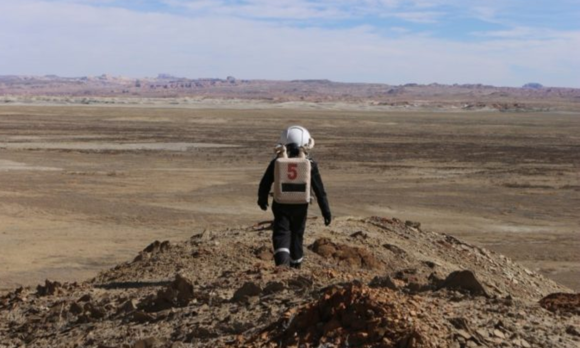
EVA Report – February 24th

Crew 263 EVA Report 24-02-2022

EVA # 3

Author: Léa Rouverand

Purpose of EVA: battery change for atmospheric experiment, installation of antenna and geology field campaign with LIBS

Start time: 9:00

End time: 10:40

Narrative: Rover batteries were checked just in case. The atmospheric experiment batteries were changed per the usual routine. The installation of the antenna for the HF wave propagation experiment was performed without any issues. One of the crew members lost their earplug at the beginning of the LIBS analysis so the EVA team leader decided to return to base by communicating through a notebook.

Destination: Atmospheric experience site (at intersection between Cow Dung Road and Entrance Road), around the Hab (antenna installation).

Coordinates (use UTM NAD27 CONUS): 518288 E, 4250586 N

Participants: Cerise Cuny, Léa Rouverand, Valentine Bourgeois, Marine Prunier

Road(s) and routes per MDRS Map: Entrance Road.

Mode of travel: Foot

EVA Report – February 23rd

Crew 263 EVA Report 23-02-2022

EVA # 2

Author: Cerise Cuny

Purpose of EVA: battery change for the atmospheric experiment.

Start time: 9:00 am
End time: 9:37 am

Narrative: Because of weather conditions, we only went out to change the batteries of the atmospheric experiments. We checked the rovers’ batteries, just in case. Everything went smoothly, no one slipped.

Destination: Atmospheric experience site (at the intersection between Cow Dung Road and Entrance Road).

Coordinates (use UTM NAD27 CONUS): 518288 E, 4250586 N

Participants: Cerise Cuny, Léa Rouverand, Valentine Bourgeois, Mathéo Fouchet

Road(s) and routes per MDRS Map: Entrance Road.

Mode of travel: Foot

EVA Report – February 22nd

Crew 263 EVA Report 22-02-2022

EVA # 1

Author: Cerise Cuny

Purpose of EVA: Initiation EVA, batteries replacement of atmospheric experiments, mapping of station with Augmented Reality, location search for future set up of antenna.

Start time: 9:39

End time: 10:39

Narrative: We checked the rover batteries (all full), and left with Opportunity and Curiosity towards Marble Ritual. We arrived at 9:43, we walked a bit, to see how comfortable we were with the EVA suits, and to get used to them. We took time to admire the Martian landscape. We left Marble Ritual with the rovers at 10:00 to join the atmospheric experiment site. We removed the LOAC because it does not bear snow storms well. We plugged a battery to PurpleAir and re-oriented the anemometer to the North. We had forgotten to bring a garbage bag to protect the battery from the rain ; as it is absolutely necessary to protect it before tonight’s snow storm, we asked our HabCom to put a garbage bag in the air lock. Elena (my buddy) and I went to fetch it while the other two stayed near the weather station to fix some things. We did not lose sight of the other pair and we stayed within the radio range.

When we were done with the atmospheric experiment we went back to the station with the rovers (10:29) and left them there to walk around the station. Nicolas was not able to test the augmented reality to map the MDRS because the HoloLens fell around his neck during the first part of the EVA. We found a nice spot for the communication antenna: far enough from the Science Dome so that it can’t fall on it even in case of extreme winds, but close enough for us to plug its 20m electric cable in the Dome. At 10:39 we were back in the air lock to end the EVA.

Destination: Marble Ritual, atmospheric experience site (at intersection between Cow Dung Road and Entrance Road), and around the station.

Coordinates (use UTM NAD27 CONUS): 518600, 4250700

Participants: Cerise Cuny, Marine Prunier, Nicolas Wattelle, Elena Lopez-Contreras.

Road(s) and routes per MDRS Map: Entrance Road, Cow Dung Road.

Mode of travel: Foot, Rover

EVA Report – February 18th

Crew 240 EVA Report 18-02-2022

EVA # 19

Author: Clément Plagne

Purpose of EVA: Exploration and looking out for interesting features for 3D mapping. Changing batteries on atmospheric experiment

Start time: 9:55

End time: 12:42

Narrative: Battery recovery went nominal, and EVA took place normally, with interesting routes taken thanks to 3D maps.

Destination: Hab Ridge

Coordinates (use UTM NAD27 CONUS): 518500 4251500

Participants: Julie Levita, Clément Plagne, Pierre Fabre, Maxime Jalabert

Road(s) and routes per MDRS Map: Cow Dung Road

Mode of travel: Rovers, foot

EVA Report – February 14th

Crew 240 EVA Report 14-02-2022

EVA #15

Author: François Vinet

Purpose of EVA: taking drone shots of specific areas in Moon Overlook.

Start time: 9:40

End time: 12:36

Narrative: We firstly changed the batteries of our experiments (LOAC, Weather station, Wind mill). This took approximately 20 minutes because of small problems. Then we drove to Moon Overlook (approximately 15 minutes) and walked a little bit among the Yellow Moon and to the Snake River. Everything went right and the drone shots are amazing. Before going back to the Hab, we freed a mouse but it directly hid in the wheel of a rover and we couldn’t remove it from there. Too bad…

Destination: Moon Overlook

Coordinates (use UTM NAD27 CONUS): 516500, 4254500

Participants: François Vinet, Marion Burnichon, Pierre Fabre, Julie Levita

Road(s) and routes per MDRS Map: Cow Dung Road 0110, Brahe Hwy 1572, Brahe Hwy 1575

Mode of travel: by rover and by foot

EVA Report – February 17th

Crew 240 EVA Report 17Feb2022

EVA # 18

Author: Pierre Fabre

Purpose of EVA: Standard battery replacement for our atmospheric experiments. Following 3D mapping of the area near Hab Ridge a little North of North Ridge, two EVAs will be performed to check the performance of crew members based on the use of these 3D maps for EVA prep to ascend the mapped area.

Start time: 9:50

End time: 11:43

Narrative: Battery replacements went well as usual, and then the EVA team proceeded to attempt a climb of Hab Ridge as part of an experiment to assess the value of 3D mapping to EVA preparation. Climb went well, and team returned early after all objectives had been met.

Destination: Hab Ridge

Coordinates (use UTM NAD27 CONUS): 518500 4251500

Participants: Pierre Fabre, François Vinet, Julie Levita, Marion Burnichon

Road(s) and routes per MDRS Map: Cow Dung Road

Mode of travel: Rovers, foot

EVA Report – February 16th

Crew 240 EVA Report 16Feb2022

EVA # 17

Author: François Vinet

Purpose of EVA: Changing the batteries of our scientific equipment, exploring the Kissing Camel area, with a particular objective of observing, photographing, and possibly collecting samples of petrified wood on the Western part of the area.

Start time: 9.45
End time: 11.45

Narrative: We finally had the EVA happen without one member. Battery change on the atmospheric experiments went nominally. The EVA went well, we found some beautiful pieces of petrified wood. Then we walked a little bit on Kissing Camel where the view was beautiful despite the wind that blew a lot. The headset of one member fell but we still were able to communicate easily with gestures, and we were home early with all objectives fulfilled.

Destination: Kissing Camel Ridge.

Coordinates (use UTM NAD27 CONUS): 518000, 4249500

Participants: François Vinet, Clément Plagne, Maxime Jalabert

Road(s) and routes per MDRS Map: Cow Dung Road

Mode of travel: by rover and by foot

Crew 240 EVA Report February 15th

Crew 240 EVA Report 15Feb2022

EVA # 16

Author: Maxime Jalabert

Purpose of EVA: Drone flights over Candor Chasma, changing batteries of atmospheric experiments.

Start time: 9h30

End time: 12h30

Narrative: After changing the batteries of the atmospherics experiments, we went to Candor Chasma to do some drone shots. We ended the EVA one hour before planned time because of some aches from crew members, general fatigue, and because objectives had been satisfactorily met.

Destination: Candor Chasma, Exploration Zone G

Coordinates (use UTM NAD27 CONUS): 522000 4251000

EVA Participants: Maxime Jalabert, Julie Levita, Pierre Fabre, Clément Plagne

Road(s) and routes per MDRS Map: Cow Dung Road by rover, followed by Stream Bed Connector and onward by foot

Mode of travel: Rover, Foot

EVA Report

Crew 240 EVA Report 13Feb2022

EVA # 14

Author: Clément Plagne

Purpose of EVA: Replacement of batteries for scientific experiment and installation of two others that weren’t functional at the beginning of the mission.

Start time: 11:05

End time: 12:00

Narrative: All events occurred according to plan, and experiments are well installed and stable but may need to be retrieved in coming days in case of very high winds.

Destination: Crossing between Cow Dung Road and Entrance Road

Coordinates (use UTM NAD27 CONUS): 518 300, 425 0500

Participants: Clément Plagne, Marion Burnichon

Road(s) and routes per MDRS Map: Entrance Road, Cow Dung Road

Mode of travel: Rovers

EVA Report – February 12th

Crew 240 EVA Report 12Feb2022

EVA # 13

Author: Maxime Jalabert

Purpose of EVA: 3D Mapping, drone shots of the EVA area, and changing batteries for experiments.

Start time: 9:35

End time: 13:20

Narrative: This EVA was surely one of the best for us. The 3D Mapping went well (approx. 30 mins) and we took some drone shots of the area while we were on the crest (see photos). There were a lot of martians with human shapes on the road but we avoided any contact.

I noticed that the battery of Perseverance was running out quite quickly compared to Spirit and Curiosity last time, so if we need to go to an other position that far from the station we will surely use Spirit and Curiosity.

Destination:Special Region, exploration zone D

Coordinates (use UTM NAD27 CONUS): 518000, 425600

Participants: Maxime Jalabert, Marion Burnichon, Pierre Fabre

Road(s) and routes per MDRS Map: Cow Dung Road

Mode of travel: Rovers, foot

Copyright © The Mars Society. All rights reserved. | Main Site