EVA Report – January 9th


Crew 272 EVA Report 09-01-2023

EVA # 6

Author: Arly Black

Purpose of EVA: 1) First geology EVA to Kissing Camel Ridge. Specific focus on evidence of KCR as an inverted paleochannel as proposed by Clarke and Stoker (2011). 2) Geologist vs non-Geologist field performance evaluation. 3) Drone scouting of surrounding area for feasible search and rescue simulation location of future EVA.

Start time: 11:00 AM

End time: 2:00 PM

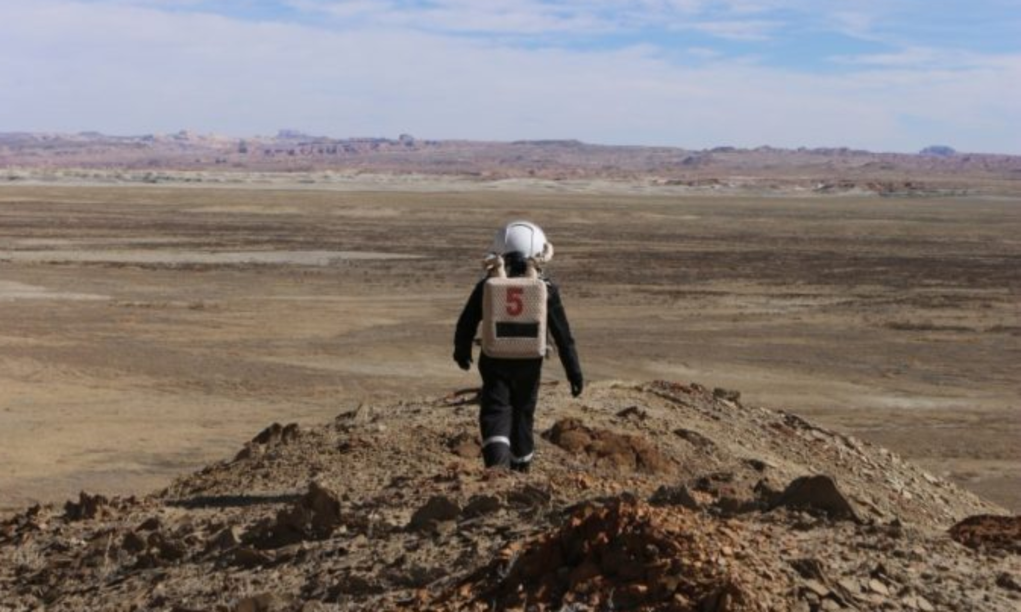
Narrative: Upon placing the fancy, new, plush headsets on their heads, the EVA crew knew their days of comms issues were over. It was love at first “copy”. With the previous headsets banished to the town of non-nominal toys, EVA prep went off without a hitch, and all explorers were suited up, thrust into the airlock, and exposed to awful puns with time to spare. The crew exited the airlock and danced their way to Opportunity and Curiosity (don’t think we didn’t see those moves Kenny and Kshitij). They drove south along Cow Dung Road, parked where the road intersects with Kissing Camel Ridge, and continued on foot 100 m south of the west ridge. Kshitij and Mason proceeded to use the drone to scout out potential locations in which to perform their search and rescue research operations. They found that the southern part of the ridge is simply perfect for their planned activity due to clear lines of sight and several good hiding places for a lost astronaut. The drone range reached 2800 ft, more than enough to cover the search grid of interest. Mason then took videos of crew members enjoying their time out in the field.

Simultaneously, Adriana and Kenny went further up the ridge, but within light-of-sight, searching for more paleoflow indicators (Adriana is worried about overusing those words, but I don’t think I’ll ever get sick of them). She took dip measurements, documented around 12 different sites of paleoflow indicators, and wrote some lithologic descriptions. She collected samples with sedimentary structures in them and excitingly, she believes she has found coal seams (geologists rejoice!). Along with minor frolicking and rock-hugging, Kenny documented crew activities and participated in further geologist vs non-geologist performance tests. Besides formations allegedly shaped like large, amorous, humped mammals, the ridge is also home to a staggering amount of petrified wood, which the crew gathered in droves! After taking a final group shot with the drone, the team packed up their supplies and their hard-earned booty and made it back to the Hab a half hour early as they had achieved all their objectives. Ultimately, this was a very successful EVA and the remaining crew back at the Hab can’t wait to get out there to collect some colourful terrified tree bark of their own!

Destination: Kissing Camel Ridge

Coordinates (use UTM WGS 84): N518400, E4249500

Participants: Kshitij Mall (Crew Commander), Mason Kuhn (Crew Engineer), Kenny Pritchard (Crew Journalist), Adriana Brown (Crew Geologist)

Road(s) and routes per MDRS Map: Drove south on Cow Dung Road until Kissing Camel Ridge. Walked on foot along ridge to the east and west relative to Cow Dung Road. Returned to rovers on foot and drove back to the Hab via Cow Dung Road.

Mode of travel: Driving and walking

EVA Report – December 29th

EVA #13

Author: Cesare Guariniello

Purpose of EVA: 1) Collecting rocks and clay samples above Hab ridge and at the foot of Skyline Rim. These samples are for analysis of properties for In-Situ Resource Utilization 2) Radio communication check.

Start time: 1230
End time: 1510

Narrative: The crew left the Hab area on foot, followed route 1103 up to Hab Ridge. Communication with the habitat was tested on top of the ridge with excellent results. During the walk, extensive videographic and photographic footage was collected. The crew sampled the soil along the way and walked about 4km, up to the bottom of Skyline Rim. Climbing in the middle of two alluvial fans, the crew found loose samples assumed to come from the layers above. In particular, one fan had boulders made of relatively large-grain sandstone. A secondary fan was strewn with large rectangular slabs of red shale. The whole EVA crew helped collect samples. Another radio communication check showed that the repeater installed on Hab Ridge allows for direct communication with the habitat from Skyline Rim. After a few minutes to rest and enjoy the beauty of the extensive view from Skyline Rim, the crew headed back to the hab.

Destination: Skyline Rim

Coordinates: 515430, 4251442

EVA Participants: Käosaar, Eifert, Iakymov, Guariniello

Road(s) and routes per MDRS Map: Walked from the Hab to Hab Ridge along 1103 (Sagan Hwy), then followed 1103 to the foot of Skyline Rim

Mode of travel: Walking

EVA Report – January 8th

EVA # 5
Author: Arly Black
Purpose of EVA: 1) Further hike into Candor Chasma to continue documenting paleoflow indicators, specifically looking for more trough cross-bedding documented during EVA 4. 2) Drone scouting of Candor Chasma.
Start time: 11:03 AM
End time: 2:22 PM
Narrative: We started off our mission on time and in high spirits. The dad jokes were flying, and comms were on fire (in the best way- both channels 1 and 2). However, after exiting the Hab, both Mason and Megan experienced comms issues – likely due to the harsh radiation of the Martian environment – and had to reenter the Hab to replace them. Twas not a good start for the M’s. The A’s, however, were sitting pretty in Curiosity, ready to get the EVA rolling. Around 11:20 AM, the EVA truly began. As we made our way towards Cow Dung Road, we had a surprise alien encounter. Two individuals of an unidentified species (Adriana believed them to be elusive Kombucha-brewers) and their spaceship were blocking one of the routes onto Cow Dung, but we did our best not to interact with the foreign species and went around them. Crisis averted. We then drove north on Cow Dung Road, past Marble Ridge, around Pooh’s Corner and arrived at Gateway to Candor. We parked our rovers and hid our keys extra carefully given the proximity of those pesky aliens.
We began our expedition through Gateway to Candor and immediately stopped to look at rocks. Adriana has given us all rock-fever (at least I think that’s what those night sweats are) and we are about it. As we made our way into Candor Chasma, Adriana noted some trough cross-bedding, i.e. preservation of paleoflow in the rock, which was a huge success for the EVA. She observed that it was dipping in the same direction as yesterday’s measurements, which was marvelous. She also found lenses of sandstone, indicative of lateral accretion, and got a lithologic description of the sandstone that contained the bedding. Megan was by her side photographing the formations, while Arly applied her PhD level note taking skills to the task of recording her findings. Meanwhile, Mason did some scouting ahead with his trusty drone to find us other interesting areas in the Chasma to explore and helped us navigate the region. We continued to all find exciting, interesting, shiny, and smooth rocks and Adriana found some metamorphic samples that she will attempt to identify, as well as determine how it was transported to Candor Chasma. We were all enthralled by the beauty of the area and kept pushing further in. The most joyful moment of the EVA, and perhaps of the entire MDRS experience, occurred when Adriana found a baby stuck in the sand on the trail – a 20 lb hunk of petrified wood baby. She decided then and there that she had to adopt it at any cost, and we all took turns hacking away (gently, of course) at it to free it from its sandy prison. We walked a little further after that but decided to head back to the rovers in order to make it back to the Hab in time for our scheduled return time (and to feed the wailing baby). Adriana walked the entire way cradling her beautiful and heavy wood/rock baby. Now to find a way to take it back with her to Indiana – carry it in a blanket on the plane?
Destination: Candor Chasma
Coordinates (use UTM WGS 84): N523000, E4251300 (Candor Chasma)
Participants: Adriana Brown (Crew Geologist), Megan Rush (HSO), Mason Kuhn (Crew Engineer), Arly Black (XO and Crew Scientist)
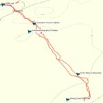
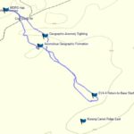
Road(s) and routes per MDRS Map: Drove on Cow Dung Road until Gateway to Candor and parked the rovers. Walked on foot through the Gateway to Candor into Candor Chasma. Scouted with the drone to extend the range of footage further through Candor Chasma as we hiked. Hiked about a mile into Candor Chasma. Returned on foot through Gateway to Candor to the rovers. Drove back to the hab via Cow Dung Road. See route in the attached image.
Mode of travel: Driving and walking

EVA Report – January6th


Crew 272 EVA Report 06-01-2023

EVA # 4

Author: Arly Black

Purpose of EVA: 1) Test of the MicroFox 15 transmitters using the Yagi-Uda antenna at Candor Chasma 2) Scouting of Candor Chasma by drone 2) Depositional environments of Candor Chasma, with specific focus on finding paleoflow indicators

Start time: 11:05 AM

End time: 2:37 PM

Narrative: After being grounded yesterday, and spending the day going over objectives and procedures, our antsy adventurers were stoked to get out and explore some more Martian terrain today. The crew was ready on time, despite a small problem with Kshitij’s mic. After pulling it out and then putting it back in, it seemed to work fine. Five minutes spent in the airlock listening to poor dad jokes was the perfect way to start the EVA. Mason and Kshitij took the lead in Opportunity, with Kshitij driving and Mason navigating, while Adriana and Kenny puttered along behind in Spirit, with Adriana driving and Kenny keep track of speed and state of charge. 8 minutes in, it was clear that Oppy performs much better than Spirit. Spirit had lost 20%, and Oppy 12%, while both driving at 10 km/hr.

The crew parked their rovers at the intersection of Cow Dung Road and Gateway to Candor, and walked on foot to Boiler Ledge, where they had left the Boiler Transmission Station (BTS) two days before. Kshitij turned on the BTS transmitter and HabCom turned on the transmitter located in the Hab. Kshitij performed a test of the Yagi-Uda antenna system using the Hab transmitter to check the range of the signal reception sector. Remarkably, he found it to be 180 degrees! Mason assisted with this, while Kenny and Adriana hammered and collected rock samples. It was at this time that Kshitij noticed issues with the cooling fan in his helmet when it started turning on and off sporadically. He also started to have radio/headset issues – it was choppy but improved over time – it was likely a loose connection.

Around 12:10 PM all crew members walked back to the rover, dropped off their samples, and picked up the drone. They then walked along Gateway to Candor to the entrance to Candor Chasma. Mason conducted a drone range test and scouted areas around Candor Chasma. The drone was able to reach around 850 m (2800 ft) which was a major success, especially when compared to the measly 300 m from last EVA – wahoo! Given that it was a sunny day with no ground interference, they had the perfect conditions for flying! Adriana began an experiment to test the performance of a non-geologist in the field – i.e banana-fingered Kenneth. No, that isn’t a slur, it is a literal description. In order to operate his phone with bulky Martian gloves, Kenny literally tied a banana peel to his gloved finger. And it worked like a charm! (now we’ll have to start saying “works like a banana”). Adriana asked questions about his perception of geologic processes in the area. His gut instincts were apparently correct, but ultimately his final answers were – womp womp – NOT. They discussed water flow direction and geomorphology features. And Adriana successfully located some paleoflow indicators!! One measurement she used was a strike and dip of forsets (we all know what that means, right?).

Meanwhile, down in the valley of Gateway to Candor, Kshitij was initially not able to detect a signal from the BTS or the Hab. The antenna needs line of sight to operate, so he climbed the north slope of the canyon (still within sight of the rest of the crew members) to get to a higher elevation with line of sight to both BTS and the Hab. There he was able to locate both locations. All in all, a very successful test!

The explorers then hiked back out through the Gateway to Candor and dropped off the drone and antenna at the rovers. The one remaining task was to turn off the BTS transmitter. Rather than send everyone back, the crew decided to make a line-of-sight train with Kenny and Adriana remaining nearest the rovers, Mason further along, and Kshitij left to trudge all the way to the transmitter. That way, each person had line of sight to at least one other person, without expending unnecessary energy. One note is that it is difficult to navigate to the Boiler Ledge and a better location method is needed. It was at this time that Kshitij experienced a complete meltdown of his helmet cooling system, sending his helmet into a foggy frenzy, and Mason stepped in to verbally and physically guide Kshitij back to the rover. At some point, Adriana lost her phone but was able to locate it. Kenny turned the rovers around to save time while Mason and Kshitij made their way back from the ledge. Then all crew members returned to the Hab in the rovers. While returning, both rovers seemed to perform better, likely due to a slight downhill slope in the road. Due to the helmet and visibility issues, the crew was seven minutes late in returning to the Hab – not too shabby!

In conclusion, all the objectives of the mission were achieved, although they did not make it as far into Candor Chasma as Adriana would have liked. Everyone got to smash some rocks with Adriana’s fabulous hammer, Little Rocky, and Kshitij successfully completed his experiment.

Lessons learned: 1. There were too many objectives laid out for this EVA given the time that was allotted – need to request more time next time. 2. It is valuable to follow a checkpoint system where landmarks are noted on your map as you pass, so that the course is maintained – this is what the crew did and it was wildly successful.

Destination: Galileo Road (Boiler Transmission Station) and Candor Chasma

Coordinates (use UTM WGS 84): N519600, E4251500 (Boiler Transmission Station), N523000, E4251300 (Candor Chasma)

Participants: Adriana Brown (Crew Geologist), Kenny Pritchard (Crew Journalist), Mason Kuhn (Crew Engineer), Kshitij Mall (Crew Commander)

Road(s) and routes per MDRS Map: Drove on Cow Dung Road until Gateway to Candor and parked the rovers. Walked on foot to Boiler Transmission Station located near Galileo Road at N519600, E4251500 to switch on the transmitter. Returned on foot to the rovers and walked through the Gateway to Candor until Candor Chasma. Later, returned on foot through Gateway to Candor to the rovers, deposited samples, drone, and antenna, and returned on foot to the coordinates near Galileo Road to switch off the transmitter. Returned on foot to rovers and returned to Hab via Cow Dung Road.

Mode of travel: Driving and walking

Eva Report – January 4th


Crew 272 EVA Report 04-01-2023

EVA # 3

Author: Arly Black

Purpose of EVA: 1) Placement of the MicroFox 15 transmitter for the radio navigation system and drone scouting of Candor Chasma near Compass Rock (20 minutes) 2) Stratigraphy of Candor Chasma to begin interpreting depositional environments and gypsum sample collection for GreenHab experiments (2 hrs)

Start time: 1056

End time: 1340

Narrative: The EVA got off to a late start because of an issue with Adriana’s comms system which needed to be swapped out for another and troubleshooting of the GPS device. After a 25-minute delay (Madelyn wishes it to be noted that SHE was ready on time!) the intrepid explorers exited the airlock and began their journey… or tried to. Curiosity wouldn’t move – who knew that could happen when it was still plugged in?! Once that was resolved by the very complicated act of pulling out the charging cord, finally they were actually on their way down scenic Cow Dung Road. The snafus continued, however, as the crew soon found themselves lost on the ol Cow Dung. They missed their turn and had to backtrack 0.25 miles to Galileo Road. Their navigation was aided by an alien ship sighting near the destination of interest. About 0.25 miles down Galileo Road, Perseverance hit 60% charge, and while Curiosity was only at 66%, all four explorers parked their vehicles and continued the rest of the way on foot to a ledge that provided a good view of both Compass Rock and the Hab, where Kshitij began to test his transmitter system, known as the Boiler Transmission Station (BTS), as well as the transmitter left in the Hab. The transmitters were set to frequencies of 147 and 146 MHz, respectively. He was able to detect a loud tone from both transmitters using his Yagi-UDA antenna. The full plan was to drive to Candor Chasma and navigate back to BTS, but due to the poor SOC of the vehicles, this aspect of the EVA was unobtainable.

Simultaneously, the drone was tested by Mason. He flew it towards Candor Chasma but had connection issues while flying low to look for areas of interest, and the drone kept trying to return on its own. He will need to check the long-range beacon and try to set up the analog controller which should boost the range compared with using a phone. Mason was able, however, to get a cool orbital video of the EVA crew with the drone. At the ledge, Adriana helped Madelyn collect two containers of sand for her Mars regolith experiments. Although no gypsum was found, the mainly quartz sand and clay should be useful for her research.

Then everyone returned to the rovers, dropped of the drone and sandy samples, and continued along Galileo on foot until they reached the Compass Rock formation. There they found some good powdery sulfates to mix in with the sandy sample (useful as sulfates have been detected on Mars). Adriana collected some samples of petrified wood, sandstone, and some other unidentified minerals. She looked for paleo flow indicators but couldn’t find much evidence of ancient river systems. However, she saw evidence of modern fluvial processes, which could be useful for giving an indication of the ancient processes. The others had fun climbing the Rock! The crew decided not to go to Candor Chasma due to time and vehicle constraints. They returned to the rovers, got back on Cow Dung Road, and headed back to the Hab. On the way back, the EVA crew performed a rover speed test to see what led to increased battery drainage – turns out going slow is better for conservation of battery life. They additionally timed all walks throughout the expedition to make sure they could accurately budget how long they could stay in the field and marked the waypoints of BTS and Madelyn’s samples. They wish it to be noted that the entire EVA they thought and acted like true Martians!

Destination: Ledge near Galileo Road and Compass Rock

Coordinates (use UTM WGS 84): N519750, E4251500 (Boiler Ledge – self-named), N520000, E4252000 (Compass Rock)

Participants: Adriana Brown (Crew Geologist), Madelyn Whitaker (GreenHab Officer), Mason Kuhn (Crew Engineer), Kshitij Mall (Crew Commander)

Road(s) and routes per MDRS Map: Drove northeast on Cow Dung Road 0.25 miles past Galileo Road 1104. Backtracked to Galileo Road 1104 and followed road for 0.25 miles. Walked on foot along Galileo Road 1104 to N519750, E4251500. Returned to rovers, then walked back along Galileo Road 1104 to Compass Rock N520000, E4242000. Returned to vehicles, drove back to Cow Dung Road and then returned to Hab.

Mode of travel: Driving and walking

EVA Report – January 3rd

Crew 272 EVA Report 03-01-2023
EVA # 1
Author: Arly Black
Purpose of EVA: Training EVA to familiarize crew members with rover operation, suits, and navigation
Start time: 1330
End time: 1445
Narrative: We donned our space suits for the first time since training two days ago. Adriana opted for the one-piece suit while Madelyn and Arly chose the two-piece, which turned out to be much more uncomfortable. We waited the required 5 minutes in the airlock before heading out to the rovers. Madelyn drove Opportunity, while Arly and Adriana took Spirit, with Arly driving and Adriana navigating. We traveled the predetermined route along Cow Dung Road, parked the rovers, and walked to Marble Ritual, stopping many times along the way to marvel at the scenery and collect interesting rocks. Adriana went into professor mode and expertly described the various rock formations and their likely causes. We learned much about chert, the likely direction of water travel based on fine sediment left near plants, and Martian anthills. After just a taste of Mars’ offerings, we reluctantly made our way back to the parked rovers and returned to the Hab. Great first venture out into Mars!
Destination: Marble Ritual
Coordinates (use UTM WGS 84): N518700, E4250800
Participants: Adriana Brown (Crew Geologist), Madelyn Whitaker (GreenHab Officer), Arly Black (Executive Officer/Crew Scientist)
Road(s) and routes per MDRS Map: Drove out from MDRS to Cow Dung Road, drove north on Cow Dung Road, and went east on foot until Marble Ritual.
Mode of travel: Driving and walking

Crew 272 EVA Report 03-01-2023
EVA # 2
Author: Arly Black
Purpose of EVA: Training EVA to familiarize crew members with rover operation, suits, and navigation
Start time: 1500
End time: 1615
Narrative: After witnessing the triumphant return of the EVA #1 team, the EVA #2 team thought they’d try their hand at Martian exploration. Although the bar was set impossibly high (the first team was #1 for a reason), they had a successful expedition. Taking the same vehicles and route as the first EVA, they then set off to the east towards Marble Ritual. They took many dramatic pictures, attempted to play cricket/baseball in their spacesuits, and discovered what may or may not be a skull – did they just discover evidence of life on Mars?! Stay tuned for potential skull/no skull updates. They later ventured to the west side of the road for a short time, where they saw many black (volcanic?) rocks. The team then returned to the Hab, and many poor jokes were exchanged while waiting in the airlock. Great time had by all.
Destination: Marble Ritual
Coordinates (use UTM WGS 84): N518700, E4250800
Participants: Kenny Pritchard (Crew Journalist), Megan Rush (HSO Officer), Mason Kuhn (Crew Engineer), Kshitij Mall (Commander)
Road(s) and routes per MDRS Map: Drove out from MDRS to Cow Dung Road, drove north on Cow Dung Road, and went east on foot until Marble Ritual.
Mode of travel: Driving and walking

EVA Report – December 14th

EVA # 2

Author: Jen Carver-Hunter and Jen 2 Jones

Purpose of EVA: Biosignature location and identification

Start time: 1:00 pm

End time: 4:00 pm

Narrative: At 13:00 we suited up in our low-fidelity EVA suits (or hi-fidelity future hi-mobility EVA suits) and entered the airlock about 13:15. We met the Queen of Mars on the other side of the road and she took us to a spot east of the hab to look for dinosaur bones for us to gain the experience of licking them. We successfully found several adhesive samples, one of which nearly resulted in a surgical procedure to remove a bone sample from EVA Crew member Amy’s tongue. After that we proceeded across the flood plain, looking at other bio signatures including a large green dinosaur bone. We visited a blue berries patch and took some samples for later analysis.

At that time, EVA crew member Jordan was feeling ill and it was determined by the Queen of Mars and our commander that it would be best for her to return to the hab for safety reasons.

We then proceeded up Sagan Road to Hab Ridge. Along the trip we stopped to collect gryphaea shells from 150,000 years ago. The furthest extent of our walking trip was the repeater at the top of Hab Ridge. We then returned down Sagan Road to the hab, arriving in the air lock at about 15:45.

Total traversed distance without rovers, approximately 6.9 kilometers and an elevation change of approximately 8.5 meters.

Destination: No Fly Zone and Hab Ridge

Coordinates (use UTM WGS 84): 518600,4250250 and 517800, 4251450

Participants: Jen Carver-Hunter, Jonathan Nalder, Jen Jones, Jenny Sumsion, Amy Fullmer, Jordan Chaves, Shannon Rupert

Road(s) and routes per MDRS Map: stay in the no-fly zone until Sagan Street, which we will climb to Hab Ridge

Mode of travel: Walking

EVA Report – December 13th

EVA # 1

Author: Jen Carver-Hunter

Purpose of EVA: Geologic sample collection

Start time: 1:00 pm

End time: 3:00 pm

Narrative: After a 5 minute decompression of the Spaceward Bound teachers, the crew took off for an EVA through Kissing Camel to Barrainca Butte Road where rock samples were collected. The mission was to collect analog samples of basalt, conglomerate, hematite, and sandstone to add to our collection of Mars rocks. We found success and processed our way to Kissing Camel for petrified wood. All rocks collected were deeply appreciated and will be placed in healthy happy homes. All teammates returned to MDRS with high anticipation of spreading out, analyzing, and exchanging rocks.

Destination: Road to Barranca Butte and Southwest Kissing Camel Ridge

Coordinates (use UTM WGS 84): 519700, 4247300 and 518200, 4249300

Participants: Jen Carver-Hunter, Jonathan Nalder, Jen Jones, Jenny Sumsion, Amy Fullmer, Jordan Chaves, Sergii Iakymov

Road(s) and routes per MDRS Map: Hab road to Cow Dung Road to 1101 and back

Mode of travel: Rovers on road, on foot off road

EVA Report – December 8th

EVA # 15
Author: M. Eby
Purpose of EVA: Deploy high altitude balloon experiment, retrieve mirror experiment for final inspection.
Start time: 12:01 PM
End time: 2:25 PM
Narrative: EVA crew departed the airlock in groups of 2 and 1, carrying the balloon experiment and the balloon inflation gear. The balloon was filled on the South side of the Hab, requiring 30 minutes to reach the target buoyancy (approximately 150 cubic feet of Helium). Once the balloon neck was tied off, the crew walked the balloon and the experiment to the North side of the Hab. From there, the experiment was powered up. The GreenHab Officer had to return to the Hab via the airlock to troubleshoot the telemetry ground terminal, with help from the Health and Safety Officer. After getting the telemetry flowing, the GreenHab Officer departed via the airlock and the XO connected the balloon train. The Commander then released the balloon, carrying the payload aloft. In calm air near the ground, the balloon lazily drifted over Hab ridge before turning East and catching the Jetstream over Hanksville. The EVA crew then transitioned to the mirror experiment location and retrieved the mirrors, bringing them back to the airlock. Once back in the Hab, the crew tracked the balloon as it rose to the target altitude of 90,000 feet and then as it descended over the Colorado Rockies (see attached image).
Destination: North side of the Hab, and to Mirrors Experiment (near Cow Dung Road & Marble Ritual).
Coordinates (use UTM WGS 84): 4251000, 518500
Participants: Commander (Ferrone), XO (Taylor), GreenHab Officer (Eby)
Road(s) and routes per MDRS Map: Moon Walk Road
Mode of travel: Walking

EVA Report – December 7th

EVA # 14
Author: B. Braun
Purpose of EVA: Reconfigure mirror coating experiment
Start time: 9:17 AM
End time: 9:58 AM
Narrative: EVA crew departed the airlock and proceeded on foot via the Hab driveway and Cow Dung Road to the area of the mirror location. Due to the snow, conditions were muddy and slippery along the road and across the terrain to the mirror experiment location. Once the team reached the mirror location, they unscrewed each of the mirror samples and flipped them over as directed by the experiment PI. After documenting the new setup with photos, the crew proceeded carefully back across the terrain to Cow Dung Road, then down the driveway to the Hab, where they paused to clear mud from their boots before entering the airlock.

Destination: Hab driveway to Cow Dung Road to mirror experiment location (near Cow Dung Road and Marble Ritual)
Coordinates (use UTM WGS 84): 4251000, 518500
Participants: Crew Engineer (Kowalski), HSO (Braun)
Road(s) and routes per MDRS Map: Cow Dung Rd (0110)
Mode of travel: Walking

Copyright © The Mars Society. All rights reserved. | Main Site