EVA Report – February 07th

Crew 240 EVA Report 07-02-2022

EVA # 8

Author: Marion Burnichon

Purpose of EVA: Battery change on atmospheric experiment, Exploration for Hab view

Start time: 9:30am

End time: 11:30

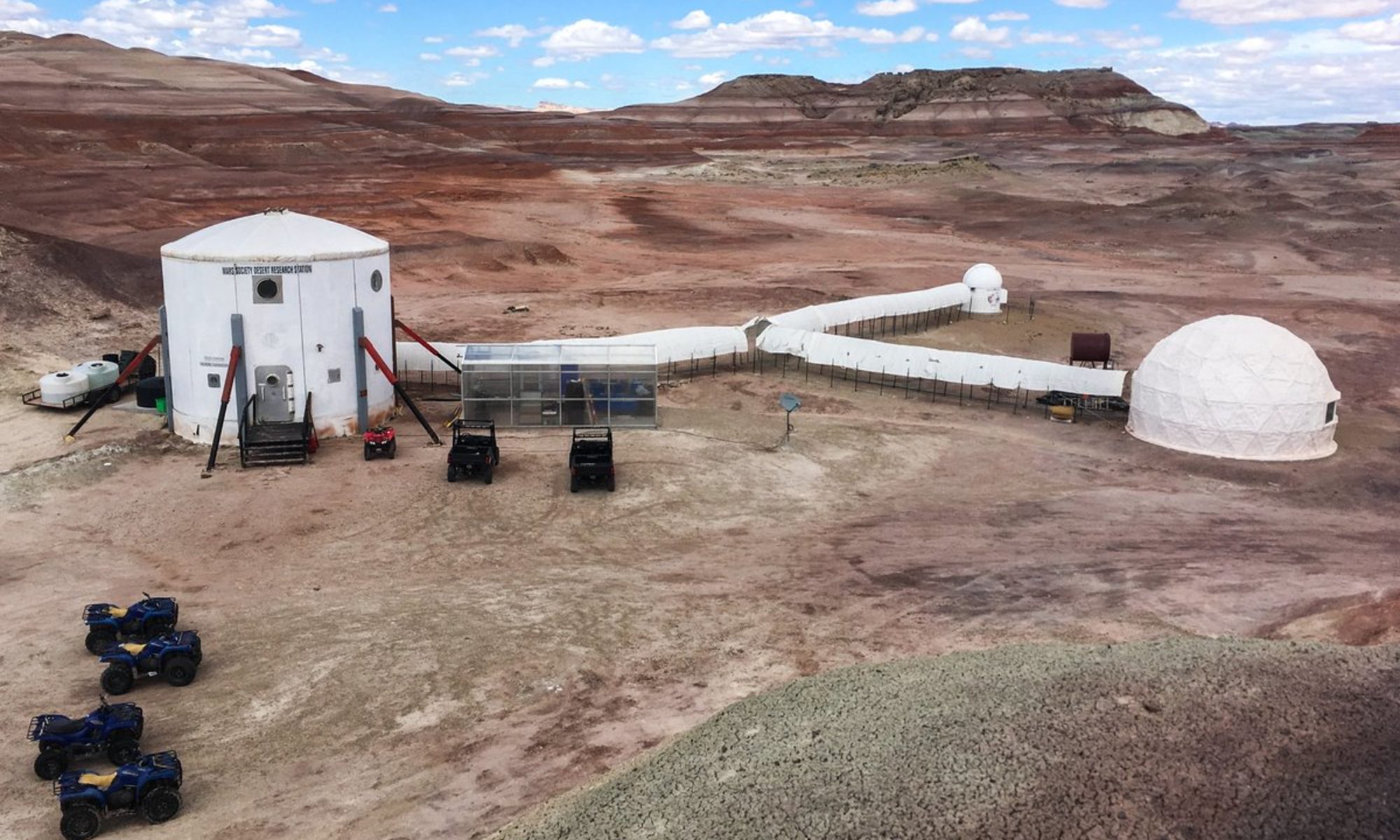
Narrative: Changed the batteries on the atmospheric experiment and checked it was behaving as expected. Brought back the rovers to the Hab. Started walking towards North Ridge and turned left to go up to Hab Ridge. Walked along to have nice views of the Hab. Captured some nice photos with camera and drone. Habcom also managed to take pictures of us from the kitchen window while on the Hab Ridge.

Destination: North and South Hab View

Coordinates (use UTM NAD27 CONUS): 518000 425000

Participants: Marion Burnichon, Pierre Fabre, Julie Levita, Francois Vinet

Road(s) and routes per MDRS Map: Entrance road, Cow Dung Road
By foot : 1103, Hab Ridge Road

Mode of travel: Rovers (Perseverance and Curiosity) and foot

EVA Report – February 6th

Crew 240 EVA Report 06Feb2022

EVA # 7

Author:Clément Plagne

Purpose of EVA: Replacing battery on LOAC atmospheric experiment

Start time: 11:05

End time: 11:32

Narrative: All went quickly and nominally, no issues to remark.

Destination: Crossing between Cow Dung Road and Entrance Road

Coordinates (use UTM NAD27 CONUS): 518 300, 425 0500

Participants:Clément Plagne, Julie Levita

Road(s) and routes per MDRS Map: Entrance Road, Cow Dung Road

Mode of travel: Opportunity, foot

EVA Report – February 5th

Crew 240 EVA Report 05Feb2022

EVA # 6

Author: Maxime Jalabert

Purpose of EVA:

– Taking pictures around the station of possible small cracks or impacts for an outreach mission about the usefulness of 3D printing

– Changing batteries on LOAC experiment

– Exploring the Candor Chasma area

Start time: 10:09

End time: 12:53

Narrative: We took pictures and measurements of small impacts caused by wear and tear around the station, which went rather quicky. Battery change went quickly. We moved on to the crossing between Cow Dung Road and Stream Bed connector, but before reaching it spotted human activity in the area, and decided to turn around and park near Pooh’s Corner – this didn’t slow us down much. We then advanced by foot into Candor Chasma, where exploration went well, and return occurred without issue as well.

Destination: Candor Chasma

Coordinates (use UTM NAD27 CONUS): 522000 4251000

Participants: Maxime Jalabert, Clément Plagne, Marion Burnichon, François Vinet

Road(s) and routes per MDRS Map: By rover: Entrance Road, Cow Dung Road. By foot : Stream Bed Connector.

Mode of travel: Rovers Perseverance and Curiosity

EVA Report – February 4th

Crew 240 EVA Report 04Feb2022

EVA # 5

Author: Pierre Fabre

Purpose of EVA: Examining the impact of 3D mapping data to EVA efficiency, following a 3D scan of the North Ridge area.

Start time: 11:15

End time: 13:43

Narrative: Driving to the crossing between Cow Dung Road and Galileo Road went well, following which we headed West. Finding ways to climb up the ridge from its northern face, which no participant had visited prior was arduous, and many attempts were stopped to ensure the utmost safety. During a safer climb, Clément’s radio dropped and took his headset with it. He managed to communicate efficiently through non-verbal means, and shortly after successful return to the rovers took place. We drove back to the LOAC experiment, and battery was replaced without issue. I then took some aerial shots of campus from the drone, and we went back in.

Destination: North Ridge

Coordinates (use UTM NAD27 CONUS): 5185000 4251500

Participants: Pierre Fabre, Julie Levita, Maxime Jalabert, Clément Plagne

Road(s) and routes per MDRS Map: Entrance Road, Cow Dung Road

Mode of travel: Rovers Spirit and Opportunity

EVA Report – February 3th

Crew 240 EVA Report 03-02-2022

EVA #4

Author: François Vinet

Purpose of EVA: 3D mapping North Ridge with a drone, climbing up Hab Ridge

Start time: 2.00pm

End time: 3.45pm

Narrative: It took 20 minutes to reach North Ridge on foot. The 3D mapping by drones was complicated and had to be done 2 times but the end result was satisfactory. The following goal was to climb the Hab Ridge to see the station from above and explore the area. However, one of the members had a significant back pain because of the suit followed by a loss of headset and microphones (the microphone used was different from the others and it is the second time we have a problem with it. A replacement request will be done in the Operation Report. Moreover, some tests will be done during the evening with the suit to adapt it better to the member). We decided to turn around before reaching Hab Rridge and we went back to the Hab.

Destination: North Ridge

Coordinates (use UTM NAD27 CONUS): 518500, 4251500

Participants: Marion Burnichon, Pierre Fabre, Julie Levita, François Vinet

Road(s) and routes per MDRS Map: Entrance Road

Mode of travel: by foot

EVA Report – February 2nd

Crew 240 EVA Report 02Feb2022

EVA # 3

Author: Clément Plagne

Purpose of EVA: Setting up atmospheric experiments

Start time: 09:10

End time: 10:15

Narrative: Drive went well with equipment securely loaded at the back of our rovers. Setup was quicker than expected, though still tough physically, and logistically due to some mistakes in protocol for setting up our weather station. This will require further checks as we go along.

Destination: Crossing between Entrance Road and Cow Dung Road

Coordinates (use UTM NAD27 CONUS):
518 300, 425 5000

Participants: Clément Plagne, Maxime Jalabert, Marion Burnichon, François Vinet

Road(s) and routes per MDRS Map: Entrance Road, Cow Dung Road

Mode of travel: Rovers Perseverance and Curiosity, foot

EVA Report February 1st

Crew 240 EVA Report 02-01-2022

EVA #2

Author: Clément Plagne

Purpose of EVA: Acquiring EVA experience, performing capture of the first 3D maps from a drone.

Start time: 14:36

End time: 16:24

Narrative: Pre-EVA briefing went smoothly, and we walked on northbound to reach the bottom of the North Ridge. Unfortunately, the head band that held Pierre’s headset in place started falling over his eyes. He still could see, and we organized with the rest of the EVA group to lead him back to the Hab, where he successfully set up his headset correctly and got back out, with enough time remaining on the EVA to reach the objective. We arrived at the spot where Pierre could carry out his observations, where he sadly once again lost some ability to listen out of his earphone but could still successfully communicate. He successfully performed a flyover with his drone and acquired good quality 3D mapping of the area. The return went on without a hitch. My spacesuit turned off its ventilation intermittently across the EVA, but never for more than a second or two, which led me to continue as planned and assess the suit post-EVA with the Engineer.

Destination: North Ridge

Coordinates (use UTM NAD27 CONUS): 518500 4251500

Participants: Clément Plagne, Maxime Jalabert, Pierre Fabre, Marion Burnichon

Road(s) and routes per MDRS Map: Entrance Road

Mode of travel: foot.

EVA Report

Crew 226 EVA Report 27-01-2022

EVA #: 8

Author: Maria Bustos, Felipe Torres

Purpose of EVA: Recognition of the lithology and geological description of the zone. Collection of clay samples.

Start time: 10:00 am

End time: 2:00 pm

Narrative:

The crew headed to Phobos Peak by foot. The crew geologist was leading this EVA as the main purpose was to describe some geological features of the zone.

The description is as follows:

Station 1.

Coordinates (UTM): 0519285X, 4250233Y

Orientation of the rock: 200°SW /6°NW

The outcrop was made of some sandstone beds surrounded by regolith. A lot of weathering was observed in the zone.

Station 2.

Coordinates (UTM): 0519076X, 4250379Y

Orientation of the rock: 182°S / 3°E

The outcrop depicted some clays surrounded by regolith. The clays had some metallic minerals which appear to be pyrite or chalcopyrite.

Station 3.

Coordinates (UTM): 0518607X, 4250091Y

Orientation of the rock: 314°NW / 28°SE

The outcrop showed some clear lamination of white clays in between a brownish regolith.

Station 4.

Coordinates (UTM): 0518549X, 4250489Y

Orientation of the rock: 232°SW/ 27°SE

Some beds were observed outcropping out from the floor with a clear laminar bedding. The rocks were classified as sedimentary of very fine grains.

Destination: Phobos Peak

Coordinates (use UTM NAD27 CONUS): 519300, 4250300

EVA Participants: Cristian Acosta, Maria Bustos, Carlos Salazar

Road(s) and routes per MDRS Map: MDRS Entrance Road

Mode of travel: by foot

Felipe Torres, Crew Scientist

EVA Report – January 26th

Crew 226 EVA Report 26-01-2022

EVA #: 7

Author: Maria Bustos, Felipe Torres

Purpose of EVA: Recognition of the lithology and geological description of the zone. Collection of clay samples.

Start time: 10:00 am
End time: 12:20 pm

Narrative: Several kinds of rocks were recognized, mostly sandstones and conglomerates. Also, ripples, wavy stratification, and other sedimentary structures were recognized. All the areas had a lot of signs of weathering, several kinds of regolith were also found, the most weathered formation was the one that contained the clays.

The clays did not show a clear stratification, and fresh clays were not so easy to find. At the end of the EVA, we found the clays in between the regolith. These clays were of white color and had some metallic minerals, we predict they may be pyrite, covelline, or chalcopyrite.

Further studies are necessary to continue analyzing the geology of the zone.
Destination: Phobos Peak

Coordinates (use UTM NAD27 CONUS): 519300, 4250300

EVA Participants: Yael Mendez, Carlos Salazar, Maria Bustos

Road(s) and routes per MDRS Map: MDRS Entrance Road

Mode of travel: by foot

Felipe Torres, Crew Scientist

EVA Report – January 24th

Crew 226 EVA Report 24-01-2022

EVA # 6

Author: Felipe Torres, Crew Scientist

Purpose of EVA: On-site test of 3D imaging to build a structure from motion and obtain a 3D image of some objects in the zone. This EVA will mainly be guided by our crew engineer which has a project about 3D imaging.

Start time: 10:00 am

End time: 11:40 am

Narrative: We headed south through Cow Dung Road, where we found Kissing Camel Ridges. It was pretty straightforward to find the location as the two rocky ridges join and almost touch each other.

First thing we started doing was analyzing which object we would build a 3D image from. We chose an interesting rock; we proceeded to take photos of the rock to then join them using a structure from motion method.

Then we used one of the crew members as a model to build the 3D image. This was a little more complicated and results weren’t as good as photographing a static object.

Finally, we took photos of a small hill, going all around. We took around 50 photos and for the post processing we will join these photos to build a 3D image.

We finished our EVA purpose earlier than expected so at around 11:25 am we headed back to the Hab.

It is also to note that we saw some contamination in this area, as if it was previously used as a shooting range since we found some type of shotgun pellets and some aluminum cans.

Overall it was a good EVA. Rovers worked nominally, and we had no battery issues as we’ve been driving them appropriately.

Destination: Kissing Camel Ridge East

Coordinates (use UTM NAD27 CONUS): 518500, 4249250

Participants: Cristian Acosta, Carlos Salazar, Felipe Torres

Road(s) and routes per MDRS Map: MDRS entrance road, Cow Dung Road, by foot

Mode of travel: Rover (Spirit, Curiosity)

Felipe Torres,
Crew Scientist.

Copyright © The Mars Society. All rights reserved. | Main Site