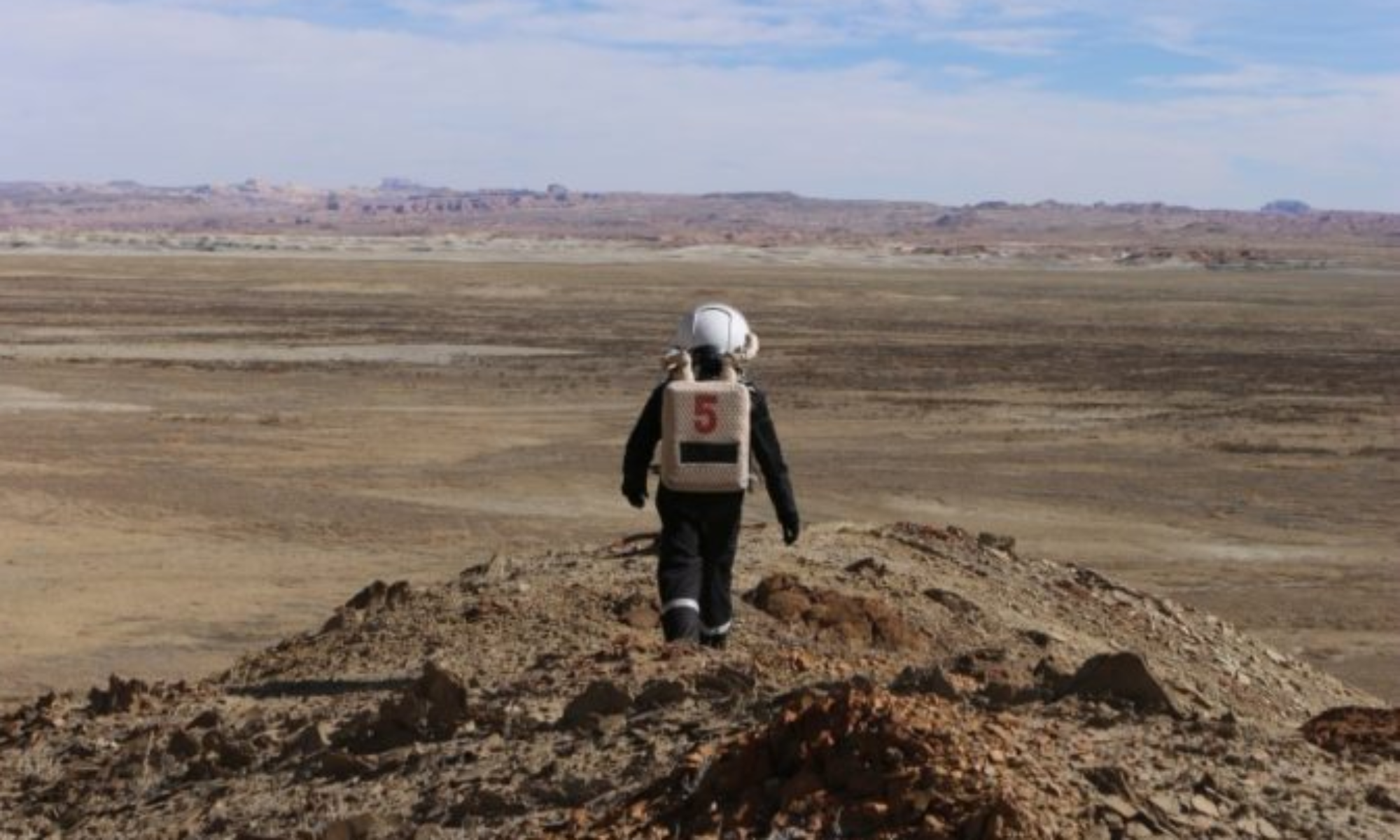
EVA Report – May 6th

Crew 235 EVA Report 06-May-2021

EVA # 6, 7

Author: Jen Carver-Hunter

Purpose of EVA: Continuation of rock sample collection

EVA 6 Start time: 0800
EVA 6 End time: 0900
EVA 7 Start Time: 0930
EVA 7 End time: 1030

Narrative: One of our crew’s goals is to collect rock samples that replicate the rocks found on Mars. For today’s EVA, our targeted specimens were gypsum and sandstone. The first planned stop for the EVA was the overlook at Copernicus Hwy, and the second planned stop on return to the Hab was Cowboy Corner.

We also decided to use these EVAs as an opportunity for the new crew to conduct an EVA without an MDRS-experienced leader. For this reason, we included a map lesson refresher prior to the EVA to ensure that all crew members would be familiar with the geologic features.

The first EVA crew (EVA 6) left the Hab in vehicles at 0800 and followed Cow Dung Rd north to Brahe Hwy. They missed the turn to Brahe Hwy and found themselves at the quarry, where they turned around and made their way to Brahe Hwy.

Then they followed Brahe Hwy to Copernicus Hwy where they stopped for a chance for a 360-degree look at the formations in the area. Then they reboarded vehicles and returned east on Brahe Hwy toward Cow Dung Road until they spotted the glint of the sun shining off the gypsum on the ground.

They collected samples of gypsum near Beige Moon before continuing on to Cowboy Corner, where they decided to not stop for sandstone collection. They also needed to release a packrat near the reservoir. After releasing it, they returned to vehicles and came back to the Hab without incident.

The second EVA crew (EVA 7) left the Hab in vehicles at 0930 and also followed Cow Dung Road north to Brahe Hwy. They did not miss the turn, so they executed a perfect left turn toward Copernicus Hwy, and stopped at the intersection of the two roads to take in the sights at the overlook.

The crew then started up their vehicles (one rover and one ATV) to start their trip back to the Hab. They also stopped near Beige Moon to collect gypsum samples. They elected to also stop at Cowboy Corner to collect sandstone samples before returning to the Hab without incident.

Destination: The overlook at Copernicus Hwy/Brahe Hwy; Beige Moon, Cowboy Corner

Coordinates (use UTM NAD27 CONUS): Destination 1 – 516100, 4254400; Destination 2 – 516500, 4254400; Destination 3 – 518350, 4252700

EVA 4 Participants: Jeff, Randall, Thomas

EVA 5 Participants: Krysta, Jennifer, Allison

Road(s) and routes per MDRS Map: Entrance Rd to Cow Dung Rd to Brahe Hwy

Mode of travel: Pathfinder Rover and 2 ATVs (only 1 ATV used on the second EVA)

EVA Report – May 5th

Crew 235 EVA Report 05 May 2021

EVA # 4, 5

Author: Jen Carver-Hunter

Purpose of EVA: Continuation of rock sample collection

EVA 4 Start time: 0900

EVA 4 End time: 1000

EVA 5 Start Time: 1200

EVA 5 End time: 1430

Narrative: One of our crew’s goals is to collect rock samples that replicate the rocks found on Mars. For today’s EVA, our targeted specimens were lava, basalt, and granite. In addition, we developed a scavenger hunt challenge for the two EVA crews to use as a competition that included specimens of gryphaea, purple lava, hematite, and sandstone blueberries.

The first planned stop for the EVA was the route to Barainca Butte, and the second planned stop on return to the Hab was east of Zubrin’s head.

The first EVA crew left the hab in vehicles at 0900 and followed Cow Dung Road south to Road 1101. After following Road 1101 west toward Barainca Butte, the crew stopped to collect rock samples, which included lava, granite, and basalt, and gryphaea. The Commander’s suit battery discharged so the EVA was aborted and the crew returned to the hab at 1000.

Because that crew’s EVA mission was not completed they requested that the second EVA crew collect extra samples to meet the day’s goals. They also requested that the second crew return some unwanted petrified wood samples to the west side of Kissing Camel Ridge, as was suggested by Dr. Rupert when she approved today’s EVA last night. Due to the dead battery in Spacesuit 7, the second EVA was only able to accommodate 3 crew members. Krysta volunteered to stay at the hab and requested that her crewmates bring samples back for her collection.

The second EVA crew left the hab in vehicles at 1200 and also followed Cow Dung Road south to Road 1101. They followed Road 1101 toward Barainca Butte and collected their samples along the road. After collecting on Road 1101, the EVA team turned around and turned north on Cow Dung Road until they reached “the Squirrel” landmark. They followed a wash to the west (they were east of Zubrin’s head) until they found the sandstone blueberry nursery.

At this point, they were able to complete the second objective of their mission. The final objective was to return the pieces of petrified wood they were done using to their collection site. Crew stopped south of Kissing Camels Ridge and walked west to return their samples before returning back to the Hab. The second EVA crew returned to the Hab with no difficulty and shared their collected samples with the first EVA crew.

Destination: Barainca Butte, east of Zubrin’s head, Kissing Camel Ridge

Coordinates (use UTM NAD27 CONUS): Destination 1 – 519700, 4247200; Destination 2 – 519750, 4248000; Destination 3 – 518250, 4249250

EVA 4 Participants: Jen, Krysta, Jennifer, Jeff

EVA 5 Participants: Atila, Randall, Thomas

Road(s) and routes per MDRS Map: Entrance Road to Cow Dung Road to Road 1101

Mode of travel: Pathfinder Rover and 2 ATVs.

EVA Report – May 4th

Crew 235 EVA Report 04 May 2021

EVA # 2, EVA #3

Author: Jen Carver-Hunter

Purpose of EVA: Specimen collection

EVA 2 Start time: 10:00

EVA 2 End time: 12:00

EVA 3 Start Time: 12:00

EVA 3 End time: 1:30

Narrative: One of our crew’s goals is to collect rock samples that replicate the rocks found on Mars. For today’s EVA, our targeted specimen was petrified wood, which we are using as an analogous specimen for the hematite found on Mars. Because Kissing Camel Ridge has an excellent source of petrified wood, we chose that location for our EVA.

The crew left the hab in vehicles and followed the road south to Kissing Camel Ridge. Crew walked to the southwest side of Cow Dung Road and followed the wash to the west along the ridge. Crew continued along the wash to the source of the petrified wood specimens in the wash. The crew on EVA 2 found a location that they thought might be the source Dr Rupert mentioned. It looked like someone had piled up mounds of petrified wood.

Destination: Kissing Camel Ridge

Coordinates (use UTM NAD27 CONUS): 518250, 4249250

EVA 2 Participants: Atila, Krysta, Jennifer, and Thomas

EVA 3 Participants: Jen, Allison, Jeff, and Randall

Road(s) and routes per MDRS Map: Entrance Road to Cow Dung Road

Mode of travel: Pathfinder Rover and 2 ATVs

EVA Report #1 – May 3rd

Crew 235 EVA Report 03 May 2021

EVA # 1

Author: Jen Carver-Hunter

Purpose of EVA: Training

Start time: 12:00

End time: 1:30

Narrative: The EVA was designed for training a new crew. After suiting up for the EVA, crew members loaded onto Pathfinder rover and 2 ATVs to practice driving the vehicles while in spacesuits. The crew stopped at Pooh’s corner where they disembarked the vehicles and continued the EVA with a short walk east of the road. During this walk, crew members practiced walking, communicating with radios, and collecting specimens while in spacesuits. After a short walk, the EVA crew returned to vehicles and drove back to the Hab.

Destination: Pooh’s Corner

Coordinates (use UTM NAD27 CONUS): 519000, 425100

Participants: Atila, Krysta, Allison, Jeff, Jen, Jennifer, Randall, and Thomas

Road(s) and routes per MDRS Map: Entrance Road to Cow Dung Road

Mode of travel: Pathfinder Rover and 2 ATVs.

EVA Report Apr 23rd

Crew 245 EVA Report 23APR2021

EVA # 12

Author: Alex Coultrup, Health and Safety Officer

Purpose of EVA: Final survey for emergency shelters and soil samples

Start time: 1015 MDT

End time: 1215 MDT (planned 1300, actual 1200)

Narrative: The EVA this morning started 15 minutes after the scheduled EVA window opened, as the crew had carefully gathered and sterilized required scientific instruments to meet Planetary Protection Protocols. After suiting up, the crew waited 5 minutes before exiting the airlock. The EVA crew departed from the Hab/Hab Grounds by foot, heading northwest. We rapidly identified the ATV road (1103) and followed it north, then west as it curved just before North Ridge, keeping an eye out for potential emergency shelter locations along the way. We followed the trail of GPS points left by the previous day’s EVA crew and demonstrated a successful navigation of our instruments.

After a thirty-minute hike, we reached the top of the western ridge stopping occasionally to drop more points and practice orienting our position with respect to both the GPS device and the map. We took soil samples along the ridge, then admired the view of North Ridge, Schubert’s Pass, and the western buttes. After determining there were no valid candidates for emergency sheltering, the team headed back along the 1103 route pointed out by the outpost as advice. The team managed a very quick return by foot to the Hab and was in the airlock just before 1200.

Destination: Schubert’s Pass

Participants: Health and Safety Officer Coultrup, Crew Scientist Ettlin

Road(s) and routes per MDRS Map: Walking up near a ridge slope by the Hab, taking 1103 walking back.

Mode of travel: Walking.

EVA Report – April 22nd

Crew 245 EVA Report 04-22-2021

EVA # 11

Author: Shayna Hume, Executive Officer

Purpose of EVA: Gathering soil samples on a ridge area.

Start time: 1000 MDT

End time: 1200 MDT (planned 1300, actual 1200)

Narrative: The EVA this morning started on schedule after the crew had carefully gathering and sterilizing required scientific instruments in order to meet the crew’s determined Planetary Protection Protocols. After suiting up, the crew waited 5 minutes before exiting. Today, the crew departed from the Hab and Hab Grounds by foot, heading northwest.

After a thirty-minute hike, we reached the top of the western ridge and began heading North towards Schubert’s Pass. After taking soil samples along the ridge, the team took a few minutes to admire the incredible view of North Ridge, Schubert’s Pass, and the western buttes.

After determining there were no valid candidates for emergency shelter, the team headed back along the 1103 route pointed out by the outpost as advice. The team managed a very quick return by foot to the Hab and was in the airlock just before 1200.

Destination: Schubert’s Pass

Participants: Executive Officer, Botanist, Engineer

Road(s) and routes per MDRS Map: Walking up near a ridge slope by the Hab, taking 1103 walking back.

Mode of travel: Walking.
Shayna Hume, Executive Officer
Red Planet People – MDRS Crew 245 "Team Patamars"
To Mars and Beyond – For All!

EVA Report – Apr 21st

Crew 245 EVA Report 21APR2021

EVA # 10

Author: Crew Scientist Olivia Ettlin

Purpose of EVA: Gathering soil samples and scouting for emergency shelters.

Start time: 1015 MDT

End time: 1330 MDT

Narrative: The EVA this morning started slightly after the beginning of the approved EVA window, as the crew was carefully gathering and sterilizing required scientific instruments according to XO Hume’s Planetary Protection Protocols. After we suited up and completed our 5-minute decompression in the airlock, we loaded our supplies into the Perseverance rover. Commander Dickstein and Health and Safety Officer Coultrup drove the Rover and Crew Scientist Ettlin took the ATV Serial Number 2. Starting charge on the Rover was 100% with 204.1 hours and the ATV required some choke before starting.

We traveled from the Hab to Entrance Road and proceeded south on Cow Dung Road for approximately 10 minutes until we reached Zubrin’s Head. Upon arrival at Zubrin’s head, we parked our vehicles on the side of the road. Using the analog map, we confirmed that our travel calculations had been accurate. From there, we embarked southwest on foot to explore the immediate region and investigate points of interest, which were communicated to us by our crewmates after their EVA to this site. As always, we carried the EVA med kit with us.

When we had completed gathering the samples, we returned to our vehicles and proceeded north on Cow Dung Road to Robert’s Rock Garden, where we did a final visit to drop waypoints and collect rock samples. From there, we returned to our vehicles and proceeded to Entrance Road, where we paused for approximately 20 minutes to capture some memorable photos with the MDRS entrance sign and facility as a backdrop, as directed by Mars Society Media Director Michael Stoltz. Finally, we returned back to the Hab. Upon returning, the Rover displayed 204.6 hours and 100% charge.

Destination: Zubrin’s Head

Coordinates of Destination: 12S 519500 UTM 4248100

Participants: Crew Scientist Olivia Ettlin, Commander Dylan Dickstein, and Health and Safety Officer Alex Coultrup

Road(s) and routes per MDRS Map: Hab to Entrance Rd, then South on Cow Dung road to Zubrin’s Head. Cow Dung Road to Entrance Rd, then back to the Hab.

Mode of travel: 2 team members in Perseverance Rover, 1 team member following close behind on ATV serial #2. All three members of the team walked the destination from the location where we parked the rovers safely on the side of the road.

EVA Report – April 17th

Author: Julio A. Hernandez

Purpose of EVA: A training EVA to improve crew mapping abilities

Start time: 09:00

End time: 11:30

Narrative: The EVA this morning started exactly at the beginning of the approved EVA window. The crew took enhanced measures during the EVA debriefing to ensure that the EVA participants were well prepared for the mission. In short, the route was mapped and landmarks were identified to aid in navigation. The health and safety checks were conducted without any issue to note; the participants were engaged and eager for their EVAs. Crew Botanist Hernandez and Crew Engineer Hariharan were the driver and navigator in the Perseverance Rover, respectively. As per Outpost’s recommendation, ATV #2 was taken for the EVA by XO Hume. The starting charge of the Rover was 100% with 202.1 hours. The ATV started up after some difficulty due to a cold engine.

We proceeded toward our destination, Robert’s Rock Garden, following the Cow Dung Road, as shown on the map and per the pre-EVA briefing. The EVA team checked COMMs with HABCOM until they were out of range. The EVA team stopped on the north side of Robert’s Rock Garden and took a photo of Kissing Camel to the East. Phobos Peak was included in the photo.

After visiting Robert’s Rock Garden, the EVA team departed to Zubrin’s Head. Identifying Zubrin’s Head proved to be challenging. Using both the map, approximated GPS coordinates, and location of the Sun, the EVA team identified a feature that they believed to be Zubrin’s Head. As a precaution to ensure the identified geological feature was indeed Zubrin’s Head, the EVA team proceeded up and down Cow Dung Road to raise their confidence in their feature identification (the feature looks like a person wearing a hat?). The EVA team proceeded to take photos of themselves next to the structure.

The EVA team then proceeded to hike in a southwest direction to explore the area. Using a local small hill, the EVA team took photos of the Barrainca Butte. After this little excursion, the EVA team returned to their vehicles to relocate themselves to the south side of Robert’s Rock Garden to collect soil samples at four different locations before returning to HAB grounds. The EVA team was granted permission to re-enter the HAB ground by HABCOM. The vehicles were parked. The Rover was parked and 86% with 202.7 hours. The EVA team was granted permission to re-enter the HAB and the airlock was sealed and re-pressurized.

Destination: Robert’s Rock Garden, Robert’s Head, Barrainca Butte

Coordinates (use UTM NAD27 CONUS): Moving through 12 s 518250 utm 4249250 (Robert’s Rock Garden), parking at 12 s 519500 utm 4248100 (Robert’s Head), hiking to near 519000 4247000 (Barrainca Butte)

Participants: Shayna Hume, Shravan Hariharan, Julio Hernandez

Road(s) and routes per MDRS Map: South Cow Dung Road

Mode of travel: Vehicles and Walking

EVA # 7

Author: Health and Safety Officer Alex Coultrup

Purpose of EVA: Training and confirmation of orienteering skills and ability to navigate to specified destinations using analog maps.

Start time: 1230 MDT

End time: 1520 MDT

Narrative: The EVA this afternoon started right at the beginning of the approved EVA window. HSO performed our required health and safety checks (blood pressure, heart rate, and temperature checks) and carefully implemented our planetary protection measures as per XO Hume’s research protocol. After we suited up and completed our 5-minute decompression in the airlock, we loaded our supplies into the Perseverance rover. Commander Dickstein and Crew Scientist Ettlin drove the Rover and HSO Coultrup took the ATV Serial Number 2. Starting charge on the Rover was 89% with 202.8 hours and the ATV started up quickly with little choke needed.

We traveled from the Hab to Entrance Road, and pulled over to consult our map. By using the map to estimate the distance, and by estimating the speed of the rover, we were able to estimate the total expected time to travel between this location and our first destination. We resumed traveling north on Cow Dung Road for the duration we calculated, and arrived at Streambed Connector as anticipated. We parked the rovers safely on the side of the road. Using the same calculation techniques as before, we estimated the duration of our walk to Destination 1. Using the analog map, we walked to Destination 1, took a photo, and enjoyed the view of the beautiful rock strata to our north upon arrival. As always, we carried the EVA med kit with us for this walk. We returned back to the vehicles using the same route, and proceeded north on Cow Dung Road toward Destination 2.

While traveling toward Destination 2, we pulled over at Galileo Road to consult our map and ensure accurate navigation. After performing our time/distance calculations, we continued North along Cow Dung Road, and were able to visually determine when we passed Cowboy Corner. We continued slightly further down Cow Dung Road, safely parked the rovers, and walked a few hundred meters toward the reservoir area, where we captured a photo of our arrival. We returned back to the vehicles using the same route, and consulted our map to perform the same navigation process we had been employing so far. We determined the distance, speed, and rate of travel, and proceeded north on Cow Dung Road toward Destination 3.

As we approached toward Destination 3, we pulled at the end of our approximated travel duration, but by consulting the analog map and visual landmarks, we were able to determine that we were not yet at the desired location. We re-started our vehicles and proceeded 30 seconds further north, and reached the intersection of Tank Wash Road and Cow Dung Road. We took a photo facing west, and returned to our vehicles.

From Destination 3, we began travelling south on Cow Dung Road until we reached the Streambed Connector. At the Streambed Connector area, we pulled over once again and spent some time collecting soil samples for our scientific research. When we had completed gathering the samples, we returned to the vehicles and proceeded south on Cow Dung Road to Entrance Road, and back to the Hab. Upon returning, the Rover displayed 203.2 hours and 86% charge.

Destination 1: Beautiful strata north of canyon at end of Streambed Connector

Coordinates of Destination 1: 12 S 0519556, UTM 4250370

Destination 2: Reservoir Dam/waterhole

Coordinates of Destination 2: 12 S 0518579, UTM 4252676

Destination 3: Intersection of Tank Wash Road and Cow Dung Road

Coordinates of Destination 3: 12 S 0518522, UTM 4253399

Participants: Crew Scientist Olivia Ettlin, Commander Dylan Dickstein, and Health and Safety Officer Alex Coultrup

Road(s) and routes per MDRS Map: Hab to Entrance Rd, then North on Cow Dung road to Streambed Connector. Cow Dung Road to Galileo Road. Cow Dung Road to Cowboy Corner. Cow Dung Road to Tank Wash Road intersection. On return route took Cow Dung Rd South to Streambed Connector. Cow Dung Road to Entrance Rd, then back to the Hab.

Mode of travel: 2 team members in Perseverance Rover, 1 team member following close behind on ATV serial #2. All three members of the team walked to each destination from the locations where we parked the rovers safely on the side of the road.

EVA Report – April 20th

Crew 245 EVA Report 20-04-2021

EVA #9

Author: Crew Engineer Shravan Hariharan

Purpose of EVA: Conduct soil sampling for astrobiology and geology studies (site was used in prior astrobiology studies that we are conducting follow-ups to), as well as emergency shelter identification and planetary protection experiments. We want to return to an original location for repeat sampling.

Start time: 1210 MDT

End time: 1530 MDT

Narrative: The EVA this afternoon began slightly after the start of the approved EVA window, as the team implemented a higher level of instrument sterilization and general cleanliness as per the XO’s planetary protection protocols. After spending five minutes in the airlock, the EVA team proceeded to their vehicles; the Executive Officer drove the Perseverance rover with the Commander navigating, and the Crew Engineer followed closely behind in ATV 1. Starting charge on the rover was 100% with 203.5 hours, and the ATV required some choke before starting.

The EVA team proceeded north on Cow Dung Road for approximately 20 minutes, until Quarry Road was reached. Communications contact with the Hab was lost approximately 2 km North of the Hab, as was expected based on experience from past EVAs. The EVA team parked vehicles by the edge of the Special Region, and proceeded on foot into Lith Canyon. The team’s first goal was to evaluate an emergency shelter identified on EVA #3, by first identifying the emergency shelter using relative location descriptions (i.e nearby landmarks and the general appearance of the shelter), and then classifying the shelter based on its utility to future crews in emergency situations. The team successfully identified and evaluated the shelter, although it was observed that the relative directions were somewhat unclear and should be modified to include precise cardinal directions of nearby landmarks. The EVA team then collected three soil samples from the streambed leading into the canyon, and marked the locations of each sample. Prior to proceeding into the canyon, the EVA team identified a second emergency shelter, and evaluated this shelter using the same qualitative criteria.

The EVA team then proceeded to enter Lith Canyon in order to scout for additional soil sampling sites. Upon exploration of the canyon floor, the ground was found to be too rocky and hard for subsurface soil sampling, so the team took several pictures of/in the site prior to returning to the vehicles. The EVA team then returned to the vehicles, and proceeded to drive back to the Hab. The vehicles were parked at the Hab, with the Perseverance rover at 241.1 hours and 84% charge. The team entered the airlock after permission was granted from Hab, and after five minutes of pressurization, the Hab was entered and EVA suits were doffed.

Destination: Lith Canyon

Coordinates (use UTM NAD27 CONUS): 12 S 0518243, UTM 4256030

Participants: Commander Dylan Dickstein, Executive Officer Shayna Hume, Crew Engineer Shravan Hariharan

Road(s) and routes per MDRS Map:

· Departure Route: Hab à Road Entrance à Cow Dung Road à Quarry Road à Lith Canyon

· Return Route: Gateway to Lith à Quarry Road à Cow Dung Road à Road Entrance à Hab

Mode of travel: 1 Rover, 1 ATV


Shravan Hariharan, Crew Engineer
Red Planet People – MDRS Crew 245 "Team Patamars"
To Mars and Beyond – For All!

EVA Report #8 – April 18th

Crew 245 EVA Report 04-18-2021

EVA # 8

Author: Health and Safety Officer Alex Coultrup

Purpose of EVA: Gathering soil samples and scouting for emergency shelters.

Start time: 1015 MDT

End time: 1335 MDT

Narrative: The EVA this morning started slightly after the beginning of the approved EVA window, as the crew was carefully gathering and sterilizing required scientific instruments according to XO Hume’s Planetary Protection Protocols. After we suited up and completed our 5-minute decompression in the airlock, we loaded our supplies into the Perseverance rover. Commander Dickstein and Crew Scientist Ettlin drove the Rover and HSO Coultrup took the ATV Serial Number 2. Starting charge on the Rover was 100% with 203.3 hours and the ATV required some choke before starting.

We traveled from the Hab to Entrance Road and proceeded south on Cow Dung Road for approximately 6 minutes until we reached Robert’s Rock Garden. Upon reaching the beginning of Robert’s Rock Garden, we parked our vehicles safely by selecting a spot on the side of the road where it was still fairly straight, before the sharp turns into the rock garden began. Using the analog map, we confirmed that our travel calculations had been accurate. From there, we embarked on foot to explore the rock garden and determine points of interest. As always, we carried the EVA med kit with us for this.

While at the rock garden, we conducted a thorough exploration and surveyed the area for locations that might make for suitable emergency shelters. We also collected multiple soil samples for our scientific research. When we had completed gathering the samples, we returned to our vehicles and proceeded north on Cow Dung Road to Entrance Road, and back to the Hab. Upon returning, the Rover displayed 203.5 hours and 100% charge.

Destination: Robert’s Rock Garden

Coordinates of Destination: Robert’s Rock Garden: 12S 0518352, UTM 4249206

Participants: Crew Scientist Olivia Ettlin, Commander Dylan Dickstein, and Health and Safety Officer Alex Coultrup

Road(s) and routes per MDRS Map: Hab to Entrance Rd, then South on Cow Dung road to Robert’s Rock Garden. Cow Dung Road to Entrance Rd, then back to the Hab.

Mode of travel: 2 team members in Perseverance Rover, 1 team member following close behind on ATV serial #2. All three members of the team walked the destination from the location where we parked the rovers safely on the side of the road.

Copyright © The Mars Society. All rights reserved. | Main Site