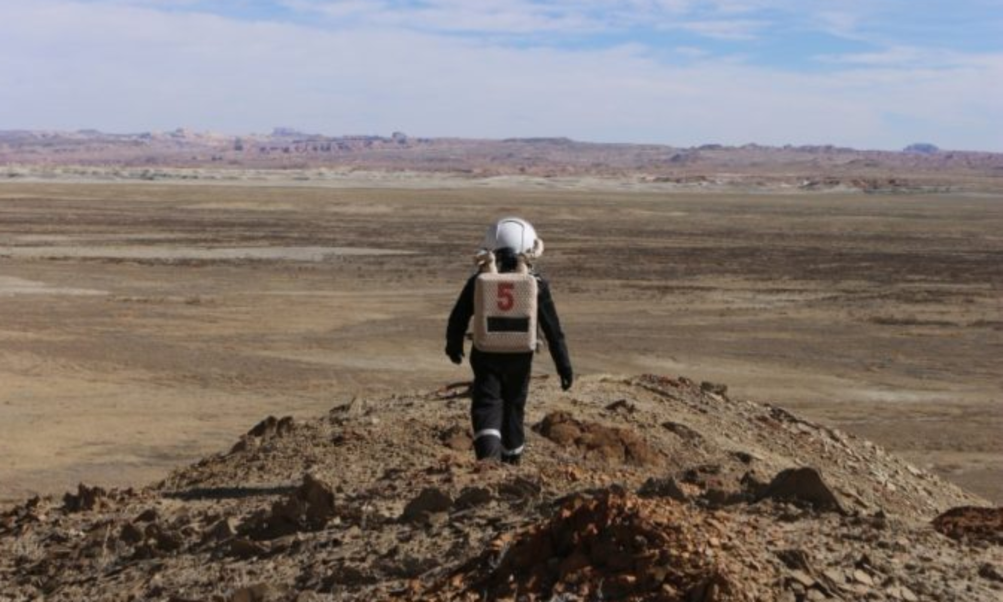
EVA # 5
Author: Clare Fletcher
Purpose of EVA: Go to notable peaks visible from the Hab for two purposes. Firstly, to investigate wayfinding methods on Mars by identifying notable features from the Hab, then seeing if we are able to identify them on a map, find them, and plot them, as well as photograph them from multiple angles for future Crews to wayfind. The dual purpose of this EVA is to look for evidence of life found in the form of endoliths, concretions, and possible gypsum or fossils (but not to remove them), to see if remote planning is adequate for geoconservation of important features.
Start time: 0950 (planned start 0930, but delays in suiting up)
End time: 1255 (planned 1300, rushed back to make it in time)
Narrative: EVA 5 was a dual-purpose EVA – wayfinding and looking for evidence of life to test how to balance exogeoconservation with the search for evidence of life on Mars. Our wayfinding was very successful! We had identified a notable peak from the Hab that we had dubbed ‘The Beehive’ and based on our bearing from the Hab to it, thought it was the peak immediately to the East of Phobos Peak on the MDRS map. We found our way to The Beehive easily, though found the terrain between Cow Dung Rd and The Beehive and Phobos Peak to be difficult to walk through as it was very soft and sandy or powdery in locations. We also noted coming back that there were notable landmarks we had passed on the way out that allowed us to find our way back more easily. We think we might name some of these features and provide GPS co-ordinates for future Crews to better understand how to get to Phobos Peak and The Beehive. On the other hand, our search for evidence of life struggled. While there was plenty of lichen around, identifying endoliths, gypsum, concretions, or fossils was very tricky. Some samples were taken, and upon further inspection we may have stumbled upon sampling the correct material, though not without first taking photos in-situ and a GPS co-ordinate. In future, it would be helpful to have teaching examples for all Crew members going on the EVA, so they are able to know what they are looking for to help on the EVA. However, all the EVA participants were actively looking for all these features and were additionally helpful, identifying material that did get sampled. All in all, a success and a good learning experience!
Destination: The hill to the East of Phobos Peak, and Phobos Peak. Parking rover at Pooh’s corner (518900, 4251200) and walking within 1km radius of the rover to 519600, 4250450.
Coordinates (use UTM WGS 84): 519600, 4250450 (rovers parked at 518900, 4251200)
Participants: Clare Fletcher, Scott Dorrington, Alex Tobal
Road(s) and routes per MDRS Map: Exit Hab via main airlock, take driveway to Cow Dung Rd 0110. Take Cow Dung Rd 0110 to Pooh’s Corner. Walk from Pooh’s Corner to hill East of Phobos Peak and Phobos Peak.
Mode of travel: Driving and walking
EVA Report – January 25th
Crew 291 EVA Report 25-01-2024
EVA # 7
Author: Clare Fletcher
Purpose of EVA: Went to Kissing Camel Ridge West to identify concretions and possible fossils, as signs of life on Mars. Attempted to reach the Hab Ridge via Kissing Camel Ridge. Dual purpose of this EVA was to get bearings to locations identified during EVA 5 that we are considering using as wayfinding points.
Start time: 1000
End time: 1230
Narrative: Kissing Camel Ridge has proven to be a site of great success for Crew 291. After a steep hike up the ridge, and a lot of disappointing conglomerate, we found the unit with the concretions. We could follow the unit for a little way, but the slight dip angle of the unit meant that we couldn’t find too many, and we would have done better on the North side of the ridge. However, the North side of the ridge was much steeper, so we weren’t able to investigate. While up near the concretions we also took a few bearings to several different peaks that we could see as part of our wayfinding research. We are yet to come to any conclusions about which peak we are seeing is which on the map, and if our crew will develop colloquial names for them that we might use amongst ourselves. We had planned to attempt to reach Hab Ridge via Kissing Camel Ridge, but we determined the path to be too treacherous in our EVA suits. With that and the lack of time, we decided to downclimb and look around the road cutting for anything interesting that had washed down the talus slopes from the top of the ridge. We found several interesting pieces of chert and jasper, as well as a few samples of interesting staining patterns, perhaps by iron oxide and copper, and desert varnish (manganese oxide).
Destination: Kissing Camel Ridge West. Walked within 700m of the rover. Parking rover at 518271, 4249560, walked to 517664, 4249650.
Coordinates (use UTM WGS 84): Parked rover at 518271, 4249560, walked to 517664, 4249650.
Participants: Andrew Wheeler, Clare Fletcher, Scott Dorrington
Road(s) and routes per MDRS Map: Exit Hab via main airlock. Drive down driveway to Cow Dung Rd 0110. Drive South on Cow Dung Rd 0110 to Kissing Camel Ridge. Walk up and along Kissing Camel Ridge to Hab Ridge.
Mode of travel: Driving and walking.
EVA Report – January 26th
Crew 291 EVA Report 26-01-2024
EVA # 9
Author: Clare Fletcher
Purpose of EVA:
Start time: 1330
End time: 1600
Narrative: Our EVA today went back to the same place as EVA 8 to drive our rover around and attain mineral spectra from various targets. We had a few technical issues as our GPS ran out of battery and a few nuts fell off the rover. However, we still had a great success with the rover today and attained some good data. Our studies attempting to find concretions had some success, though limited at this first location. Some gypsum was also attained. We decided we had enough rover charge to make it to the river crossing (the furthest requested point for our EVA), and we had more success finding gypsum and concretions there. As it is Australia Day, we also took some Aussie mascots into the field, so they too could experience Mars research. Overall a successful EVA for #9!
Destination: Tharsis Montes. 518196, 4253742 parking (if battery permits). 518607, 4253884 furthest point. Walking within 700m of the rover (permitting the battery doesn’t run out prior to reaching river crossing).
Coordinates (use UTM WGS 84): 518196, 4253742 parking (if battery permits). 518607, 4253884 furthest point.
Participants: Clare Fletcher, Steve Hobbs, Rob Hunt
Road(s) and routes per MDRS Map: Exit Hab via main airlock. Drive down driveway to Cow Dung Rd 0110. Drive North on Cow Dung Rd 0110 until river crossing.
Mode of travel: Driving and walking.
EVA Report – January 22nd
EVA # 1
Author: Clare Fletcher
Purpose of EVA: Training EVA to Marble Ritual to test EVA suits, comms, mobility, driving.
Start time: 1200
End time: 1330
Narrative: At 1200 our sim began with Rob, Clare, and Alex undertaking the first EVA. We were a bit like kids in a candy store and were both overwhelmed and enthusiastic about stepping foot onto Mars for the first time. We already had a comms issue as Alex came over faint on the radio, but as we could hear him and Mission Control could too, we decided to proceed with the EVA. At Marble Ritual we tested our dexterity by trying to pick up rocks that were in baskets over head height and then by climbing up some hills. We went up to a ridge behind the alligator shaped rock (as Aussies, we want to dub it ‘crocodile rock’). We took a few photos as well as taking some geology field drawings, though kept having to stop as we had other comms issues occurring (we’ve learned a lot about how to secure our headsets better).
Destination: Marble Ritual N518750, E4250900
Coordinates (use UTM WGS 84): N518750, E4250900
Participants: Rob Hunt, Clare Fletcher, Alexander Tobal
Road(s) and routes per MDRS Map: Cow Dung Rd 0110
Mode of travel: Spirit and Opportunity, some walking
EVA Report – January 16th
Crew 290 EVA Report 16-01-2024
EVA # 09
Author: Madelyn Hoying
Purpose of EVA: MADMEN and REMI data collection at site of interest, identified on the way to Kissing Camel Ridge (EVA 08) site.
Start time: 1230
End time: 1530
Narrative: Many MADMEN sites were explored, with holes dug (and filled in afterwards) at many sites to evaluate the gradient in rock type from sandy to green tuffaceous to red clay. Once a site was identified with the full gradient covered in our 6-inch depth, MADMEN sampling proceeded smoothly. REMI was also able to collect from several sites over a range of terrain. Of note, this EVA site had the most comms blackouts; the crew handled this well, and no problems arose.
Destination: Near Kissing Camel Ridge
Coordinates (use UTM WGS 84): N4249500, E518000
Participants: Rebecca McCallin (XO), Anja Sheppard (Crew Scientist), Nicole Chan (Crew Journalist)
Road(s) and routes per MDRS Map: Drive south on Cow Dung Rd until reaching the site identified on EVA 08, then park and walk to investigate.
Mode of travel: Driving and walking
Vehicles to be used (If applicable): Curiosity and Opportunity
EVA Report – January 18th
Crew 290 EVA Report 18-01-2024
EVA # 11
Author: Madelyn Hoying
Purpose of EVA: MADMEN sample collect along White Rock Canyon, to complete sampling among diverse geologic sites. REMI collect in Aonia Terra.
Start time: 0930
End time: 1330
Narrative: The crew reached 55% battery and parked just beyond Zubrin’s Head. After some scouting, they found exactly the terrain we needed! The MADMEN sample collection proceeded smoothly, while REMI managed 11 samples. This was our last and smoothest EVA!
Destination: Aonia Terra
Coordinates (use UTM WGS 84): N4247500, E520500
Participants: Anja Sheppard (Crew Scientist), Anna Tretiakova (Crew Engineer), Ben Kazimer (GreenHab Officer)
Road(s) and routes per MDRS Map: Drive south on Cow Dung Road until reaching White Rock Canyon (just before reaching the cattle guard) and then walk to sample collection site(s).
Mode of travel: Driving and walking
Vehicles to be used (If applicable): Spirit and Curiosity
EVA Report – January 15th
Crew 290 EVA Report 15-01-2024
EVA # 08
Author: Madelyn Hoying
Purpose of EVA: MADMEN data collection at the edge of Kissing Camel Ridge, with REMI collection in the Rock Garden.
Start time: 1230
End time: 1530
Narrative: The crew are now settling into the EVA routine in the field, with sample collection and field evaluation running smoothly for both MADMEN and REMI. This site was a bit more difficult for soil collection given the geomorphology at the area of interest. A rock outcrop extended partially over the intended collection site, necessitating some creative maneuvers to reach the site in the suits. The dispersed rocks provided a benefit too; a large one near the site acted as a lab bench with a flat, elevated surface for pH measurements. REMI successfully covered 12 sites in the 3-hour EVA, with time to spare. Overall, this confirms the scheduling needed for our EVAs: we can comfortably scout, select, and evaluate 1 MADMEN sample site with 2 crew members in 3 hours.
Destination: Kissing Camel Ridge
Coordinates (use UTM WGS 84): N4249500, E518000
Participants: Madelyn Hoying (Commander), Benjamin Kazimer (GreenHab Officer), Anja Sheppard (Crew Scientist)
Road(s) and routes per MDRS Map: Drive south on Cow Dung Rd until reaching Kissing Camel Ridge, then park and walk along the south side of the ridge and in the Rock Garden area to find ideal sample sites. Note: comms blackout area is expected behind the ridge; this will be accounted for in field procedures.
Mode of travel: Driving and walking
Vehicles to be used (If applicable): Spirit and Perseverance
EVA Report – January 13th
Crew 290 EVA Report 13-01-2024
EVA # 07
Author: Madelyn Hoying
Purpose of EVA: MADMEN data collection at the edge of Candor Chasma, which has geomorphological features that indicate the possibility of microbial life but is expected to be too difficult of terrain to bring REMI.
Start time: Intended 1230, actual 1335
End time: 1630
Narrative: The discovery of a pH meter that we can bring in the field led to the crew bumping our EVA back by an hour. This gave time to adjust the protocol and prepare the new sample setup. Chopper (Rebecca), Funk, Roots (Anna), and PODO set off on their EVA to Chandor Chasma with Melon (Madelyn) on CAPCOM. Two promising sample sites were collected, which the crew will continue analyzing in the coming days. While in the field, the battery connection broke on the temperature probe; if possible, our wonderful Crew Engineer will find a way to fix this!
Destination: Chandor Chasma
Coordinates (use UTM WGS 84): N4252141.8, E521204.1
Participants: Rebecca McCallin (XO), Benjamin Kazimer (GreenHab Officer), Anna Tretiakova (Crew Engineer), Nicole Chan (Crew Journalist)
Road(s) and routes per MDRS Map: Drive north on Cow Dung Rd until reaching Galileo Road 1104, then drive east past Compass Rock, which was as far east as possible with rover batteries. The surrounding area was then explored on foot.
Mode of travel: Driving and walking
Vehicles to be used (If applicable): Curiosity and Opportunity
EVA Report – January 10th
Crew 290 EVA Report 10-01-2024
EVA # 04
Author: Madelyn Hoying
Purpose of EVA: Confirm all systems on REMI robot are nominal after shipping and reconstruction, and to begin collecting initial data from at least 2 different terrain types.
Start time: 1400
End time: 1600
Narrative: This was a repeat of the original plan for EVA 03 to confirm all systems on REMI robot are nominal and begin sampling for MADMEN. REMI sampled six different sites within 180 meters of the Hab. The focus of the sites was mostly on sandy and gravelly terrain near small streamways. All systems were nominal during the EVA, and the crew had little to no difficulty running commands and controlling the robot with suits on. A new setup procedure in the RAM airlock also helped alleviate some struggles from EVA 03. For MADMEN, the use of the salinity meter in the field was confirmed without obstruction by the suits or gloves. Regolith and rock samples were collected and easily identified as samples of interest by the field scientists and CAPCOM, with temperature and additional data collected at each sample depth. Overall, this was a resounding success!
Destination: within 200m of MDRS
Coordinates (use UTM WGS 84): N518169, E4250939
Participants: Anja Sheppard (Crew Scientist), Ben Kazimer (GreenHab), and Nicole Chan (Crew Journalist)
Road(s) and routes per MDRS Map: Exit the RAM airlock with REMI and walk to sites of interest within a 200m radius
Mode of travel: Walking
Vehicles to be used (If applicable): None
EVA Report – January 11th
Crew 290 EVA Report 11-01-2024
EVA # 05
Author: Madelyn Hoying
Purpose of EVA: Engineering EVA to fix the rearview mirror on Spirit, build up a regolith ramp outside the RAM airlock to remove the drop off for robotic operations, and smectite collection (no more than 2lbs) for an attempt at making ISRU-derived clay items. Would like to test methods of loading/unloading REMI into the bed of the rover, and securing it with bungee cords.
Start time: 0900
End time: 1030
Narrative: All engineering tasks were successfully completed. The Hab’s front airlock door had blown partially open in the wind even after pre-emptively securing it with rope on Sol 3, so the EVA crew exited the RAM airlock and secured the front door. They then proceeded to secure all rover rear-view mirrors, noting that they were particularly loose and that Perseverance has a cracked mirror. Soil collection for RAM ramp began at the site specified by Mission Support but ran into too rocky of an area. Mission Support approved a proposed sandy site to collect from and the ramp was completed. Smectite was collected for ISRU clay, with all collection areas filled in afterwards. Additionally, methods for loading, unloading, and securing REMI in the bed of the rover were successfully demonstrated with two crewmembers and some ratchet straps. Pictures and additional details can be provided, with the crew noting no concerns about the ability to do this in the field.
Destination: within 100m of MDRS
Coordinates (use UTM WGS 84): N518169, E4250939
Participants: Anja Sheppard (Crew Scientist), Anna Tretiakova (Crew Engineer)
Road(s) and routes per MDRS Map: Exit the RAM airlock and walk to sites of interest within a 100m radius
Mode of travel: Walking
Vehicles to be used (If applicable): None