
EVA #5
Author: Lindsay Rutter
Purpose of EVA: Collecting endolith and non-endolith rock samples on the Jotunheim structure
Start time: 0817
End time: 1032
Narrative:
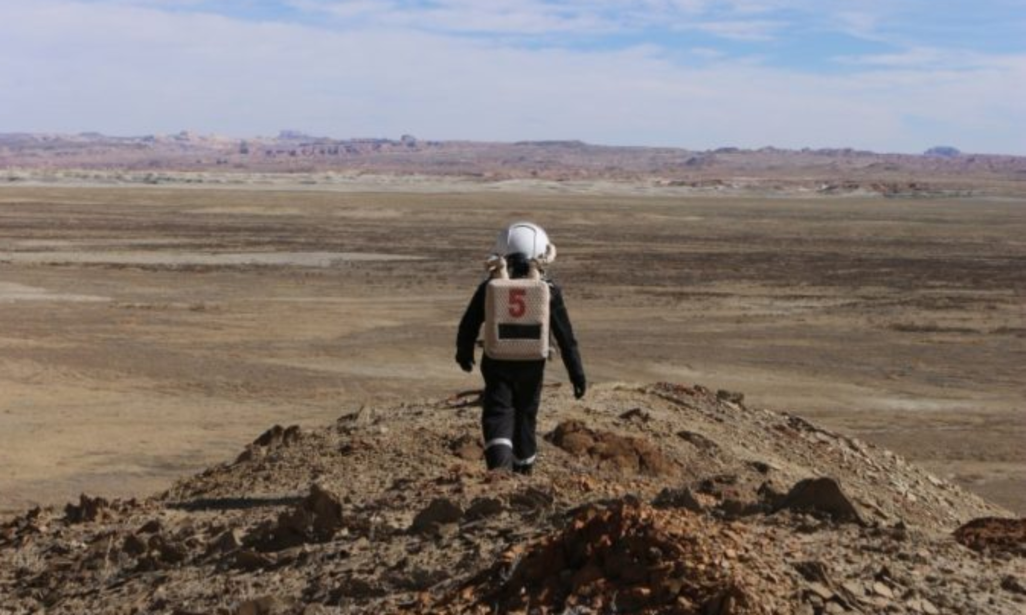
Dave and Lindsay departed the HAB using the Opportunity and Curiosity rovers. The weather was cloudy, with a chance of rain. They turned left onto Cow Dung Road and proceeded North, until they arrived without incident at the intersection with Galileo Road. They parked approximately 50m North of the intersection, established contact with HabCom, and indicated they would likely experience radio blackout while circumnavigating the Jotunheim feature, and would return to an area with reception by 1000. They then dismounted the rovers, and traversed the remaining 500m to the structure by foot.
During the walk, they encountered numerous features that were visually similar to the target destination, but they did not experience difficulty finding it because Lindsay had already reached the structure using the same route in a previous EVA. Upon arrival, they conclusively identified the target destination with the aid of GPS. They then began to circumnavigate the structure counterclockwise. At five separate points along the structure, Lindsay collected samples, primarily on the structure’s slopes. Lindsay selected triplicate samples of endolith rocks and triplicate samples of non-endolith rocks. She donned extra large lab gloves over her spacesuit gloves and collected the rocks into sterilized bags for follow-up analysis. Dave recorded GPS coordinates, elevation, and collection time for each sample using the GPS Essentials application. He also manually recorded the metadata in a field notebook.
Dave and Lindsay departed the Jotunheim feature at 0958. Along the return walk, they attempted to reestablish connection every 30 seconds with HabCom, and successfully reestablished contact about halfway on the return walk to their rovers. Upon arriving at the rovers, Lindsay’s radio displayed a low battery warning and began failing to properly transmit and receive, despite it being fully charged at the beginning of the EVA. She rectified the issue by reconnecting her headpiece with her backup radio.
Dave and Lindsay began to depart Southward on Cow Dung Road, heading back to the HAB. About halfway of the return distance, they noted an off-white, elevated, and dome-shaped feature about 10m from the Westside berm of the road, that could be investigated in a future EVA. They returned to the HAB without incident. Less than one minute after entering the airlock, they were informed light precipitation had begun.
Destination: Jotunheim Structure
Coordinates: zone 12 4251912 N 518799 E (38.41712 N, -110.78466 W [NAD27])
Participants: L. Rutter, D. Laude
Road(s) and routes per MDRS map: Cow Dung Road 0110
Mode of travel: Opportunity and Curiosity rovers, walking