
EVA #: 6
Author: Cesare Guariniello
Purpose of EVA: weather observation project; EVA and EMU evaluation project
Start time: 9:57
End time: 12:01
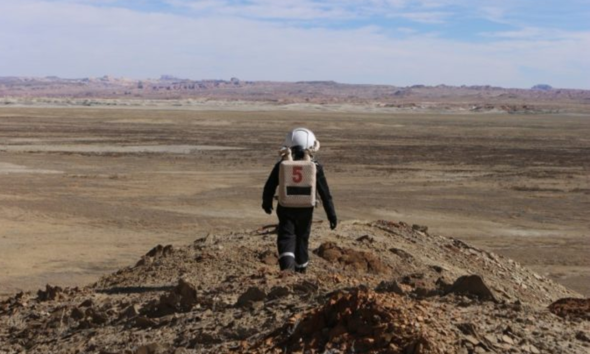
Narrative: Cesare, Ben, and Shefali drove to the north side of Kissing Camel range, where Ben took radio measurements and Cesare proposed potential scenarios for crew decision-making.
After collecting a few rock samples, the crew drove the rovers to the south of the range, which is exposed and clear of snow.
More radio measurements were taken, and the crew could climb the south side of the West Kissing Camel range. On the way back, Ben took more radio measurements along the first ridge south of the habitat.
Destination: Kissing Camel
Coordinates (use UTM NAD27 CONUS): 12S 518300, 4249000
EVA Participants: Cesare Guariniello, CMD; Ben Durkee, JOU Shefali Rana, HSO
Road(s) and routes per MDRS Map: Cow Dung Road to the south of Kissing Camel Range
Mode of travel: Driving, then work in the field and walking
Vehicles Used: Curiosity and Spirit
EVA #: 7
Author: Pat Pesa
Purpose of EVA: crew decision-making evaluation and radio measurements (during transfers); seismic measurements to evaluate subsurface layers (once at destination); EVA and EMU evaluation (once back in habitat)
Start time: 12:49
End time: 14:57
Narrative: Luz Ma and Pat took the Curiosity and Spirit rovers to just south of Kissing Camel range to the Hippo formation. Pat set up his Seismic equipment with the help of Luz Ma (lots of untangling wires) and started recording data.
It is a quite fun experiment because, after the tedious setup, you get to "smack" the ground with a sledgehammer to generate waves for the geophones to pick up! After these tests, Luz Ma continued her Climate and Weather readings, and we embarked on a short journey near the area.
Besides the overabundance of slushy snow and mud, the EVA was greatly successful and led to some great science and exploration.
Destination: South of Kissing Camel along Cow Dung Rd
Coordinates (use UTM NAD27 CONUS): 12S 51900, 4248600
EVA Participants: Pat Pesa, GEO; Luz Ma Agudelo, ENG
Road(s) and routes per MDRS Map: Cow Dung Road to the northwest of Zubrin’s head
Mode of travel: Driving and walking
Vehicles Used: Curiosity and Spirit