
Crew 214 EVA Report 05-11-2019
EVA # 8
Author: Andrew Wheeler
Purpose of EVA: Geological Sampling
Start time: 0930
End time: 1200
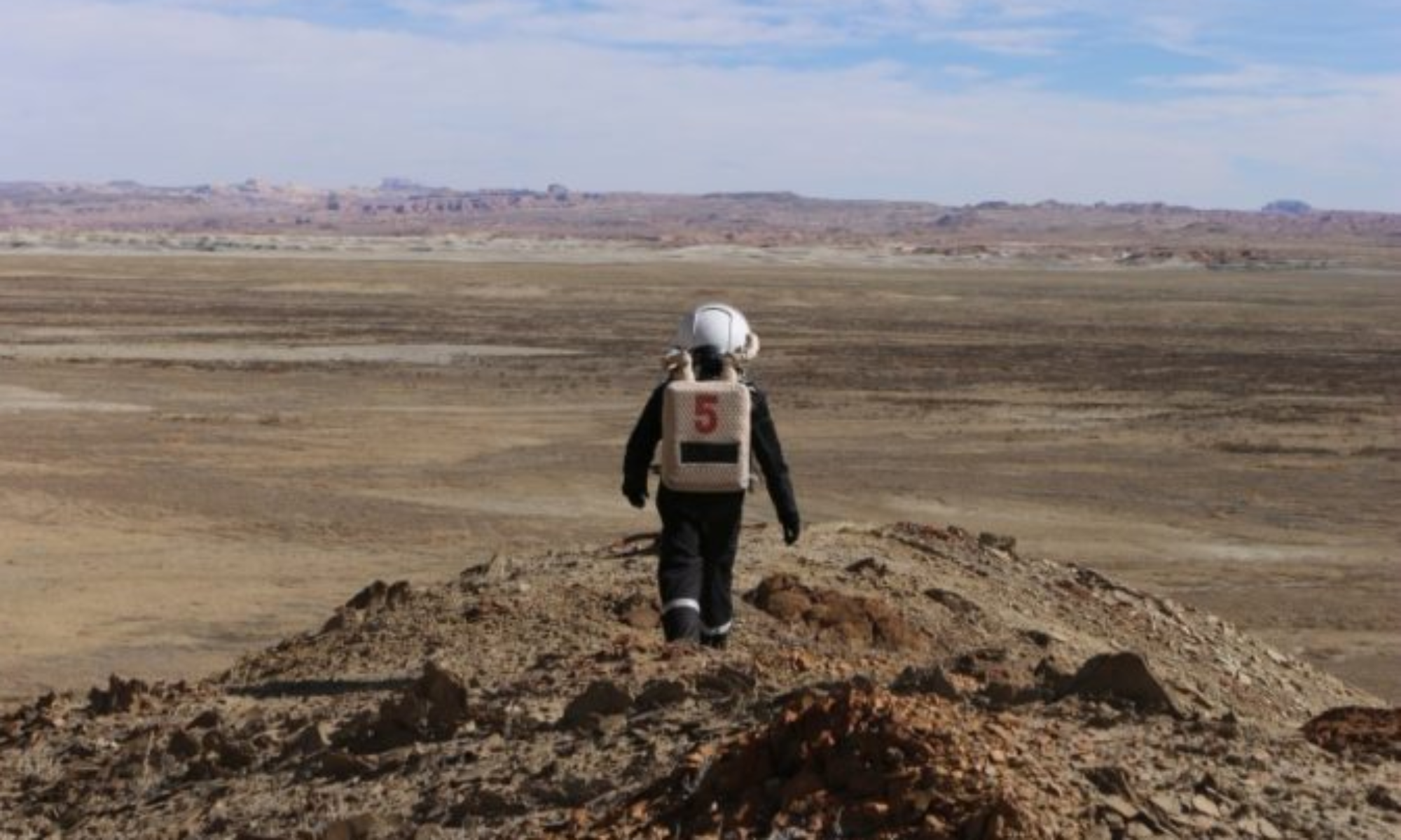
Narrative: The sixth EVA for science saw a change in target with the change in investigation focus. Hydrated minerals are a potential source of water here on Mars and at White Moon (517800E 4254650N) the mineral gypsum (CaSO4.2H2O) is one such source. We collected both crystalline specimens and gypsum rich soils to demonstrate liberation of water through simple heating. Results are pending. On our return from White Moon, we called in to TW#2 at 518477E 4253767N to collect more micrometeorite samples and we sampled 3 plots. We have now completed 43% of the grid.
Destination: White Moon via Cow Dung Road to Brahe Highway intersection and Tank Wash on return to the hab.
Coordinates (use UTM NAD27 CONUS): 517800E 4254650N
Participants: Andrew Wheeler, Dianne McGrath
Road(s) and routes per MDRS Map: Cow Dung Road to Brahe Highway (White Moon)
Mode of travel: Spirit Rover, Curiosity Rover
EVA Report – November 4th
Crew 214 EVA Report 04-11-2019
EVA # 7
Author: Andrew Wheeler
Purpose of EVA: Geological Sampling
Start time: 0945
End time: 1215
Narrative: The fifth EVA for science saw us returning to the Tank Wash location #2 at 518477E 4253767N where we continued sampling the 1m x 1m plots) for micrometeorites. The longer EVA allowed us to collect 28 samples. We have now completed 40% of the grid and anticipate 3 x normal length or 2 x longer duration EVAs will complete this sampling program.
Destination: Drove from the hab along Cow Dung Road to Tank Wash and then returned to the hab.
Coordinates: 518477E 4253767N
Participants: Andrew Wheeler, Sandy Dance
Road(s) and routes per MDRS Map: Cow Dung Road to Tank Wash
Mode of travel: Spirit Rover
EVA Report – November 2nd
Crew 214 EVA Report 02-11-2019
EVA # 6
Author: Andrew Wheeler
Purpose of EVA: Geological Sampling
Start time: 1400
End time: 1600
Narrative: The fourth EVA for science saw us returning to the Tank Wash location #2 at 518477E 4253767N where we continued sampling the 1m x 1m plots) for micrometeorites. The success of the magnet in attracting particles from the surface is both encouraging and satisfying. In the time allotted, 10 samples were collected.
On the return to the hab, a revisit to the line of sight from the Cactus Road #1 location at 519570E 4251974N allowed the next crew member to operate the heliograph. This was successfully accomplished and observed and recorded at the hab.
Destination: Drove from the hab along Cow Dung Road to Tank Wash and then returned to Galileo Road and the junction it has with Cactus Road.
Coordinates (use UTM NAD27 CONUS): 518477E 4253767N
Participants: Andrew Wheeler, Guy Murphy
Road(s) and routes per MDRS Map: Cow Dung Road to Tank Wash
Mode of travel: Curiosity Rover
EVA Report – November 1st
Crew 214 EVA Report 01-11-2019
EVA # 5
Author: Andrew Wheeler
Purpose of EVA: Geological Sampling
Start time: 1400
End time: 1600
Narrative: The third EVA for science saw us returning to the Tank Wash location #2 at 518477E 4253767N where we continued setting out the 100 square metre (100 1m x 1m plots) sampling grid. Having completed that task, we took our first samples looking for micrometeorites in the evaluation of the micrometeorite flux. 2 plots were sampled and very fine magnetic particles were recovered from both.
On the return to the hab, a revisit to the line of sight from the Cactus Road #1 location at 519570E 4251974N allowed another crew member exposure to the heliograph. With radio communications established and the hab personnel alerted, the heliograph operated as expected and was observed and recorded at the hab.
Destination: Drove from the hab along Cow Dung Road to Tank Wash and then returned to Galileo Road and the junction it has with Cactus Road. Coordinates (use UTM NAD27 CONUS): 518477E 4253767N
Participants: Andrew Wheeler, Dianne McGrath
Road(s) and routes per MDRS Map: Cow Dung Road to Tank Wash
EVA Report – Oct 31st
Crew 214 EVA Report 31-Oct-2019
EVA # 4
Author: Andrew Wheeler
Purpose of EVA: Geological Sampling
Start time: 1000
End time: 1200
Narrative: The second EVA for science saw us traversing to the Tank Wash location #2 at 518477E 4253767N where we commenced setting out the 100 square metre (100 1m x 1m plots) sampling grid.
This location appears to be a relatively undisturbed natural surface that hasn’t undergone recent erosion or weathering. It is sufficiently away from the hab that metallic residue won’t contaminate the surface and appears to be upwind of vehicular and pedestrian activity.
A secondary experiment was a test of material brought to the surface by ants at a nest adjacent to the sampling grid. It was hypothesized that the magnetic material of a terrestrial origin may be present and would contaminate the micrometeorite sample material. Using a small neodymium magnet, it was observed that there was zero magnetic material located on the anthill.
A tertiary experiment was the use of a heliograph as an emergency communications method. There is a line of sight from the Cactus Road #1 location at 519570E 4251974N to the hab. With radio communications established and the hab personnel alerted, the heliograph operated as expected and was observed and recorded at the hab.
Destination: Drove from the hab along Cow Dung Road to Tank Wash and then returned to Galileo Road and the junction it has with Cactus Road.
Coordinates (use UTM NAD27 CONUS): 518477E 4253767N
Participants: Andrew Wheeler, Sandy Dance
Road(s) and routes per MDRS Map: Cow Dung Road to Tank Wash
EVA Report – October 30th
Crew 214 EVA Report 30-10-2019
EVA # 3
Author: Andrew Wheeler
Purpose of EVA: Geological Reconnaissance
Start time: 1330
End time: 1540
Narrative: This EVA is the first of the scientific activities. Locations for deployment of a sampling grid necessary for collection of magnetic material from the top 1 cm of the regolith that could be identified as micrometeorites were visited and evaluated. One corner of potential grid locations were GPS surveyed and photographed for later layout of the grid. There are two locations near Tank Wash off Cow Dung Road (1) and two locations southeast of the junction of Galileo Road and Cactus Road (2). They are as follows:
Tank Wash #1 518472E 4253624N (preference #4)
Tank Wash #2 518477E 4253767N (preference #1)
Cactus Road #1 519570E 4251974N (preference #3)
Cactus Road #2 519958E 4251995N (preference #2)
Destination: Drove from the hab along Cow Dung Road to Tank Wash and then returned to Galileo Road and the junction it has with Cactus Road.
Coordinates (use UTM NAD27 CONUS): (1): 518500E 4253800N (2): 520100E 4251500N
Participants: David Mateus, Guy Murphy, Andrew Wheeler
Road(s) and routes per MDRS Map: Cow Dung Road, Galileo Road, Cactus Road
EVA Report – October 29th
Crew 215 EVA Report 29-10-2019
EVA # 2
Author: Sandy Dance
Purpose of EVA:
Start time: 3:30pm
End time: 5pm
Narrative: This was an initial exploration for training purposes, where the suits (one piece) were used outside for the first time, plus learning how to handle the rovers. The trip involved heading north along Cow Dung Road, gradually uphill, before stopping and alighting from the vehicle. Here testing the ability to walk over rough ground took place. Then the journey ended after retracing the steps.
Destination: URC Northside to cross of Cows Dung Road with Galileos Road
Coordinates (use UTM NAD27 CONUS): 4252000, 519050
Participants: David Mateus, Dianne McGrath, Sandy Dance
Road(s) and routes per MDRS Map: Cow Dung Road, Galileo Rd 1104 Mode of travel: Curiosity Rover, Spirit Rover, walking
EVA Report – October 29th
Crew 214 EVA Report 29-10-2019
EVA # 1
Author: Andrew Wheeler
Purpose of EVA: Training
Start time: 1400
End time: 1445
Narrative: This was a training exercise in Rover operations, familiarity with the roughness of the tracks and walking, climbing and driving whilst wearing spacesuits. It involved driving along Cow Dung Road to the Galileo Road turnoff to change drivers and then returning to Pooh’s Corner. Here, walking and climbing to higher ground and then descending to the rovers whilst wearing the two piece spacesuits, was practiced before returning to the hab.
Destination: Drove from the hab along Cow Dung Road to Galileo Road turn off before returning to Pooh’s Corner and the hab.
Coordinates (use UTM NAD27 CONUS): 519100E 4252000N
Participants: David Mateus, Guy Murphy, Andrew Wheeler
Road(s) and routes per MDRS Map: Cow Dung Road
Mode of travel: Curiosity Rover, Spirit Rover, walking
EVA Report – May 17th
Crew 212 EVA Report 17-May-2019
EVA #13
Author: Hector Palomeque
Purpose of EVA: Search&Rescue drone mission scenario attempt 2
Start time: 07:30 (postponed to 08:30 due to weather)
End time: 09:30 (delayed to 09:45 due to miscommunications)
Narrative: This EVA was performed in order to test the Tarot drone in Search and Recovery missions and the very first test in a Martian-like environment of the Observation Rover. The EVA was postponed due to the strong winds but after the EVA crew had the permission of the Director (Dr. Shannon Rupert) to proceed the EVA started with a delay of 1 hour (08:30).
Two of the EVA crew members prepared the Tarot drone for take-off, however, this mission had to be suspended again due to a mechanical/electronic error that does not allow its correct drone take-off and makes it fall.
The other two EVA crew members made the test of the Observation Rover on land. It was a successful test. All the mechanics of the Rover seems to work properly. It is able to move even over tiny rocks and to climb hills.
Unfortunately, the crew had a misunderstanding with the end time. Also, because of the miscommunications with the Hab, the crew was not able to communicate that they were going back 15 minutes late.
Nevertheless, the situation was treated at the debriefing after EVA in order to gain knowledge and experience for everyone, agreeing at the end with the determination of the EVA crewmember responsible for communications and the correct protocol for doing it.
Destination: Hab – Marble Ritual
Coordinates (use UTM NAD27 CONUS): Sector12S Northern 4250933, Eastern 518167
Participants: Zoe, Vittorio, Paolo, and Hector
Road(s) and routes per MDRS Map: 1103
Mode of travel: Driving – Curiosity and Spirit
EVA #12 Report – May 16th
Crew 212 EVA Report 17-MAY-2019
EVA #012
Author: Zoe Townsend
Purpose of EVA: Collection of sand for outreach purposes and physiological experiments to see how the suits performed in exercise.
Start time: 09.30
End time: 11.00
Narrative:
Today’s EVA was aimed at assisting with the project on the physiological effects of the suits. The EVA was to walk up to the Mid Ridge Planitia viewpoint to see how much oxygen was in the blood before and after the EVA, therefore assessing the suitability of the suits.
The experiment was deemed a partial failure where there were difficulties in isolating the suit to the outside elements. The windy weather also affected the testing where it wasn’t a true test of the suits fans ability.
Summary of the debrief, after the EVA:
- · Communication was the best over all the sim
- · Issue with clarification of time change (read earlier email from commander)
Coordinates (UTM NAD27 CONUS): Sector12S Northern 4251250, Eastern 516000
EVA Participants: Paola, Mariona (Medic), Camilo and Zoe (Commander)
Road(s) and routes per MDRS Map: Sagan Street 1103
Mode of travel: (walking or driving)? Walking.